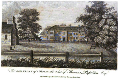
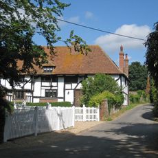
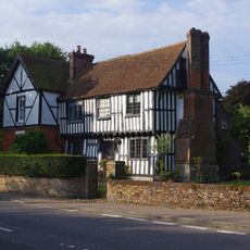
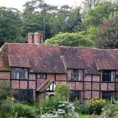
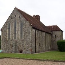
Acrise Place, Manor house in Acrise, England
Acrise Place is a manor house in Acrise with a brick structure that preserves original elements from the 16th century but was heavily modified in 1671 and 1691. The property includes the main house along with former stable blocks that once formed the working buildings of the estate.
Thomas and Jane Papillon acquired Acrise Place in 1666 and their family held the property over several generations until 1850. The changes made to the building in 1671 and 1691 document investments the family made during their time there.
The building shows features from different building periods and reflects how English country estates changed over time. The stable blocks and main house tell through their different styles how the owners' needs and tastes shifted across generations.
Visiting requires planning ahead since the building sits on private grounds and is not always open to visitors. It is worth checking in advance about viewing possibilities and making an inquiry before attempting to visit the location.
During World War II, fighter pilot Anthony Drew pursued a V1 flying bomb and came dangerously close to the building's structure in the process. This dramatic event is a little-known chapter of the area's wartime history and shows how far aerial combat extended into remote corners of the region.
The community of curious travelers
AroundUs brings together thousands of curated places, local tips, and hidden gems, enriched daily by 60,000 contributors worldwide.