Enable Location

We need your location to show you interesting places around you

Discover nearby places

Find interesting locations and hidden gems around you

Precise directions

Get accurate directions and distances to places

Your location is never shared with other users. It's only used when you tap the location button.

Bathurst Basin

Log in to your account

Start exploring — it's free

Trusted by 68,265 travelers worldwide

Continue with Google
Continue with Apple
or

We will send you a code to connect

By continuing, you accept our Terms and Conditions and our Privacy Policy

Check your inbox

We've sent a pincode in your inbox. Please enter the code below.

Bathurst Basin
Discussion Reviews 1 Photos
2.2k Popularity

Bathurst Basin, Harbor basin in Bristol, England

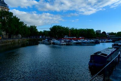
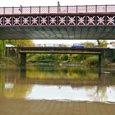
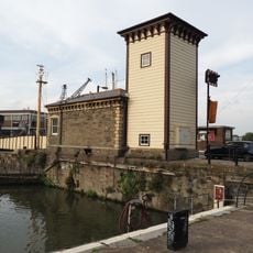
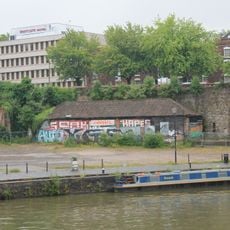
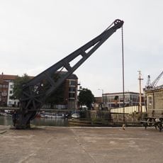
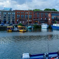
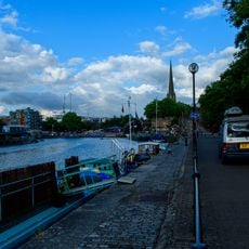
Bathurst Basin is a triangular water basin in Bristol that connects the Floating Harbour to the River Avon. Two sets of locks beside stone quay fronts control the water level and define the character of the space.

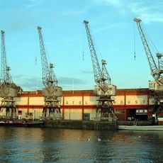
The basin developed from an earlier pond called Trin Mills and took its name from Charles Bathurst, a Bristol Member of Parliament in the early 1800s. During World War II, the lock to the New Cut was blocked to prevent drainage and has remained closed since then.

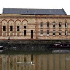
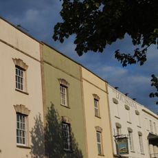
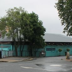
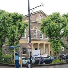
The Bristol General Hospital building on the eastern quay shows how the basin has transformed over time, changing from a medical center with storage areas into apartments and restaurants today. Walking along the water, you can see this shift in how people use the historic structure.

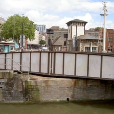
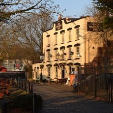
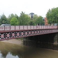
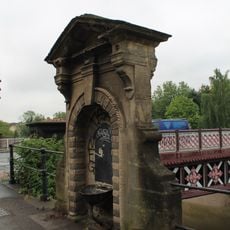
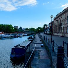
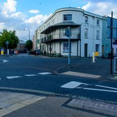
The basin is easily accessible from the surrounding waterfront, where you can walk along the stone quays to observe the locks and water. The promenade offers good views and space to move around the area comfortably.

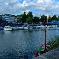
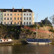
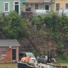
The Cabot Cruising Club operates from the basin and has maintained a moored lightvessel called John Sebastian since 1954. This historic ship remains a distinctive feature that many visitors walking past the waterfront might not notice.

The community of curious travelers

AroundUs brings together thousands of curated places, local tips, and hidden gems, enriched daily by 60,000 contributors worldwide.

Start exploring
Location
GPS coordinates
51.44690,-2.59480
Latest update
December 13, 2025 12:20
Around this place
M Shed
United Kingdom

M Shed

267 m
Bristol Industrial Museum
United Kingdom

Bristol Industrial Museum

265 m
Old City Gaol, Bristol
United Kingdom

Old City Gaol, Bristol

235 m
Prince Street Bridge
United Kingdom

Prince Street Bridge

234 m
Bedminster Bridge
United Kingdom

Bedminster Bridge

287 m
Robinson's Warehouse, Bristol
United Kingdom

Robinson's Warehouse, Bristol

70 m
Sailors Refuge, Bristol
United Kingdom

Sailors Refuge, Bristol

296 m
The Ostrich Inn
United Kingdom

The Ostrich Inn

127 m
The Louisiana Public House
United Kingdom

The Louisiana Public House

113 m
Bedminster Old Bridge
United Kingdom

Bedminster Old Bridge

253 m
Prince Street Bridge Engine House And Accumulator Tower
United Kingdom

Prince Street Bridge Engine House And Accumulator Tower

250 m
The Grove Wharf Extending Approximately 200 Metres Between Redcliffe Bridge And Mud Dock
United Kingdom

The Grove Wharf Extending Approximately 200 Metres Between Redcliffe Bridge And Mud Dock

242 m
Redcliffe Wharf Quays And Bollards, Extending Approximately 250 Metres South Of Redcliffe Bridge
United Kingdom

Redcliffe Wharf Quays And Bollards, Extending Approximately 250 Metres South Of Redcliffe Bridge

257 m
Severn Shed
United Kingdom

Severn Shed

284 m
Drinking Fountain Approximately 3 Metres North West Of Bedminster Bridge
United Kingdom

Drinking Fountain Approximately 3 Metres North West Of Bedminster Bridge

241 m
7, 8 And 9, Bathurst Parade
United Kingdom

7, 8 And 9, Bathurst Parade

84 m
Numbers 3-13 And Attached Front Area Railings And Gates
United Kingdom

Numbers 3-13 And Attached Front Area Railings And Gates

179 m
Hand Crane On Redcliffe Wharf
United Kingdom

Hand Crane On Redcliffe Wharf

204 m
Hand Crane At Mud Dock
United Kingdom

Hand Crane At Mud Dock

253 m
Old City Gaol, South East Perimeter Wall
United Kingdom

Old City Gaol, South East Perimeter Wall

139 m
Walls, Quays And Bollards To Bathurst Basin
United Kingdom

Walls, Quays And Bollards To Bathurst Basin

41 m
Numbers 2 To 12 And Attached Front Area Railings
United Kingdom

Numbers 2 To 12 And Attached Front Area Railings

256 m
Quay Walls Of Mud Dock
United Kingdom

Quay Walls Of Mud Dock

248 m
1-4, Wapping Road
United Kingdom

1-4, Wapping Road

116 m
Zion House And Attached Railings And Gateways
United Kingdom

Zion House And Attached Railings And Gateways

233 m
Portal cranes on Prince's Wharf, Bristol
United Kingdom

Portal cranes on Prince's Wharf, Bristol

253 m
Quay Wall Of Bathurst Wharf
United Kingdom

Quay Wall Of Bathurst Wharf

162 m
2-6, Bathurst Parade
United Kingdom

2-6, Bathurst Parade

96 m
Show the full map
Reviews
Share your experience

No review yet

Discussions
Start a discussion...

No discussion yet

« Bathurst Basin - Harbor basin in Bristol, England » is provided by Around Us (aroundus.com). Images and texts are derived from Wikimedia project under a Creative Commons license. You are allowed to copy, distribute, and modify copies of this page, under the conditions set by the license, as long as this note is clearly visible.

Discover hidden gems everywhere you go!

From secret cafés to breathtaking viewpoints, skip the crowded tourist spots and find places that match your style. Our app makes it easy with voice search, smart filtering, route optimization, and insider tips from travelers worldwide. Download now for the complete mobile experience.

Around Us App Screenshot

A unique approach to discovering new places

Le Figaro

All the places worth exploring

France Info

A tailor-made excursion in just a few clicks

20 Minutes

Around Us
Travel Guide & Maps
Download

Send to your phone

QR Code
1

Open the camera app on your mobile.

2

Point at the QR code with your camera. A notification will appear.

3

Tap the notification to open the link.