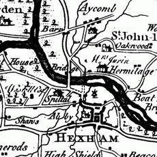
Border Counties Bridge, Railway bridge ruins in Northumberland, England
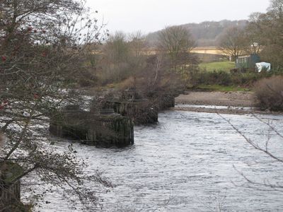
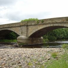
Border Counties Bridge is a railway crossing that once spanned the River Tyne with five sections supported by four stone piers. These piers remain visible in the water today and show where the structure once carried trains across the river.
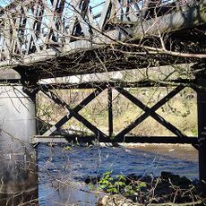
The bridge was built in 1856 to connect railway routes between Newcastle and the Carlisle line. Operations stopped in 1958 due to maintenance issues, and the structure was taken down the following year, leaving only the stone piers behind.
The stone piers reflect how rail connections shaped industrial growth in the region during the 1800s and what engineering meant to people of that era. What remains today shows how this crossing once linked communities on both sides of the border through commerce and travel.
The site can be viewed from the nearby road where the piers are visible in the river below. It is helpful to visit during daylight hours and bring sturdy shoes if you want to get closer to the water's edge for a better view.
The four stone piers stand in a distinctive line across the riverbed and are most fully visible when water levels drop. This arrangement attracts photographers and history enthusiasts who come to document the stark geometry of the submerged stones.
Location: Northumberland
Inception: 1856
GPS coordinates: 54.98210,-2.12070
Latest update: December 14, 2025 16:40
Hexham Old Bridge
556 m
Constantius Bridge
329 m
Warden Railway Bridge
1.3 km
Warden Bridge
1.5 km
Church of St Michael
1.6 km
Church of St John of Beverley
1 km
War Memorial to North-East of Church of St John
1 km
Archway To Church Flags Archway To Cowgarth
1.6 km
Bridge Over Halgut Burn In Grounds Of Hexham House
1.5 km
Hexham Primary Infants And Junior School
1.4 km
Drinking Fountain To South Of Central Range Of Hexham County Primary Infant And Junior School
1.4 km
1 and 2 Temperley Place
1.6 km
Holy Island House
1.3 km
Hexham House
1.5 km
St Wilfrid's Gateway The Priory Gatehouse
1.6 km
Bandstand
1.6 km
Pant With Adjacent Hydrant
1.6 km
Footbridge Over The Birkey Burn 220 Metres South Of Acomb House
1.4 km
24, Market Street
1.6 km
Hydrant 5 Metres South-West Of Cartshed South Of Fold Cottage
1.5 km
20 And 22, Market Street
1.6 km
The Spital
437 m
2, Gilesgate
1.5 km
9, Market Street
1.6 km
Cross In Churchyard About 3 Metres South Of Tower Of Church Of St Michael
1.6 km
Wall To Bowling Green, From Hexham House To Priory Gateway
1.5 km
Milestone South Of Old Road 12 Metres West Of Entrance To The Hermitage
1.3 km
The Hermitage
1.3 kmVisited this place? Tap the stars to rate it and share your experience / photos with the community! Try now! You can cancel it anytime.
Discover hidden gems everywhere you go!
From secret cafés to breathtaking viewpoints, skip the crowded tourist spots and find places that match your style. Our app makes it easy with voice search, smart filtering, route optimization, and insider tips from travelers worldwide. Download now for the complete mobile experience.
A unique approach to discovering new places❞
— Le Figaro
All the places worth exploring❞
— France Info
A tailor-made excursion in just a few clicks❞
— 20 Minutes