Constantius Bridge, Road bridge in Northumberland, England.
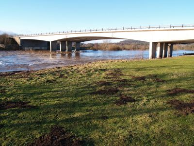
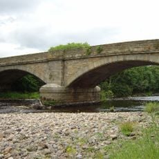
The Constantius Bridge is a road bridge spanning the River Tyne with three concrete spans that carry four traffic lanes on the A69 route. The structure connects both banks of the river in this section of Northumberland.
The bridge was built in 1976 as part of the Hexham bypass project to divert traffic around the town center. This construction replaced the earlier A69 route that ran directly through Hexham.
The bridge takes its name from a Roman Emperor who left his mark on these lands during ancient times. This naming choice reflects the region's deep connection to Roman history.
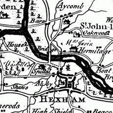
The bridge is maintained by National Highways and sits at the point where the River Tyne divides into its northern and southern branches. Vehicles can use the crossing throughout the year under varying weather conditions.
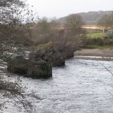
During construction in August 1975, severe flooding caused the collapse of temporary scaffolding and support structures at the western span. This incident delayed the project and required reinforcement measures to be put in place.
Location: Northumberland
Inception: 1976
GPS coordinates: 54.98410,-2.12450
Latest update: December 14, 2025 18:43
Hexham Old Bridge
832 m
Border Counties Bridge
329 m
Warden Railway Bridge
964 m
Warden Bridge
1.2 km
Church of St Michael
1.2 km
Church of St John of Beverley
1.2 km
War Memorial to North-East of Church of St John
1.2 km
Archway To Church Flags Archway To Cowgarth
1.9 km
Bridge Over Halgut Burn In Grounds Of Hexham House
1.9 km
Hexham Primary Infants And Junior School
1.7 km
Drinking Fountain To South Of Central Range Of Hexham County Primary Infant And Junior School
1.8 km
1 and 2 Temperley Place
1.9 km
Holy Island House
1.7 km
Hexham House
1.8 km
St Wilfrid's Gateway The Priory Gatehouse
1.9 km
Bandstand
1.9 km
Pant With Adjacent Hydrant
1.6 km
Footbridge Over The Birkey Burn 220 Metres South Of Acomb House
1.5 km
24, Market Street
1.9 km
Hydrant 5 Metres South-West Of Cartshed South Of Fold Cottage
1.6 km
20 And 22, Market Street
1.9 km
The Spital
766 m
2, Gilesgate
1.8 km
9, Market Street
1.9 km
Cross In Churchyard About 3 Metres South Of Tower Of Church Of St Michael
1.3 km
Wall To Bowling Green, From Hexham House To Priory Gateway
1.9 km
Milestone South Of Old Road 12 Metres West Of Entrance To The Hermitage
1.5 km
The Hermitage
1.5 kmVisited this place? Tap the stars to rate it and share your experience / photos with the community! Try now! You can cancel it anytime.
Discover hidden gems everywhere you go!
From secret cafés to breathtaking viewpoints, skip the crowded tourist spots and find places that match your style. Our app makes it easy with voice search, smart filtering, route optimization, and insider tips from travelers worldwide. Download now for the complete mobile experience.
A unique approach to discovering new places❞
— Le Figaro
All the places worth exploring❞
— France Info
A tailor-made excursion in just a few clicks❞
— 20 Minutes