Barrow, Mountain summit in Lake District, England
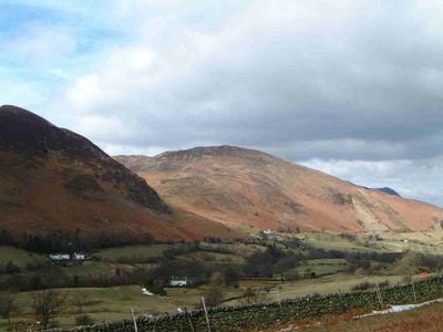
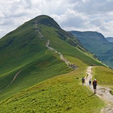
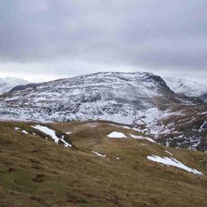
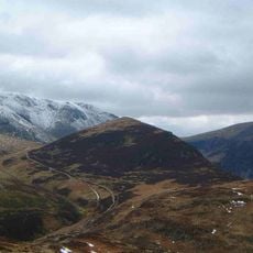
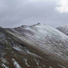
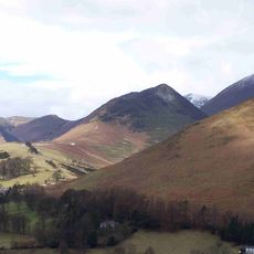
Barrow is a mountain summit in the Lake District that reaches 455 meters and features a narrow ridge running from Braithwaite down through the Newlands Valley. The slopes drop away steeply on both sides, creating a dramatic spine of land that offers open views from start to finish.
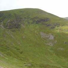
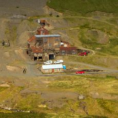
Mining operations began on this mountain during the 17th century when workers extracted minerals from the slopes. The workings were abandoned in 1888, leaving spoil heaps and traces visible along the eastern side.
The name derives from Anglo-Saxon language, reflecting the geographical character of the long ridge that defines this Lake District mountain.
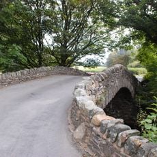
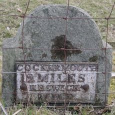
You can start your walk from Stair hamlet in the Newlands Valley or from Braithwaite village, both offering straightforward routes to the summit. The ridge walk is exposed in places, so weather conditions matter and sturdy boots help on the rough ground.
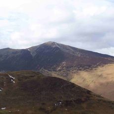
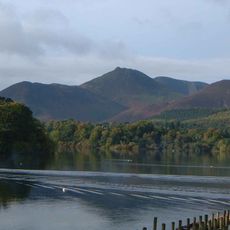
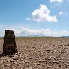
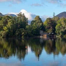
The summit sits with a grass cairn ringed by heather, opening to views across Derwentwater and the surrounding fells. Beyond the top, the terrain continues westward to Barrow Door, a natural depression that forms a natural gateway between neighboring valleys.
Location: Cumbria
Elevation above the sea: 455 m
GPS coordinates: 54.58569,-3.19746
Latest update: December 12, 2025 14:27
Catbells
2.6 km
Derwent Island House
3.4 km
Grisedale Pike
3 km
Theatre by the Lake
3.9 km
Causey Pike
1.3 km
Lingholm
2.7 km
Crag Hill
3.7 km
Maiden Moor
3.8 km
Newlands Church
2.5 km
Crosthwaite Parish Church
3.9 km
Sail
3.3 km
Outerside
1.6 km
Ruskin Monument
3.7 km
Scar Crags
2.2 km
Ard Crags
2.9 km
Swinside
1.7 km
Church of St Mary
3.6 km
Force Crag Mine
2.8 km
Stair Bridge
1.1 km
St Herbert's Church, Braithwaite
1.8 km
Above Derwent War Memorial
2.4 km
Low Snab And Adjoining Barn
3.2 km
The Old Chapel At Landing Stage
3.5 km
Low House Farm
2.7 km
Force Crag mines and barytes mill and a prehistoric cairnfield
2.9 km
Goldscope copper and lead mines and remains of associated dressing floors, stamp mill, dressing mill, reservoir and leats
3.4 km
Milestone, High Hill, Great Crosthwaite, nr pedestrian bridge
3.3 km
Milestone, Whinlatter Forest, between visitor centre & Braithwaite
2.9 kmVisited this place? Tap the stars to rate it and share your experience / photos with the community! Try now! You can cancel it anytime.
Discover hidden gems everywhere you go!
From secret cafés to breathtaking viewpoints, skip the crowded tourist spots and find places that match your style. Our app makes it easy with voice search, smart filtering, route optimization, and insider tips from travelers worldwide. Download now for the complete mobile experience.
A unique approach to discovering new places❞
— Le Figaro
All the places worth exploring❞
— France Info
A tailor-made excursion in just a few clicks❞
— 20 Minutes