Buckden Pike, Memorial cairn at mountain summit in Yorkshire Dales, United Kingdom
Description
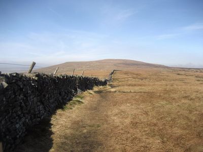
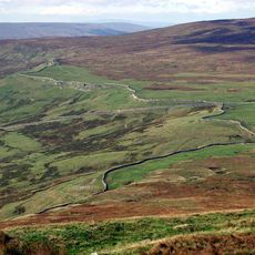
The stone cairn stands near the summit of Buckden Pike at about 702 meters (2300 feet) elevation in Yorkshire Dales National Park. It is a simple monument built from stacked stones that stands out clearly on this mountain top.
History
In 1942, a Polish Air Force Wellington bomber crashed on Buckden Pike, with only one of the five crew members surviving. This tragedy later led to the construction of the memorial to ensure the event would not be forgotten.
Culture
The memorial honors Polish airmen and their role during World War II in this region. Local people have worked to keep the story of these men alive and their memory respected.
Practical
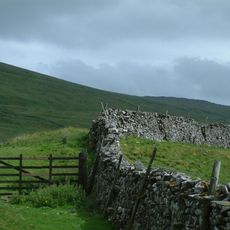
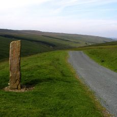
Several marked trails from Buckden village lead to the summit, with the shortest route following a steep bridleway. The terrain is rough and weather conditions can change quickly, especially at the summit elevation.
Did you know?
The memorial has drill holes that once contained cards identifying visible mountain peaks and geographical features in the distance. These information cards are now often missing, but the holes in the stone still suggest this ingenious feature.
AroundUs brings together thousands of curated places, local tips, and hidden gems, enriched daily by 60,000 contributors worldwide. Discover all places nearby (United Kingdom).
Great Whernside
6.4 km
Little Whernside
6.8 km
Yockenthwaite small stone circle
6.1 km
Tor Dike linear earthwork
3.9 km
Hunters Stone
3.8 km
Church of St Michael and All Angels
3.5 km
Church of St Mary
6.6 km
The George Inn
3.5 km
Fox And Hounds Public House
4 km
Kettlewell Bridge
6.6 km
The Buck Inn
2.4 km
Yockenthwaite Bridge
5.6 km
Town Foot Bridge
6.5 km
Bridge Approximately 100 Metres North-West Of Myers Garth
4.5 km
Bridge Over River Wharfe
3.5 km
Yockenthwaite Hall With Attached Outbuilding And Garden Wall And Gate To Front
5.5 km
The Old Hall
6.5 km
Buckden Bridge
2.5 km
Low Hall
6.6 km
The Vicarage
6.5 km
K6 Telephone Kiosk
6.5 km
West Gate Farmhouse With Barn Attached To Right
6.5 km
Medieval wayside cross
3.2 km
Packhorse bridge across Crook Gill, 530m south west of Mount Pleasant Farm
2.5 km
The Green
6.6 km
Grave Slab 1 Metre South Of Chancel Of Church Of St Mary
6.6 km
Scar House
3.9 km
The King's Head
6.6 kmDiscover hidden gems everywhere you go!
From secret cafés to breathtaking viewpoints, skip the crowded tourist spots and find places that match your style. Our app makes it easy with voice search, smart filtering, route optimization, and insider tips from travelers worldwide. Download now for the complete mobile experience.
A unique approach to discovering new places❞
— Le Figaro
All the places worth exploring❞
— France Info
A tailor-made excursion in just a few clicks❞
— 20 Minutes