Chest opened
+${chestReward.xp} XP
Explorer
NOUVEAU ×${chestReward.collectible.quantity}
tapez pour fermer
Chest locked

Open chests in the app

Around Us is built for your phone — chests unlock when you walk, explore and capture nearby places.

Enable Location

We need your location to show you interesting places around you

Discover nearby places

Find interesting locations and hidden gems around you

Precise directions

Get accurate directions and distances to places

Your location is never shared with other users. It's only used when you tap the location button.

Archers Way

Log in to your account

Start exploring — it's free

Trusted by 72,881 travelers worldwide

Continue with Google
Continue with Apple
or

We will send you a code to connect

By continuing, you accept our Terms and Conditions and our Privacy Policy

Check your inbox

We've sent a pincode in your inbox. Please enter the code below.

Archers Way
Discussion Reviews 1 Photos
25.1k Popularity

Archers Way, Residential street in Conisbrough, England

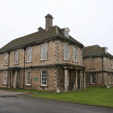
Archers Way is a residential street in Conisbrough that runs through a suburban neighborhood and connects to several neighboring roads. The street features a mix of residential properties spread across its length.

The street received its current name in 2009 following a formal change requested by local residents. This renaming was prompted by practical concerns that had affected the community for some time.

The previous name of the street inspired writers Ed Hurst and Rob Bailey to include it in their publication about unusual British place names.

The street is easily accessible and well-connected to the rest of Conisbrough's road network. Visitors can find straightforward walking access and a quiet residential environment.

Tour groups from overseas were regularly brought here to photograph an unusual street sign that had become an unexpected attraction. This attention from visitors eventually led residents to take action for a name change.

The community of curious travelers

AroundUs brings together thousands of curated places, local tips, and hidden gems, enriched daily by 60,000 contributors worldwide.

Start exploring
Location
GPS coordinates
53.48472,-1.21150
Latest update
December 20, 2025 11:38
Around this place
Conisbrough Castle
United Kingdom

Conisbrough Castle

966 m
Conisbrough Viaduct
United Kingdom

Conisbrough Viaduct

404 m
Church of St Peter
United Kingdom

Church of St Peter

1.2 km
Wadworth Hall
United Kingdom

Wadworth Hall

4.6 km
St James' Church, High Melton
United Kingdom

St James' Church, High Melton

3.2 km
Don Bridge
United Kingdom

Don Bridge

3.5 km
St John the Evangelist's Church, Cadeby
United Kingdom

St John the Evangelist's Church, Cadeby

1.8 km
Church of St Peter
United Kingdom

Church of St Peter

3.4 km
Church of St John the Baptist
United Kingdom

Church of St John the Baptist

4.5 km
Church of St Mary
United Kingdom

Church of St Mary

3.4 km
Church of St John the Baptist
United Kingdom

Church of St John the Baptist

4.4 km
Church of St Peter
United Kingdom

Church of St Peter

1.9 km
Church of St James
United Kingdom

Church of St James

4.3 km
Conisbrough Wesleyan Methodist Chapel
United Kingdom

Conisbrough Wesleyan Methodist Chapel

1.2 km
Church of St John the Baptist
United Kingdom

Church of St John the Baptist

4.8 km
War Memorial in Coronation Park
United Kingdom

War Memorial in Coronation Park

977 m
Set Of Stocks Resited In Coronation Park
United Kingdom

Set Of Stocks Resited In Coronation Park

975 m
Manor House
United Kingdom

Manor House

4.3 km
Milepost In Pavement To Front Of Number 10
United Kingdom

Milepost In Pavement To Front Of Number 10

1.6 km
Fountain and Lamp Standard at the southern entrance to Coronation Park
United Kingdom

Fountain and Lamp Standard at the southern entrance to Coronation Park

987 m
The Earl Of Strafford
United Kingdom

The Earl Of Strafford

4.5 km
Denaby War Memorial
United Kingdom

Denaby War Memorial

2.5 km
Milestone Against Roadside Wall Immediately To North Of Leylands Farm Cottages
United Kingdom

Milestone Against Roadside Wall Immediately To North Of Leylands Farm Cottages

3.3 km
Milestone, on Carr Lane boundary of Crookhill Park Golf Course
United Kingdom

Milestone, on Carr Lane boundary of Crookhill Park Golf Course

1.6 km
Milepost Approximately 70 Metres To West Of Junction With Denaby Lane
United Kingdom

Milepost Approximately 70 Metres To West Of Junction With Denaby Lane

3.2 km
Milestone At Junction With Ashton Lane And Maltby Lane
United Kingdom

Milestone At Junction With Ashton Lane And Maltby Lane

4.6 km
Standing cross at the junction of Holywell Lane with High Street, Maltby Lane and Ashton Lane
United Kingdom

Standing cross at the junction of Holywell Lane with High Street, Maltby Lane and Ashton Lane

4.6 km
Warmsworth Hall
United Kingdom

Warmsworth Hall

2.8 km
Show the full map
Reviews
Share your experience

No review yet

Discussions
Start a discussion...

No discussion yet

« Archers Way - Residential street in Conisbrough, England » is provided by Around Us (aroundus.com). Images and texts are derived from Wikimedia project under a Creative Commons license. You are allowed to copy, distribute, and modify copies of this page, under the conditions set by the license, as long as this note is clearly visible.

Discover hidden gems everywhere you go!

From secret cafés to breathtaking viewpoints, skip the crowded tourist spots and find places that match your style. Our app makes it easy with voice search, smart filtering, route optimization, and insider tips from travelers worldwide. Download now for the complete mobile experience.

Around Us App Screenshot

A unique approach to discovering new places

Le Figaro

All the places worth exploring

France Info

A tailor-made excursion in just a few clicks

20 Minutes

Around Us
Travel Guide & Maps
Download

Send to your phone

QR Code
1

Open the camera app on your mobile.

2

Point at the QR code with your camera. A notification will appear.

3

Tap the notification to open the link.