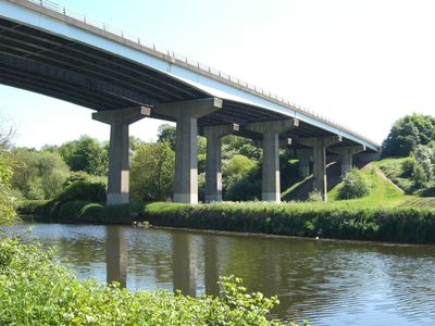
Don Bridge, Grade II listed viaduct in Sprotbrough, England.
Don Bridge is a stone road bridge crossing the River Don in Sprotbrough, connecting Warmsworth and Sprotbrough through its solid masonry structure. Its arched design and robust construction reflect the engineering methods of the 19th century.
Built in the 19th century, the bridge was constructed to meet growing transportation needs across the Don. It was later added to the Grade II listed buildings register to protect its historical significance.
The bridge takes its name from the river it crosses, becoming a daily landmark for local people. It serves as a physical link between two communities that have grown alongside it.
The bridge is open daily to vehicles and pedestrians and can be easily accessed via the main road through Sprotbrough. It is best to arrive during quieter times if you wish to observe the structure up close from below.
The bridge showcases Victorian engineering techniques that are rarely used in modern construction. Visitors can observe the fine detail of the stonework and craftsmanship when standing beneath the arches.
Location: Sprotbrough and Cusworth
Location: Warmsworth
GPS coordinates: 53.50865,-1.17672
Latest update: December 14, 2025 14:40
Cusworth Hall and Park
2.3 km
Conisbrough Viaduct
3.2 km
Mansion House, Doncaster
3.2 km
Cusworth Hall Museum & Park
2.3 km
St George's Minster
3.3 km
Doncaster Civic Office
3.3 km
Doncaster Museum
3.5 km
Doncaster Market
3.4 km
Nether Hall
3.7 km
St James' Church, High Melton
3.8 kmCo-Coperative Emporium And Danum House
3.1 km
Doncaster Corn Exchange
3.4 km
St John the Evangelist's Church, Cadeby
3.4 km
Church of St Peter
1.1 km
Christ Church
3.7 km
Church of St Mary
833 m
Church of St Katharine, Loversall
4.1 km
Church of St James
2.8 km
Bennetthorpe War Memorial
3.8 km
Milepost Approximately 75 Metres To North West Of Junction With Piperings Lane
3.8 km
Original Plant Works Building To South West Of Doncaster Station
2.7 km
St James' Pool And Health Club
3.1 km
Milepost Approximately 60 Metres To North West Of Lady Pitt's Bridge
3.1 km
National Westminster Bank
3.3 km
Milestone Against Roadside Wall Immediately To North Of Leylands Farm Cottages
3.7 km
Water Tower At Former BR Works
2.9 km
Milepost Approximately 50 Metres To West Of Pedestrian Entrance To Scawsby Ridgwood Comprehensive School
3.5 km
Station Booking Hall And Offices
2.9 kmVisited this place? Tap the stars to rate it and share your experience / photos with the community! Try now! You can cancel it anytime.
Discover hidden gems everywhere you go!
From secret cafés to breathtaking viewpoints, skip the crowded tourist spots and find places that match your style. Our app makes it easy with voice search, smart filtering, route optimization, and insider tips from travelers worldwide. Download now for the complete mobile experience.
A unique approach to discovering new places❞
— Le Figaro
All the places worth exploring❞
— France Info
A tailor-made excursion in just a few clicks❞
— 20 Minutes