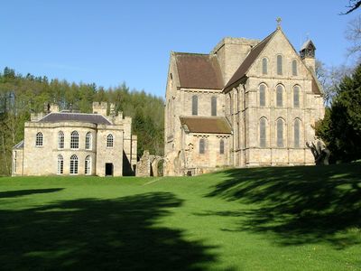
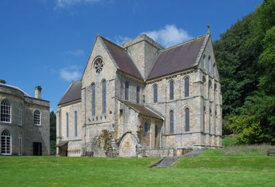
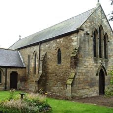
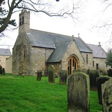
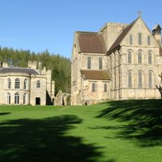
Brinkburn Priory, Augustinian priory in Northumberland, England.
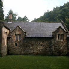
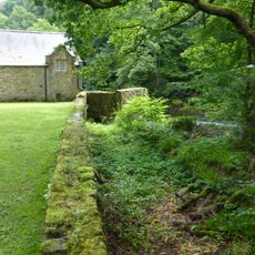
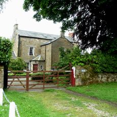
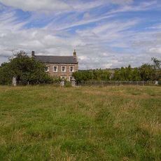
Brinkburn Priory is a medieval monastic site featuring a stone church nestled within a loop of the River Coquet and enclosed by woodland and scattered ruins. The grounds reveal the layout of various religious buildings, with foundations and walls still visible across the property.
The priory was founded between 1130 and 1135 by William Bertram, Baron of Mitford, with its first prior brought from a priory in Norfolk. The site grew into an important religious center that eventually ceased operations due to the religious upheaval of later centuries.
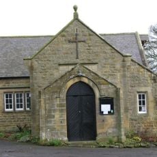
The black-robed Augustinian canons maintained a strict daily schedule of communal services, contemplative prayer, shared meals, and collective dormitory arrangements.
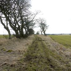
The site is reached by a pleasant woodland path of about ten minutes from the parking area and is maintained by English Heritage. The walk is straightforward and brings you directly to the church and surrounding ruins.
The church contains a William Hill organ with exceptional acoustics that create a special resonance for vocal and instrumental music. This distinctive sound quality makes it a rewarding place for anyone attuned to musical and acoustic properties.
Location: Brinkburn
Inception: 12 century
Website: https://english-heritage.org.uk/visit/places/brinkburn-priory
GPS coordinates: 55.27870,-1.81822
Latest update: December 9, 2025 18:46
Embleton Hall
3.4 km
Linden Hall
4.1 km
Hydraulic Silo Building 70 Metres East Of Cragend Farmhouse
3.9 km
Brinkburn Mill
86 m
Devil's Causeway
3.3 km
Church of St Thomas of Canterbury (Rc)
4.7 km
Church of St Helen
4.8 km
Church of St Mary
3.1 km
The Priory Church
57 m
Pant On North Of Junction With Church Street
3.1 km
Former Schoolmasters House And Old Schoolroom
4.8 km
The Anglers Arms
2.1 km
Rookwood House And Adjacent Cottage
2.9 km
Horsley Tower And Adjacent Outbuilding
4.7 km
Pauperhaugh Bridge Over The River Coquet
2 km
Weldon Bridge, Over River Coquet And Wall To North-west
2.2 km
Wall on North Side of Former Mill Race to South East of Manor House
39 m
Milepost Opposite Besom Barn Restaurant
4 km
The Old Vicarage
4.8 km
Garden Walls With Outbuildings At The Old Vicarage
4.8 km
Milepost At Ngr Nz 1429667
3.1 km
Milepost On East Side Of Old Road Down To Weldon Bridge (Q.V.)
2.3 km
Brinkheugh Farmhouse And Outbuilding To East
480 m
Pill Box At Nz 126 982
921 m
Pill Box At Nz 099 994
2 km
Lishman House
3.2 km
Pair Of Stones On Cartington Longframlington Parish Boundary
4.6 km
The Manor House
73 mVisited this place? Tap the stars to rate it and share your experience / photos with the community! Try now! You can cancel it anytime.
Discover hidden gems everywhere you go!
From secret cafés to breathtaking viewpoints, skip the crowded tourist spots and find places that match your style. Our app makes it easy with voice search, smart filtering, route optimization, and insider tips from travelers worldwide. Download now for the complete mobile experience.
A unique approach to discovering new places❞
— Le Figaro
All the places worth exploring❞
— France Info
A tailor-made excursion in just a few clicks❞
— 20 Minutes