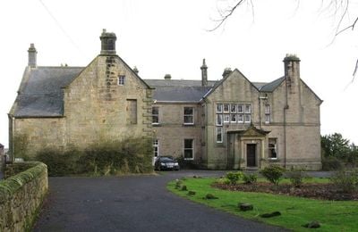
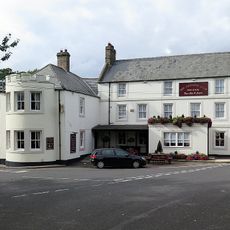
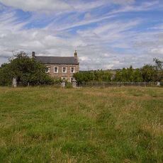
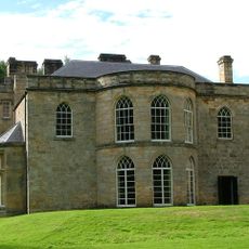
Embleton Hall, English country house and hotel in Longframlington, England.
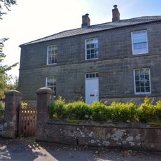
Embleton Hall is a two-storey stone building in Longframlington featuring slate roofs, rusticated quoins, sash windows, and a projecting porch with a pediment at the entrance. The property sits on grounds that include deciduous woodland and recreational facilities typical of country estates from its era.
The manor house was built by Thomas Embleton in 1730 and came under the ownership of the Fenwick family in 1780. Their stewardship shaped the estate for more than two centuries before its sale to new ownership in 1986.
The interior spaces maintain elements of traditional English design with decorative panelling and stone or marble fireplaces throughout multiple rooms.
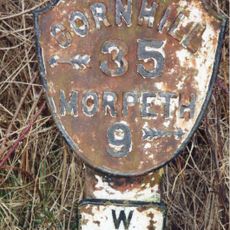
The property offers hotel accommodations and can be accessed by standard road routes in the area. Visitors should remember that rooms are housed in a historic building, so layouts and facilities reflect the property's age and character.
The building received Grade II listed status in 1953, marking its recognition as a structure of national importance. This designation means alterations to the fabric of the building are regulated to preserve its historical integrity.
Location: Longframlington
GPS coordinates: 55.30626,-1.79599
Latest update: December 14, 2025 14:24
Brinkburn Priory
3.4 km
Swarland Old Hall
3 km
Hydraulic Silo Building 70 Metres East Of Cragend Farmhouse
4.4 km
Brinkburn Mill
3.4 km
Devil's Causeway
847 m
Church of St Mary
365 m
The Priory Church
3.4 km
Pant On North Of Junction With Church Street
332 m
The Anglers Arms
2.9 km
Pauperhaugh Bridge Over The River Coquet
3.5 km
Weldon Bridge, Over River Coquet And Wall To North-west
3 km
Wall on North Side of Former Mill Race to South East of Manor House
3.4 km
Milepost Opposite Besom Barn Restaurant
1.1 km
Boundary Stones On Boundary With Longframlington Civil Parish 460 Metres North Of Shirlaw Pike
4.1 km
Milepost 180 Metres North Of Framlington Gate
2.7 km
3 Boundary Stones On Boundary With Longframlington Civil Parish
4.2 km
2 Boundary Stones On Boundary With Longframlington Civil Parish
3.9 km
2 Boundary Stones On Boundary With Longframlington
4.2 km
Pair Of Boundary Stones To North Of Hill Summit
4.2 km
4 Boundary Stones On Boundary With Longframlington Civil Parish
4.2 km
Brinkheugh Farmhouse And Outbuilding To East
3.1 km
Milepost On East Side Of Old Road Down To Weldon Bridge (Q.V.)
3.3 km
Pill Box At Nz 126 982
3.2 km
Pill Box At Nz 099 994
3.7 km
Newmoor Hall
2.4 km
The Manor House
3.4 km
Lishman House
172 m
Pair Of Stones On Cartington Longframlington Parish Boundary
2.6 kmVisited this place? Tap the stars to rate it and share your experience / photos with the community! Try now! You can cancel it anytime.
Discover hidden gems everywhere you go!
From secret cafés to breathtaking viewpoints, skip the crowded tourist spots and find places that match your style. Our app makes it easy with voice search, smart filtering, route optimization, and insider tips from travelers worldwide. Download now for the complete mobile experience.
A unique approach to discovering new places❞
— Le Figaro
All the places worth exploring❞
— France Info
A tailor-made excursion in just a few clicks❞
— 20 Minutes