Enable Location

We need your location to show you interesting places around you

Discover nearby places

Find interesting locations and hidden gems around you

Precise directions

Get accurate directions and distances to places

Your location is never shared with other users. It's only used when you tap the location button.

Chicksands Priory

Log in to your account

Start exploring — it's free

Trusted by 62,586 travelers worldwide

Continue with Google
Continue with Apple
or

We will send you a code to connect

By continuing, you accept our Terms and Conditions and our Privacy Policy

Check your inbox

We've sent a pincode in your inbox. Please enter the code below.

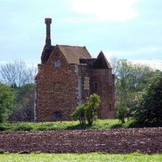
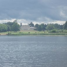
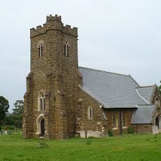
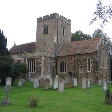
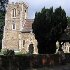
Chicksands Priory, Grade I listed country house in Campton and Chicksands, England.

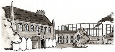
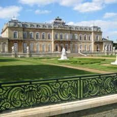
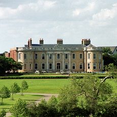
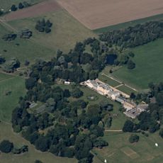
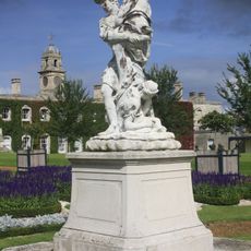
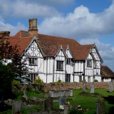
Chicksands Priory is a Grade I listed country house in Bedfordshire featuring medieval ecclesiastical architecture and formal gardens on a substantial estate. The building displays stonework from multiple periods and stands within landscaped parkland.

The priory was founded in 1101 as a Benedictine nunnery and transferred to the Gilbertine Order in 1147 before eventually becoming a private residence. The site took on military and scientific significance during the 20th century.

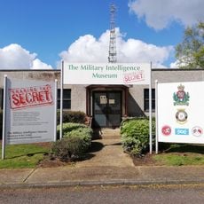
The building served as a strategic intelligence center during World War II, intercepting German coded signals for decryption at Bletchley Park.

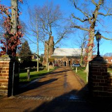
Access to the grounds is available through organized tours, which cover the architectural features and layout of the property. It is advisable to check in advance whether visits are possible on your chosen day, as they may be limited.

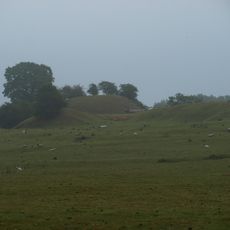
From 1950 to 1995, the grounds housed the FLR-9 direction finding antenna, locally known as the Elephant Cage. This distinctive installation was one of the largest radio detection systems in Europe at that time.

The community of curious travelers

AroundUs brings together thousands of curated places, local tips, and hidden gems, enriched daily by 60,000 contributors worldwide.

Start exploring
Inception
12 century
GPS coordinates
52.04070,-0.36607
Latest update
December 8, 2025 19:46
Around this place
Wrest Park
United Kingdom

Wrest Park

4.8 km
St Marys Church, Clophill
United Kingdom

St Marys Church, Clophill

3 km
Haynes Park
United Kingdom

Haynes Park

4.8 km
Southill Park
United Kingdom

Southill Park

3.5 km
Wardon Abbey
United Kingdom

Wardon Abbey

4.6 km
Cainhoe Castle
United Kingdom

Cainhoe Castle

3.2 km
Parish Church of All Saints, Campton
United Kingdom

Parish Church of All Saints, Campton

1.5 km
St Mary's Church, Lower Gravenhurst
United Kingdom

St Mary's Church, Lower Gravenhurst

4.2 km
Southill Lake and Woods
United Kingdom

Southill Lake and Woods

4.4 km
Military Intelligence Museum
United Kingdom

Military Intelligence Museum

417 m
Southill Baptist Chapel
United Kingdom

Southill Baptist Chapel

4.4 km
Church of All Saints, Southill
United Kingdom

Church of All Saints, Southill

3.8 km
Church of Saint Mary the Virgin
United Kingdom

Church of Saint Mary the Virgin

4.5 km
Parish Church of Saint Mary
United Kingdom

Parish Church of Saint Mary

3.3 km
Church of All Saints
United Kingdom

Church of All Saints

4.7 km
Church of St Mary the Virgin
United Kingdom

Church of St Mary the Virgin

3.6 km
Church of All Saints
United Kingdom

Church of All Saints

4.4 km
Parish Church of St Michael and All Angels
United Kingdom

Parish Church of St Michael and All Angels

2.2 km
Parish Church of Saint Giles
United Kingdom

Parish Church of Saint Giles

3.4 km
Clock House  Post Office
United Kingdom

Clock House Post Office

4.9 km
Hare And Hounds Public House
United Kingdom

Hare And Hounds Public House

4.9 km
The White Hart Public House
United Kingdom

The White Hart Public House

2.2 km
The Flying Horse Public House
United Kingdom

The Flying Horse Public House

4.3 km
Statue of Atlas Approximately 250M South-East of Wrest Park House
United Kingdom

Statue of Atlas Approximately 250M South-East of Wrest Park House

4.9 km
Four Statuary Groups in the South Parterre (also known as the French Garden) south of Wrest House, depicting Aeneas and Anchises, the Abduction of Helen of Troy, Venus and Adonis and Meleager and Atalanta
United Kingdom

Four Statuary Groups in the South Parterre (also known as the French Garden) south of Wrest House, depicting Aeneas and Anchises, the Abduction of Helen of Troy, Venus and Adonis and Meleager and Atalanta

4.9 km
Well Head And War Memorial At Junction With Grange  Street
United Kingdom

Well Head And War Memorial At Junction With Grange Street

4.3 km
Haynes Mission Hall
United Kingdom

Haynes Mission Hall

3.5 km
Manor House
United Kingdom

Manor House

3.6 km
Show the full map
« Chicksands Priory - Grade I listed country house in Campton and Chicksands, England » is provided by Around Us (aroundus.com). Images and texts are derived from Wikimedia project under a Creative Commons license. You are allowed to copy, distribute, and modify copies of this page, under the conditions set by the license, as long as this note is clearly visible.

Discover hidden gems everywhere you go!

From secret cafés to breathtaking viewpoints, skip the crowded tourist spots and find places that match your style. Our app makes it easy with voice search, smart filtering, route optimization, and insider tips from travelers worldwide. Download now for the complete mobile experience.

Around Us App Screenshot

A unique approach to discovering new places

Le Figaro

All the places worth exploring

France Info

A tailor-made excursion in just a few clicks

20 Minutes

Around Us
Travel Guide & Maps
Download

Send to your phone

QR Code
1

Open the camera app on your mobile.

2

Point at the QR code with your camera. A notification will appear.

3

Tap the notification to open the link.