St Marys Church, Clophill
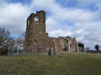
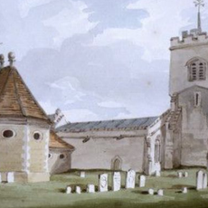
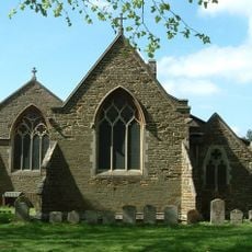
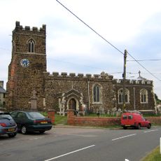
St Marys Church, Clophill, Medieval church ruins on hilltop in Clophill, England
St. Mary's Church in Clophill is a medieval church ruin sitting on a hilltop with tall walls made of coarse ironstone and large perpendicular windows added around 1450 to the nave. The restored structure clearly shows medieval craftsmanship with its distinctive stonework and ashlar detailing.
This church was built during the medieval period and served the local community for centuries as the main religious gathering place. After a new church was constructed in the village center in 1848 due to growing population, this structure was converted to serve as a mortuary chapel.
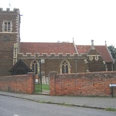
The churchyard still serves as a burial ground, and the restored ruins now function as a place to learn about medieval religious buildings in Bedfordshire. People come here to understand how such structures were used in the past.
The site is freely accessible and can be visited at any time, with the best views of the structure available from the paths around the building. The location sits on a hilltop, so comfortable walking shoes are recommended for exploring the surroundings.
The building deviates from the typical east-facing orientation of medieval churches and instead shows an unusual alignment. This departure from standard orientation makes it a rare and noteworthy example among medieval religious structures in England.
Location: Clophill
Inception: 14 century
GPS coordinates: 52.03730,-0.40960
Latest update: December 8, 2025 20:03
Wrest Park
3.3 km
Haynes Park
3.1 km
Chicksands Priory
3 km
Cainhoe Castle
1.6 km
Maulden Wood
2.4 km
Ailesbury Mausoleum
3.4 km
Parish Church of All Saints, Campton
3.9 km
Maulden Church Meadow
3.4 km
Maulden Heath
2.2 km
Military Intelligence Museum
3.1 km
Church of Saint Mary the Virgin, Maulden
3.4 km
Parish Church of Saint Mary
632 m
Church of Saint Mary the Virgin
2.6 km
Church of St James
3.4 km
Parish Church of Saint Giles
3.6 km
Statue of Lady Jemima, 27m South of the West Half House
4 km
Chinese Bridge Across North End Of Broad Water
3.7 km
The Flying Horse Public House
1.6 km
Statue of Atlas Approximately 250M South-East of Wrest Park House
3.5 km
Four Statuary Groups in the South Parterre (also known as the French Garden) south of Wrest House, depicting Aeneas and Anchises, the Abduction of Helen of Troy, Venus and Adonis and Meleager and Atalanta
3.3 km
Haynes Mission Hall
3.2 km
Group Of Six Statues 270M South Of Wrest Park House
3.6 km
Orangery, Steps And Four Cherub Statues On Pedestals
3.5 km
Bowling Green House And Two Urns On Pedestals 5m To The South-east And North-east
3.8 km
The Hawking Party Statue 150M South Of The Orangery (Formerly Listed As Equestrian Statue Group)
3.6 km
Sundial Approximately 270M South Of Wrest Park House
3.6 km
Fountain Within Small Circular Pond And Eight And Eight Surrounding Statues Approx 200M South Of Wrest Park House
3.5 km
Bath House And Cascade
3.5 kmVisited this place? Tap the stars to rate it and share your experience / photos with the community! Try now! You can cancel it anytime.
Discover hidden gems everywhere you go!
From secret cafés to breathtaking viewpoints, skip the crowded tourist spots and find places that match your style. Our app makes it easy with voice search, smart filtering, route optimization, and insider tips from travelers worldwide. Download now for the complete mobile experience.
A unique approach to discovering new places❞
— Le Figaro
All the places worth exploring❞
— France Info
A tailor-made excursion in just a few clicks❞
— 20 Minutes