Enable Location

We need your location to show you interesting places around you

Discover nearby places

Find interesting locations and hidden gems around you

Precise directions

Get accurate directions and distances to places

Your location is never shared with other users. It's only used when you tap the location button.

Claymills Pumping Station

Log in to your account

Start exploring — it's free

Trusted by 62,858 travelers worldwide

Continue with Google
Continue with Apple
or

We will send you a code to connect

By continuing, you accept our Terms and Conditions and our Privacy Policy

Check your inbox

We've sent a pincode in your inbox. Please enter the code below.

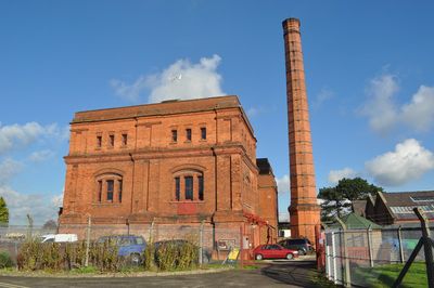
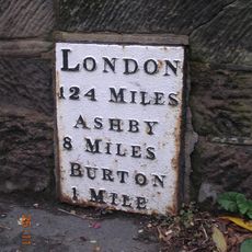
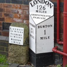
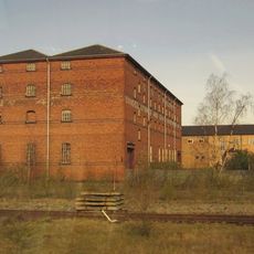
Claymills Pumping Station, Victorian sewerage pumping station in Burton, England

Claymills is a restored Victorian pumping station housing four large Woolf compound beam engines built by Gimson and Company of Leicester in 1885, arranged in mirror pairs facing each other. The facility was designed to manage both sewage and brewery waste from the town, and the original machinery remains operational today.

The station was constructed in the late 1800s to handle the rapid growth of Burton as an industrial town, operating for over 80 years before closing in 1971. Following decades of decline, volunteer restoration efforts began in 1993 to recover the engines and building.

The site reveals how Victorian engineers solved the sewage challenges of an expanding industrial town through clever mechanical design. Watching the machines operate today shows visitors how people once managed these essential services without modern technology.

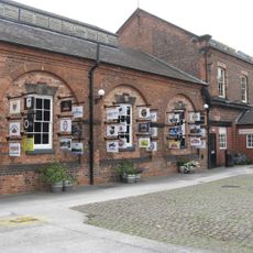
The site opens on select weekends when the engines run on steam, allowing visitors to see the machinery in operation up close. Wear suitable clothing as it gets hot and noisy near the working engines.

Two of the engines were originally built as steam-powered dynamos and can still generate electricity for the building's lighting today. This dual-purpose design demonstrates how efficiently Victorian engineers created machines that served multiple functions.

The community of curious travelers

AroundUs brings together thousands of curated places, local tips, and hidden gems, enriched daily by 60,000 contributors worldwide.

Start exploring
Location
GPS coordinates
52.82980,-1.61132
Latest update
December 14, 2025 09:47
Around this place
National Brewery Centre
United Kingdom

National Brewery Centre

2.9 km
Monks Bridge
United Kingdom

Monks Bridge

1.2 km
Bladon Castle
United Kingdom

Bladon Castle

1.1 km
Dovecliff Hall
United Kingdom

Dovecliff Hall

1.6 km
St John the Divine
United Kingdom

St John the Divine

2.2 km
United Kingdom

Burton Mill

1.8 km
St Mark's, Winshill
United Kingdom

St Mark's, Winshill

2.4 km
St. Chad's Church
United Kingdom

St. Chad's Church

2.2 km
St Mary's, Stretton
United Kingdom

St Mary's, Stretton

1 km
St Wilfrid's Church, Egginton
United Kingdom

St Wilfrid's Church, Egginton

2 km
Church of St Mary the Virgin, Newton Solney
United Kingdom

Church of St Mary the Virgin, Newton Solney

1.6 km
167, Horninglow Street
United Kingdom

167, Horninglow Street

2.8 km
Dove Aqueduct
United Kingdom

Dove Aqueduct

1.2 km
Craythorne Hall (Now Includes Craythorne Grange)
United Kingdom

Craythorne Hall (Now Includes Craythorne Grange)

2 km
Milepost At Beam Hill Cross Roads (Ngr Sk2346125998)
United Kingdom

Milepost At Beam Hill Cross Roads (Ngr Sk2346125998)

2.8 km
Former Hydraulic Power House
United Kingdom

Former Hydraulic Power House

2.2 km
Milepost, Ashby Road; Winshill, by No. 29, below junction with Mervyn Road
United Kingdom

Milepost, Ashby Road; Winshill, by No. 29, below junction with Mervyn Road

2.8 km
Trent And Mersey Canal Milepost At Sk 259 260
United Kingdom

Trent And Mersey Canal Milepost At Sk 259 260

373 m
1, Beacon Road
United Kingdom

1, Beacon Road

2.9 km
Magistrates Court
United Kingdom

Magistrates Court

2.8 km
Milepost At Royal Oak Inn (Ngr Sk2433524765)
United Kingdom

Milepost At Royal Oak Inn (Ngr Sk2433524765)

2.2 km
Newton Solney pipe bridge
United Kingdom

Newton Solney pipe bridge

2.3 km
Milepost, Tutbury Road, jct with BeamHill Road at Outwoods Cross
United Kingdom

Milepost, Tutbury Road, jct with BeamHill Road at Outwoods Cross

2.8 km
Pickford's Bonded Warehouse
United Kingdom

Pickford's Bonded Warehouse

2.3 km
Burton Bridge
United Kingdom

Burton Bridge

2.7 km
Milepost, Horninglow Road North; by Royal Oak PH, just W of bypass flover
United Kingdom

Milepost, Horninglow Road North; by Royal Oak PH, just W of bypass flover

2.2 km
Milepost, Burton Bridge, just W of ramp to flood plain
United Kingdom

Milepost, Burton Bridge, just W of ramp to flood plain

2.7 km
Milestone, Horninglow Road North; by Royal Oak PH, just west of bypass flover
United Kingdom

Milestone, Horninglow Road North; by Royal Oak PH, just west of bypass flover

2.2 km
Show the full map
« Claymills Pumping Station - Victorian sewerage pumping station in Burton, England » is provided by Around Us (aroundus.com). Images and texts are derived from Wikimedia project under a Creative Commons license. You are allowed to copy, distribute, and modify copies of this page, under the conditions set by the license, as long as this note is clearly visible.

Discover hidden gems everywhere you go!

From secret cafés to breathtaking viewpoints, skip the crowded tourist spots and find places that match your style. Our app makes it easy with voice search, smart filtering, route optimization, and insider tips from travelers worldwide. Download now for the complete mobile experience.

Around Us App Screenshot

A unique approach to discovering new places

Le Figaro

All the places worth exploring

France Info

A tailor-made excursion in just a few clicks

20 Minutes

Around Us
Travel Guide & Maps
Download

Send to your phone

QR Code
1

Open the camera app on your mobile.

2

Point at the QR code with your camera. A notification will appear.

3

Tap the notification to open the link.