Church of Saint Oswald, King and Martyr, Oswaldkirk

Log in to your account

AroundUs is a community-driven map of interesting places, built by curious explorers like you. It grows with every review, story, and photo you share.
Connect to save your favorite spots, contribute locations, and create personalized routes.
Continue with Google
Continue with Apple
Continue with X
Continue with Facebook
Continue with email
By continuing, you accept our Terms and Conditions and our Privacy Policy
Create an account

Church of Saint Oswald, King and Martyr, Oswaldkirk

Add to collection
Map
Suggest a change
Share

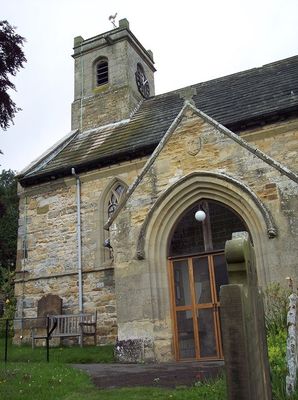
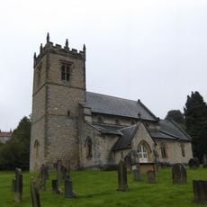
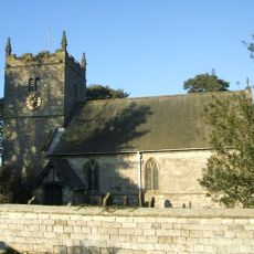
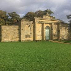
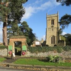
Church of Saint Oswald, King and Martyr, Oswaldkirk, Medieval church in Oswaldkirk, North Yorkshire, England.

The Church of Saint Oswald in Oswaldkirk sits on a hillside and displays Norman architecture with a 12th-century entrance portal. The building's interior and exterior are marked by Celtic stonework patterns carved into the masonry throughout.

The church was built around 1101, replacing an earlier wooden Anglo-Saxon chapel that once occupied the same site. Remains of an Anglo-Saxon stone cross from the pre-Norman era still survive within the building today.

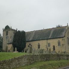
Saint Oswald, the Anglo-Saxon king and saint for whom the church is named, continues to hold meaning in local devotion and community gatherings. The building serves the village as both a place of worship and a social hub where residents gather throughout the year.

The site is easily accessible on foot from the village center and sits atop a rise with views across the surrounding countryside. Visitors should check ahead as access may be restricted during certain events or services held throughout the year.

Inside the church sits a carved stone relief from around 1000 depicting the Virgin and Child, a rare example of early medieval sculpture in the region. Two 17th-century bells hung in the tower continue to ring during services, connecting centuries of sound to the present day.

Location: Oswaldkirk

Inception: 12 century

GPS coordinates: 54.20222,-1.04972

Latest update: December 14, 2025 18:08

Photos
Around this place
Ampleforth Abbey
United Kingdom

Ampleforth Abbey

2.3 km
Duncombe Park
United Kingdom

Duncombe Park

4.4 km
Gilling Castle
United Kingdom

Gilling Castle

2.3 km
The Star Inn
United Kingdom

The Star Inn

4.1 km
Stonegrave Minster
United Kingdom

Stonegrave Minster

3.6 km
Holy Cross Church, Gilling
United Kingdom

Holy Cross Church, Gilling

2.1 km
Church of St Saviour
United Kingdom

Church of St Saviour

4.1 km
Church of All Saints And St James, Nunnington
United Kingdom

Church of All Saints And St James, Nunnington

4.5 km
Church of Saint Hilda
United Kingdom

Church of Saint Hilda

3.8 km
Church of St Chad
United Kingdom

Church of St Chad

2.8 km
Milepost Approximately 320 Metres South Of Church Of Holy Cross
United Kingdom

Milepost Approximately 320 Metres South Of Church Of Holy Cross

2.3 km
Milestone, ¾ mile N of Gilling
United Kingdom

Milestone, ¾ mile N of Gilling

1.3 km
Tuscan Temple
United Kingdom

Tuscan Temple

4 km
Milestone, East Gilling, opp. green metal TP signpost
United Kingdom

Milestone, East Gilling, opp. green metal TP signpost

1.9 km
Milestone, 1 mile S of Sproxton nr uc road to Ampleforth
United Kingdom

Milestone, 1 mile S of Sproxton nr uc road to Ampleforth

1.6 km
Laundry
United Kingdom

Laundry

4.6 km
Gilling East War Memorial Gate
United Kingdom

Gilling East War Memorial Gate

2.1 km
The Malt Shovel
United Kingdom

The Malt Shovel

249 m
Studford Ring
United Kingdom

Studford Ring

4.1 km
Ionic Temple
United Kingdom

Ionic Temple

4.5 km
Milepost Approximately 350 Metres North Of Birch House
United Kingdom

Milepost Approximately 350 Metres North Of Birch House

1.2 km
Milepost Approximately 400 Metres East Of Stonegrave Lodge
United Kingdom

Milepost Approximately 400 Metres East Of Stonegrave Lodge

2.6 km
Milepost Approximately 850 Metres North-West Of Bank Top Farm
United Kingdom

Milepost Approximately 850 Metres North-West Of Bank Top Farm

845 m
Milepost Approximately 100 Metres South-East Of South Farm
United Kingdom

Milepost Approximately 100 Metres South-East Of South Farm

4.2 km
Milestone Approximately Half A Mile West Of Village
United Kingdom

Milestone Approximately Half A Mile West Of Village

3.3 km
Northern Stable Block
United Kingdom

Northern Stable Block

4.5 km
Milestone Approximately Quarter Of A Mile North Of Village N Of Village
United Kingdom

Milestone Approximately Quarter Of A Mile North Of Village N Of Village

3.2 km
Milestone, on straight road
United Kingdom

Milestone, on straight road

4.2 km
Show the full map
Reviews

Visited this place? Tap the stars to rate it and share your experience / photos with the community! Try now! You can cancel it anytime.

« Church of Saint Oswald, King and Martyr, Oswaldkirk - Medieval church in Oswaldkirk, North Yorkshire, England » is provided by Around Us (aroundus.com). Images and texts are derived from Wikimedia project under a Creative Commons license. You are allowed to copy, distribute, and modify copies of this page, under the conditions set by the license, as long as this note is clearly visible.

Discover hidden gems everywhere you go!

From secret cafés to breathtaking viewpoints, skip the crowded tourist spots and find places that match your style. Our app makes it easy with voice search, smart filtering, route optimization, and insider tips from travelers worldwide. Download now for the complete mobile experience.

Around Us App Screenshot

A unique approach to discovering new places

Le Figaro

All the places worth exploring

France Info

A tailor-made excursion in just a few clicks

20 Minutes