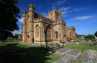
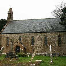
Church of St Bartholomew, Crewkerne, Medieval church in Crewkerne, England
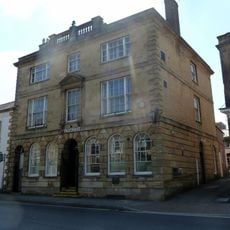
Church of St Bartholomew is a Grade I listed building constructed from warm-colored Ham Hill stone with large aisle windows and Tudor-era chapel additions. The building has been modified over time, with the organ later relocated to the south transept.
The building was erected in 1401, replacing an earlier Saxon church that served as a minster for a royal estate. The site held authority over several surrounding parishes, reflecting its medieval religious importance.
The church displays carved green men throughout its interior stonework, a decorative tradition that reflects the craftsmanship of medieval artisans. These figures represent a blend of folk tradition and religious art that visitors can observe while walking through the space.
The church sits on elevated ground west of the town center, making it visible from several approach routes. Since it remains an active parish church, visiting hours may be affected by services and religious events.
A preserved medieval oven sits in the northeast corner of the north chapel, once used specifically for baking communion bread. This rare survival shows the practical side of religious life that many churches no longer display.
Location: Crewkerne
Inception: 15 century
GPS coordinates: 50.88140,-2.79250
Latest update: December 14, 2025 14:25
Crewkerne Castle
2.6 km
Beacon Limestone Formation
2.1 km
Christ Church, Crewkerne
136 m
North Perrott Manor House
2.4 km
Church of All Saints
3.5 km
Church of St Michael and All Angels
3.2 km
Church of St Martin, North Perrott
3 km
Crewkerne Town Hall
478 m
Church of St Leonard
1.6 km
George Hotel
429 m
30, Church Street
3.4 km
King's Head Inn
3.5 km
White Hart Hotel
435 m
Group Of Three Monuments In Churchyard, About 10 Metres South Of South-East Corner, Church Of All Saints
3.4 km
The Thatched Farmhouse
1.5 km
Royal Oak Public House
280 m
Crewkerne War Memorial
346 m
Milestone, Outside The Post Office And Stores
3.2 km
Higher Farmhouse
3.6 km
17 Market Street and attached railings
356 m
Moorlands
2.6 km
Road Bridge Over Mill Stream
2.7 km
Milestone At Ngr St 4550 1055, About 140 Metres South-West Of Eastham's Gate Farmhouse
1.6 km
Former Sunday School
3.4 km
Eastham's Gate Farmhouse
1.8 km
National Westminster Bank
421 m
Milestone, near Folly Farm
1.3 km
Milestone, between South Perrot and Misterton
2.9 kmVisited this place? Tap the stars to rate it and share your experience / photos with the community! Try now! You can cancel it anytime.
Discover hidden gems everywhere you go!
From secret cafés to breathtaking viewpoints, skip the crowded tourist spots and find places that match your style. Our app makes it easy with voice search, smart filtering, route optimization, and insider tips from travelers worldwide. Download now for the complete mobile experience.
A unique approach to discovering new places❞
— Le Figaro
All the places worth exploring❞
— France Info
A tailor-made excursion in just a few clicks❞
— 20 Minutes