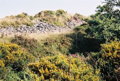
Cranbrook Castle, Iron Age hill fort in Moretonhampstead, England
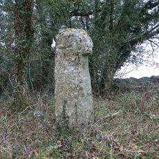
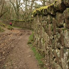
Cranbrook Castle is an Iron Age hill fort situated near Moretonhampstead in Devon, England. Its layout features earthen ramparts and ditches arranged in concentric rings around the summit, representing a typical defensive design from that prehistoric era.
This fortification was constructed during the Iron Age when Celtic communities built earthwork defenses around their settlements. It demonstrates the military strategy of that period, which involved positioning such structures on elevated terrain to monitor wider areas and repel intruders.
Celtic warriors used this stronghold to defend their territory and maintain control over the surrounding lands. The remains tell of an era when this region was ruled by competing chieftains who built such fortifications to demonstrate power.
The site is most easily reached on foot and the area is freely accessible to visitors. Sturdy footwear and weather protection are important since walking here involves uneven ground and exposure to the open hillside conditions.
The fort belongs to a group of three similar fortifications that likely operated as a coordinated defense network. This arrangement reveals how Iron Age communities organized territorial control across the wider region.
The community of curious travelers
AroundUs brings together thousands of curated places, local tips, and hidden gems, enriched daily by 60,000 contributors worldwide.