Prestonbury Castle, Iron Age hillfort in Drewsteignton, England
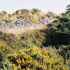
Prestonbury Castle is an Iron Age hillfort with three layers of ramparts and ditches arranged in concentric rings. The site sits at roughly 240 meters (787 feet) elevation with views over the Teign Valley below.
The hillfort was built and occupied from around the 6th century BC until the middle of the 1st century AD. It served as a high-status settlement before being abandoned as defensive needs shifted.
The multiple ramparts and ditches reveal how Iron Age communities organized themselves and built defensive structures. These earthworks still show how people arranged their settlements on high ground for protection.
The site is accessible on foot via walking paths that wind through the different enclosures. Trails connect the inner, middle, and outer sections so visitors can explore the whole fortification.
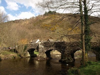
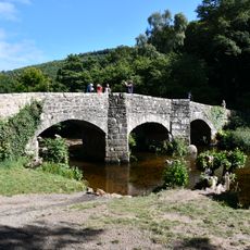
This site is part of a wider network of hillforts in the region, including Cranbrook Castle and Wooston Castle nearby. Together these places show how Iron Age communities created a system of defensive positions across the landscape.
Location: Drewsteignton
GPS coordinates: 50.69650,-3.77443
Latest update: December 14, 2025 18:14
Fingle Bridge
476 m
Drewe Arms
1.4 km
Cranbrook Castle
1.4 km
Church of the Holy Trinity
1.4 km
The Old Inn
1.5 km
Ashplants, Fingle Cottage Rookwood Cottage
1.3 km
K6 Telephone Kiosk
1.4 km
Mudge Headstone Approximately 12 Metres East Of Chancel Of Church Of The Holy Trinity
1.4 km
Preston Cottages
550 m
Church Gate Cottages
1.3 km
Church Rooms
1.4 km
Glebe Cottages
1.4 km
Primrose Cottage
1.3 km
Adjacent Piller And Mardon Headstones Approximately 12 Metres North-East Of Chancel Of Church Of Holy Trinity
1.4 km
Anonymous Chest Tomb Approximately 5 Metres South East Of Aisle Of Church Of Holy Trinity
1.4 km
Stevens Headstone Approximately 1.5 Metres East Of Chancel Of Church Of Holy Trinity
1.4 km
Bolt Headstone Approximately 10 Metres East North East Of Chancel Of Church Of Holy Trinity
1.4 km
Edgecombe
1.3 km
Anonymous Chest Tomb Approximately 2 Metres South Of Aisle Of Church Of Holy Trinity
1.4 km
Series Of Adjacent Headstones Lining Both Sides Of Path Approximately 3-9 Metres South Of Church Porch
1.4 km
Broadmeadow
1.5 km
Clysterhayes
1.4 km
Snell Headstone Approximately 1.5 Metres East Of Chancel Of Church Of Holy Trinity
1.4 km
Lady House
1.4 km
Churchyard Lych Gate Adjoining North Side Of Church Cottage
1.4 km
Drewsteignton War Memorial
1.4 km
Hillside House
1.4 km
Wayside Stone At Sx 742 887
1.4 kmVisited this place? Tap the stars to rate it and share your experience / photos with the community! Try now! You can cancel it anytime.
Discover hidden gems everywhere you go!
From secret cafés to breathtaking viewpoints, skip the crowded tourist spots and find places that match your style. Our app makes it easy with voice search, smart filtering, route optimization, and insider tips from travelers worldwide. Download now for the complete mobile experience.
A unique approach to discovering new places❞
— Le Figaro
All the places worth exploring❞
— France Info
A tailor-made excursion in just a few clicks❞
— 20 Minutes