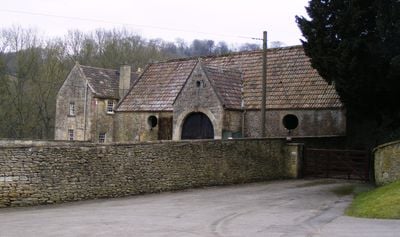
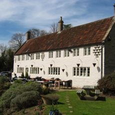
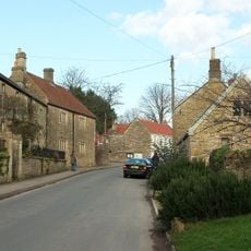
Combe Hay Manor, Manor house in Combe Hay, England
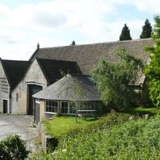
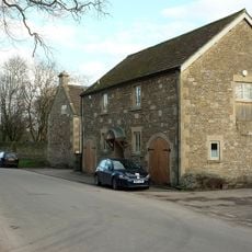
Combe Hay Manor is a substantial manor house in Somerset, constructed of ashlar Bath stone with hipped slate roofs and symmetrical ashlar chimney stacks. The building combines architecture from two distinct periods into a unified design.
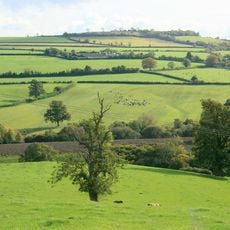
William the Conqueror granted these lands to Odo, Bishop of Bayeux, which included eight carucates of arable land. The current structure was built in two phases, with the western section completed between 1728 and 1730.
The manor displays ornate interior decorations from the 18th century, including decorative plasterwork, marble fireplaces, and multiple paneled rooms. These finishes reflect the wealth and taste of the families who lived here during that period.
This Grade I listed building is subject to strict heritage protection, so checking conditions before visiting is helpful. Access and visiting arrangements may vary depending on the season and private status, so advance information gathering is advisable.
The manor was built in two separate construction phases, with the western section completed between 1728 and 1730, while the eastern elevations were added about 40 years later. This delayed completion reveals how building projects and finances were spread across long periods.
Location: Combe Hay
GPS coordinates: 51.33720,-2.38111
Latest update: December 14, 2025 15:01
Stoney Littleton Long Barrow
2.7 km
The Packhorse
1.8 km
Church of St Julian, Wellow
1.5 km
Cross Keys Inn
2.4 km
Duncorn Hill
2.4 km
Church of St James, Southstoke
1.8 km
Church of All Saints, Dunkerton
2.5 km
Combe Hay Parish Church
49 m
Chapel Of St Martin
2.5 km
The Wheatsheaf
227 m
Wellow Bridge
1.9 km
K6 Telephone Kiosk By Memorial Trough
1.6 km
Wellow Signal Box
1.7 km
Wansdyke: section 1230yds (1120m) eastwards from Burnt House Inn
2 km
Weaver's Farmhouse
1.7 km
Group Of 3 Boundary Posts On A367,At Junction With Combe Hay Lane,At National Grid Reference St 7345 6187
1.9 km
Midford Viaduct
2.6 km
Group of three boundary posts at National Grid Reference ST 7480 6186
2.4 km
Boundary Post At Ngr St 7183 6049
1.8 km
Boundary Post On A367 At Dunkerton Bridge National Grid Reference St 7156 5932
2 km
Boundary Post On A367 At National Grid Reference St 7338 6167
1.9 km
Dovecote, 100 Yards To Rear Of Manor House
1.6 km
Tithe Barn And Adjoining Stable And Dovecote And Horse Engine House
1.7 km
Milestone At National Grid Reference St7538 6148
2.5 km
The Lodge
622 m
Wellow Farmhouse
1.7 km
Milestone At Ngr St 7182 6040
1.8 km
Milestone, Roman Road, between roundabout at Park & Ride and entrance to Odd Down Recycling site
1.6 kmVisited this place? Tap the stars to rate it and share your experience / photos with the community! Try now! You can cancel it anytime.
Discover hidden gems everywhere you go!
From secret cafés to breathtaking viewpoints, skip the crowded tourist spots and find places that match your style. Our app makes it easy with voice search, smart filtering, route optimization, and insider tips from travelers worldwide. Download now for the complete mobile experience.
A unique approach to discovering new places❞
— Le Figaro
All the places worth exploring❞
— France Info
A tailor-made excursion in just a few clicks❞
— 20 Minutes