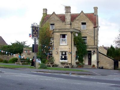
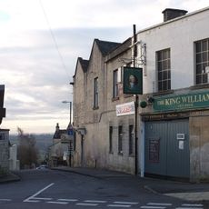
Cross Keys Inn, Historical pub in Combe Down, England
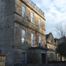
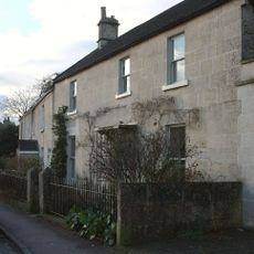
The Cross Keys Inn is a coaching inn in Combe Down built with squared rubble stone walls and traditional roof tiles covering its two-gabled structure. Located at a crossroads, the building displays the solid craftsmanship typical of its period.
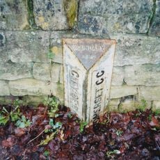
The building was constructed in the early 18th century on former Bath Priory land and first appeared in records in 1718 as a public house. Its early development coincided with growing traffic on the surrounding routes.
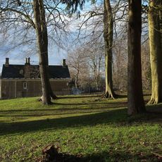
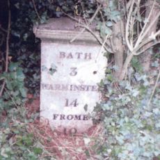
This inn reflects the traditional purpose of English coaching houses, which served travelers on major routes connecting Bath, Bristol, Warminster, and Wells. Its solid stone construction and two-gabled roof still convey the atmosphere of the coaching era.
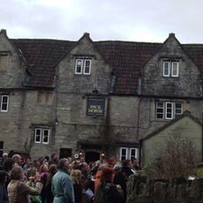
The establishment is open from midday until evening with a restaurant section and full wheelchair access throughout. It is worth checking in advance if special events or private bookings affect regular service.
Ralph Allen, the influential postmaster who shaped Georgian Bath, leased the property from 1739 to 1760. His connection to the inn underscores its importance in the region's development during that era.
Location: Combe Down
Location: Bath and North East Somerset
Accessibility: Wheelchair accessible
Address: Cross Keys Inn, Midford Road, Bath, Somerset, BA2 5RZ
Website: http://crosskeysbath.co.uk
GPS coordinates: 51.35554,-2.36365
Latest update: December 14, 2025 15:00
Midford Castle
1.3 km
Combe Down and Bathampton Down Mines
1.5 km
The Packhorse
663 m
Church of St James, Southstoke
657 m
Church of St Luke
1.5 km
Church of the Holy Trinity
1.3 km
Combe Down Post Office
1.1 km
Chapel Of St Martin
620 m
83-101, Church Road
1.3 km
King William Iv Public House
1 km
St Philip & St James Church
1.3 km
National Westminster Bank
1.3 km
Wansdyke: section 1230yds (1120m) eastwards from Burnt House Inn
682 m
Lonsdale
1.3 km
Vale View House
1.3 km
Claremont House, With Front Boundary Walls And Piers
1.4 km
Group Of 3 Boundary Posts On A367,At Junction With Combe Hay Lane,At National Grid Reference St 7345 6187
1.3 km
Bridge Over Footpath Between Fersfield And Prior Park Farm Woods
1.6 km
Parish Boundary Marker at ST7559762404
968 m
Group of three boundary posts at National Grid Reference ST 7480 6186
41 m
St Christopher
1.3 km
Boundary Post On A367 At National Grid Reference St 7338 6167
1.3 km
Combe Ridge
1.4 km
Milestone At National Grid Reference St7538 6148
734 m
24, Combe Road
971 m
Gate Piers At South End Of Ralph Allen Drive
1.5 km
Tithe Barn And Adjoining Stable And Dovecote And Horse Engine House
692 m
Milestone, Entry Hill, nr jct with Entry Hill Drive
1.1 kmVisited this place? Tap the stars to rate it and share your experience / photos with the community! Try now! You can cancel it anytime.
Discover hidden gems everywhere you go!
From secret cafés to breathtaking viewpoints, skip the crowded tourist spots and find places that match your style. Our app makes it easy with voice search, smart filtering, route optimization, and insider tips from travelers worldwide. Download now for the complete mobile experience.
A unique approach to discovering new places❞
— Le Figaro
All the places worth exploring❞
— France Info
A tailor-made excursion in just a few clicks❞
— 20 Minutes