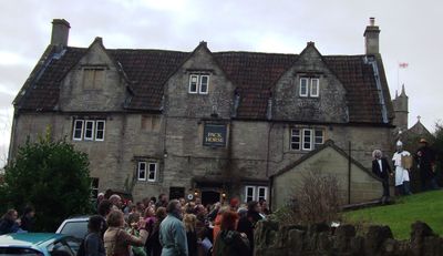
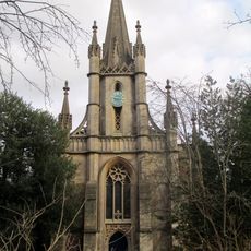
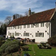
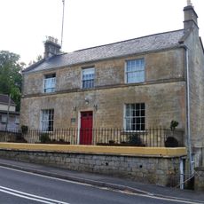
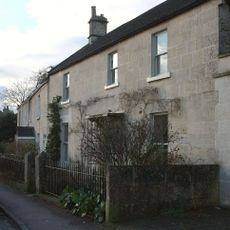
The Packhorse, Grade II listed pub in Southstoke, England.
The Packhorse is a Grade II listed pub built from stone walls and organized across two levels with exposed wooden beams and fireplaces in its rooms. The interior displays crafted details from its long building history.
The pub was built in the 17th century as a stopping point for merchants transporting goods through the region. It gained Grade II listed status due to its original building methods and architectural features.
The pub serves as a gathering place where villagers drink regional ales and join in community events that keep local connections strong. These meetings shape the social fabric of Southstoke in the present day.
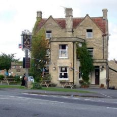
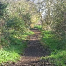
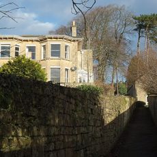
The pub sits on Midford Road where regular buses stop, making it accessible from Bath by public transport. The location is surrounded by walking paths that invite exploration of the surrounding countryside.
The building uses limestone blocks from local quarries, showing how craftsmen in the region worked traditionally. These stones come from the immediate area and represent local building materials of Somerset.
Location: Southstoke
Address: The Packhorse, Old School Hill, Southstoke, Bath, Somerset, BA2 7DU
Website: https://packhorsebath.co.uk
GPS coordinates: 51.34961,-2.36460
Latest update: December 14, 2025 13:03
Midford Castle
1.3 km
Cross Keys Inn
663 m
Church of St James, Southstoke
49 m
Church of the Holy Trinity
1.7 km
Combe Down Post Office
1.5 km
Chapel Of St Martin
1.1 km
83-101, Church Road
1.7 km
The Wheatsheaf
1.6 km
King William Iv Public House
1.4 km
St Philip & St James Church
1.7 km
Claremont House, With Front Boundary Walls And Piers
1.7 km
National Westminster Bank
1.7 km
Lonsdale
1.7 km
Tucking Mill Viaduct
1.7 km
Parish Boundary Marker at ST7559762404
1.5 km
Wansdyke: section 1230yds (1120m) eastwards from Burnt House Inn
832 m
Vale View House
1.7 km
Group Of 3 Boundary Posts On A367,At Junction With Combe Hay Lane,At National Grid Reference St 7345 6187
1.4 km
Group of three boundary posts at National Grid Reference ST 7480 6186
635 m
Boundary Post On A367 At National Grid Reference St 7338 6167
1.4 km
St Christopher
1.7 km
Midford Viaduct
1.5 km
Midford Viaduct (B&NSR)
1.6 km
The Moorings
1.5 km
Combe Ridge
1.7 km
24, Combe Road
1.4 km
Milepost At National Grid Reference St 7621 6071 On South Side Of Road
1.6 km
Tithe Barn And Adjoining Stable And Dovecote And Horse Engine House
100 mVisited this place? Tap the stars to rate it and share your experience / photos with the community! Try now! You can cancel it anytime.
Discover hidden gems everywhere you go!
From secret cafés to breathtaking viewpoints, skip the crowded tourist spots and find places that match your style. Our app makes it easy with voice search, smart filtering, route optimization, and insider tips from travelers worldwide. Download now for the complete mobile experience.
A unique approach to discovering new places❞
— Le Figaro
All the places worth exploring❞
— France Info
A tailor-made excursion in just a few clicks❞
— 20 Minutes