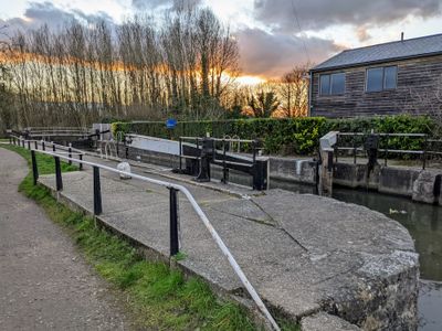
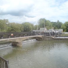
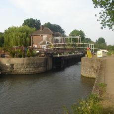
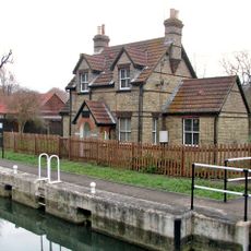
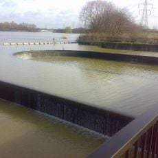
Dobbs Weir Lock, Navigation lock on River Lea, Hertfordshire, England
Dobbs Weir Lock is a navigation lock on the River Lea in Hertfordshire that allows boats to move between different water levels. The lock measures approximately 26 meters long and 5 meters wide, with a water level difference of about 2.4 meters between its upper and lower gates.
The lock was built in the 18th century as part of the River Lee Navigation system to support the movement of goods between London and rural regions. It remains a functional piece of this historical waterway that once drove commerce and connection across the river valley.
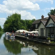
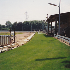
The lock sits along the Lea Valley Walk, where people come to walk, cycle, and fish in the river. It serves as a meeting point for those enjoying outdoor activities in the valley.
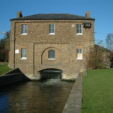
The lock is maintained by the Canal & River Trust and is accessible to boaters navigating the river. Visitors should plan to spend time at the lock as it takes several minutes to pass through, and guidance is available from staff on site.
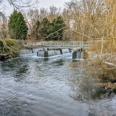
The lock creates a habitat that attracts numerous water birds and aquatic species, making it a quiet spot for wildlife observation. Many visitors are surprised to discover that they can watch herons, ducks, and other river animals while passing through.
Location: Hertfordshire
GPS coordinates: 51.75240,0.00331
Latest update: December 14, 2025 18:01
New River
1.4 km
Rye House, Hertfordshire
2.1 km
Dobbs Weir
404 m
Rye House Stadium
1.9 km
Rawdon House
1.2 km
Feildes Weir
1.5 km
Carthagena Weir
1 km
Carthagena Lock
1 km
Feildes Weir Lock
1.4 km
Church of St Augustine, Broxbourne
1.5 km
Church of St Catherine & St Paul
1.5 km
The Rye House Public House
2 km
The Golden Lion Inn
1.3 km
The Swan Inn
1.4 km
Front Wall And Wrought Iron Arch At Parish Church Of St Augustine
1.6 km
Rathmore House
1.3 km
Hoddesdon and Rye Park War Memorial
1.4 km
New River Bridge
1.5 km
Netherhall
1.5 km
Clock Tower
1.4 km
Remains Of Window And Wall Near Inner Edge Of Moat South East Of Rye House Gatehouse
2.1 km
Brick Bottle Kiln And Puddling Wheel
1.3 km
Remains Of Window And Wall Near Inner Edge Of Moat West Of Rye House Gatehouse
2 km
Pumping Station (Thames Water)
1.1 km
Rye House moated enclosure and gatehouse
2.1 km
Gateposts To South Of Rye House Gatehouse On The Causeway At The South West Corner Of The Moat
2 km
Broxbourne War Memorial
1.6 km
Nazeing Labyrinth Weir
1.4 kmVisited this place? Tap the stars to rate it and share your experience / photos with the community! Try now! You can cancel it anytime.
Discover hidden gems everywhere you go!
From secret cafés to breathtaking viewpoints, skip the crowded tourist spots and find places that match your style. Our app makes it easy with voice search, smart filtering, route optimization, and insider tips from travelers worldwide. Download now for the complete mobile experience.
A unique approach to discovering new places❞
— Le Figaro
All the places worth exploring❞
— France Info
A tailor-made excursion in just a few clicks❞
— 20 Minutes