Doll Tor, Bronze Age stone circle and burial ground in Birchover, England
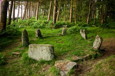
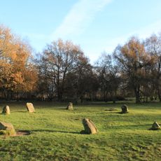
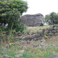
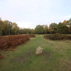
Doll Tor is a Bronze Age stone circle near Birchover comprised of six upright stones arranged in a rectangular pattern. Dry stone walls connect the standing rocks and divide the interior spaces of the monument.
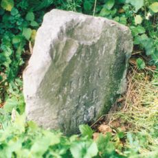
The monument was constructed in the Bronze Age and served as a burial site for an extended period. Archaeologists began systematic study in the 1850s, with additional investigations taking place decades later to understand its full extent.
The site served as a burial ground where cremated remains of community members were placed among the stones as part of ancient ritual practices. The arrangement of the standing rocks suggests this location held ceremonial importance for those who built it.
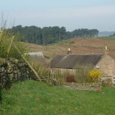
The site sits on sloping ground and is reached via field and woodland paths from Birchover village. Sturdy footwear is helpful as the terrain can be uneven and muddy depending on recent weather conditions.
The site experienced unauthorized alterations in the 1990s when unknown individuals added extra stones and disturbed the eastern mound. Restorers later carefully returned it to its original arrangement based on historical records.
Location: Birchover
Operator: Historic England;Peak National Park Authority
GPS coordinates: 53.16248,-1.64499
Latest update: December 10, 2025 16:25
Nine Ladies
1.2 km
Robin Hood's Stride
1.5 km
Stanton Hall
1.3 km
Nine Stones Close
1.3 km
Andle Stone
376 m
St Michael's Church, Birchover
811 m
Holy Trinity Church, Stanton-in-Peak
1.4 km
Winster Hall
2.3 km
Old Millclose engine house and associated features, 570m south west of Cowley Hall
2.2 km
Rowtor Rocks
508 m
The Flying Childers Inn
1.4 km
Druid Inn
755 m
Holmelea
2.3 km
Hawley Bridge 100 metres north north east of Harthill Lodge
2.1 km
Village Well
722 m
Cratcliff Rocks hermitage
1.2 km
Castle Ring defended settlement
1.8 km
Reform Tower
1.4 km
Milestone 15 Metres North Of Stoney Ley Lodge
1.1 km
Milestone 150 Metres South West Of Brimsbury Well
1.3 km
Barn at Harthill Hall Farm
2 km
Meadowside
1.6 km
Milepost 300 Yards South Of The Junction Of New Road And Chadwick Hill
2.2 km
The Lodge
1.5 km
Cliff Farmhouse
2.2 km
Bronze Age burial, ceremonial and settlement remains on Stanton Moor, and evidence for medieval, post-medieval and 19th to early
974 m
Holly House
1.5 km
Milestone, near Oxclose Wood, S of A6 jct
2.2 kmVisited this place? Tap the stars to rate it and share your experience / photos with the community! Try now! You can cancel it anytime.
Discover hidden gems everywhere you go!
From secret cafés to breathtaking viewpoints, skip the crowded tourist spots and find places that match your style. Our app makes it easy with voice search, smart filtering, route optimization, and insider tips from travelers worldwide. Download now for the complete mobile experience.
A unique approach to discovering new places❞
— Le Figaro
All the places worth exploring❞
— France Info
A tailor-made excursion in just a few clicks❞
— 20 Minutes