Andle Stone, Boulder in Stanton Moor, United Kingdom
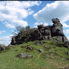
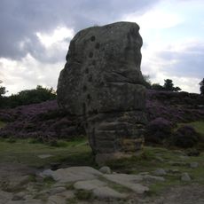
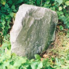
Andle Stone is a large boulder on Stanton Moor in Derbyshire, measuring roughly 6 meters in length and 4 meters in height. Its surface displays numerous circular markings that were made over a long period.
The stone bears inscriptions commemorating the Duke of Wellington and Lieutenant Colonel William Thornhill, who both fought in the battles of Assaye and Waterloo. These carvings connect the natural boulder to important moments in British military history.
The stone carries multiple local names such as Oundle Stone, Anvil Stone, and Twopenny Loaf, showing how differently people in the region know and refer to it. This variety of names reflects how long the formation has been part of local tradition.
The stone sits on private farmland and is best reached via Birchover Road, which serves as the main access point. The area is open and exposed, so it is best visited in daylight hours.
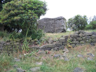
The stone is surrounded by a circular dry stone wall that frames it like a natural monument. The markings on its surface date back to pre-Roman times, showing that people visited this spot thousands of years ago.
Location: Stanton
GPS coordinates: 53.16320,-1.63949
Latest update: December 14, 2025 18:07
Nine Ladies
893 m
Robin Hood's Stride
1.9 km
Doll Tor
376 m
Stanton Hall
1.2 km
Nine Stones Close
1.7 km
St Michael's Church, Birchover
1.1 km
Holy Trinity Church, Stanton-in-Peak
1.3 km
Winster Hall
2.4 km
Old Millclose engine house and associated features, 570m south west of Cowley Hall
1.9 km
Rowtor Rocks
217 m
The Flying Childers Inn
1.4 km
Druid Inn
987 m
Hawley Bridge 100 metres north north east of Harthill Lodge
2.2 km
Village Well
837 m
Holmelea
2.4 km
Cratcliff Rocks hermitage
1.6 km
Castle Ring defended settlement
2.1 km
Stanton Old Hall
2.4 km
Reform Tower
1 km
Milestone 150 Metres South West Of Brimsbury Well
1.6 km
Milestone 15 Metres North Of Stoney Ley Lodge
1.3 km
Barn at Harthill Hall Farm
2.1 km
Bronze Age burial, ceremonial and settlement remains on Stanton Moor, and evidence for medieval, post-medieval and 19th to early
599 m
Milepost 300 Yards South Of The Junction Of New Road And Chadwick Hill
2.4 km
Meadowside
1.9 km
The Lodge
1.5 km
Holly House
1.4 km
Milestone, near Oxclose Wood, S of A6 jct
2.3 kmVisited this place? Tap the stars to rate it and share your experience / photos with the community! Try now! You can cancel it anytime.
Discover hidden gems everywhere you go!
From secret cafés to breathtaking viewpoints, skip the crowded tourist spots and find places that match your style. Our app makes it easy with voice search, smart filtering, route optimization, and insider tips from travelers worldwide. Download now for the complete mobile experience.
A unique approach to discovering new places❞
— Le Figaro
All the places worth exploring❞
— France Info
A tailor-made excursion in just a few clicks❞
— 20 Minutes