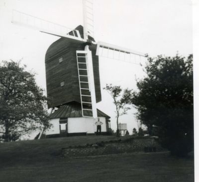
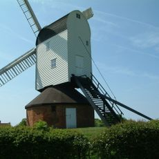
Fryerning Mill, Preserved post windmill in Mill Green, England.
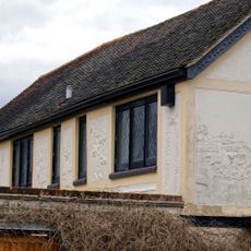
Fryerning Mill is a post windmill in Mill Green built with a single-story roundhouse and oak timber framing to process grain. It features both spring sails and patent sails that worked together to grind the grain, and it remains visible today as an external structure on the site.
Built in 1759 by millwright Robert Barker from Chelmsford, it replaced an earlier mill that had operated from 1564 to 1731. The new structure was needed after the previous one had served the area for more than 150 years.
The mill reflects how grain processing shaped daily life in the area for generations and how people depended on this technology for their livelihoods. Walking around it, you notice the sturdy wooden structure built specifically for this agricultural work.
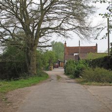
The mill sits in Mill Green and can be viewed from public pathways that run around the area. Since it is displayed as an external structure, access may be limited, so check locally before planning a visit to understand what viewing options are available.
In 1852, the mill owner became caught in the sails and endured twelve full rotations before being rescued, a harrowing reminder of the dangers people faced working with such machinery. This incident reveals the real hazards involved in operating grain mills of that era.
Location: Ingatestone and Fryerning
GPS coordinates: 51.68100,0.37100
Latest update: December 14, 2025 17:42
Ingatestone Hall
2.5 km
Mountnessing Windmill
2.9 km
Church of St Laurence, Blackmore
3.8 km
Church of St Edmund and St Mary, Ingatestone
1.6 km
Church of St Mary
3.1 km
Milestone And Cover Plate 45 Metres South West Of Ivy Cottage
2.1 km
Church of St Margaret
2.5 km
Church of St Mary the Virgin, Fryerning
598 m
St Paul's Church
3.7 km
The Bull Inn
3.8 km
The Red Lion Inn
2.6 km
The Spread Eagle Inn
3.5 km
The Bell Inn
1.5 km
Ingatestone Hall Gatehouse
2.5 km
George and Dragon
3.4 km
Milestone 27 Metres South South West Of The Spread Eagle Public House
3.5 km
United Reformed Church, Ingatestone
1.6 km
28 And 30, High Street
1.5 km
Milestone 12 Metres North West Of 9 Maldon Road
3.5 km
Holbrooks
3 km
Barn North East Of Corrells Farmhouse
3 km
Milepost Between Numbers 74 And 76
1.5 km
Swan House
3.8 km
Milepost 17 Metres South Of Number 306
3.5 km
98, High Street
1.5 km
Milestone, Maldon Road, by gate to public footpath
3.5 km
Milestone, opp. Heybridge Hotel
2.1 km
Milestone, opp. Spread Eagle PH
3.5 kmVisited this place? Tap the stars to rate it and share your experience / photos with the community! Try now! You can cancel it anytime.
Discover hidden gems everywhere you go!
From secret cafés to breathtaking viewpoints, skip the crowded tourist spots and find places that match your style. Our app makes it easy with voice search, smart filtering, route optimization, and insider tips from travelers worldwide. Download now for the complete mobile experience.
A unique approach to discovering new places❞
— Le Figaro
All the places worth exploring❞
— France Info
A tailor-made excursion in just a few clicks❞
— 20 Minutes