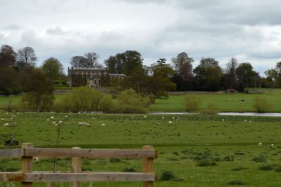
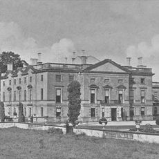
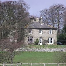
Forcett Hall, Grade I listed country house in Forcett, England
Forcett Hall is a three-story country house with Roman Doric columns and a classical front in Durham, England. The building contains multiple reception rooms arranged around a traditional layout and demonstrates a complete transformation from its earlier Elizabethan form.
The estate was home to the Shuttleworth family for several centuries, until a major redesign took place around 1740. This transformation followed the fashionable architectural ideals of that period and created the building you see today.
The front of the house displays classical columns and proportions that reflect how English gentry wanted to present themselves to the world. Walking through the rooms, you notice how each space was designed to impress guests and demonstrate refined taste.
The hall is typically open only by prior arrangement, as it remains a private residence. Visitors should contact ahead to confirm viewing possibilities and understand current access limitations.
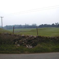
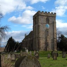
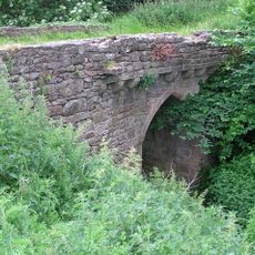
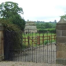
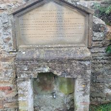
The estate sits on the site of an ancient Iron Age fortification and contains an 18th-century grotto with barrel-vaulted underground chambers. This hidden structure reveals how wealthy owners of that time designed subterranean spaces for leisure and intrigue.
Location: Forcett
GPS coordinates: 54.50640,-1.73583
Latest update: December 9, 2025 18:41
Stanwick Camp
1.4 km
Stanwick Park
1.6 km
St John the Baptist's Church, Stanwick
1.4 km
St James' Church, Melsonby
4.9 km
Chapel Bridge Over Black Beck
3.8 km
Church of St Cuthbert
374 m
Church of St Mary
4.3 km
Christ Church
2.7 km
Ruins Of St Lawrence's Chapel
3.9 km
Roman Catholic Church of St Mary
5 km
Church of St Paul
3.3 km
Dovecote 100 metres north of St Lawrence's Chapel
4 km
Dunsa Manor
5 km
Gainford War Memorial
4.3 km
Dovecote,45 Metres South Of Gainford Hall
4.4 km
Water Tap And Tablet Opposite Oak Tree Inn
4.5 km
Village Cross
4.4 km
Cross Base
5.5 km
Milestone, 110 Metres South Of Greystone Hall
4.3 km
Barforth Hall With Attached Outbuilding To North East
4.4 km
Milepost 400 Metres North Of Junction With Pudding Hill Road
3.7 km
Milepost 400 Metres North Of Junction With Pudding Hill Road
3.7 km
Aldbrough St John Packhorse Bridge
3.2 km
Lych Gate to Church of St Mary
4.5 km
Dovecote
292 m
Milestone, NW of lane to Hartforth
4.2 km
Milestone, S end of Melsonby village
5.1 km
Milestone, 2 miles W of B6274 jct
4.2 kmVisited this place? Tap the stars to rate it and share your experience / photos with the community! Try now! You can cancel it anytime.
Discover hidden gems everywhere you go!
From secret cafés to breathtaking viewpoints, skip the crowded tourist spots and find places that match your style. Our app makes it easy with voice search, smart filtering, route optimization, and insider tips from travelers worldwide. Download now for the complete mobile experience.
A unique approach to discovering new places❞
— Le Figaro
All the places worth exploring❞
— France Info
A tailor-made excursion in just a few clicks❞
— 20 Minutes