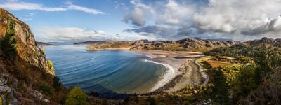
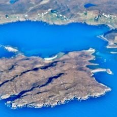
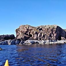
Gruinard Bay, Coastal bay in Highland, Scotland
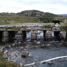
Gruinard Bay extends 5.5 miles along its western shore and 4.5 miles on its eastern shore, forming an L-shaped inlet with pink sand beaches.
The bay gained military significance during World War II when its nearby island was used for biological warfare testing by British scientists in 1942.
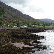
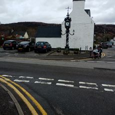
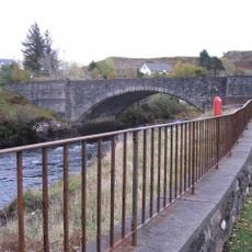
The settlements of Little Gruinard, Sand, First Coast, and Second Coast maintain traditional fishing practices along the eastern shore of the bay.
Three rivers flow into the bay: the Little Gruinard, River Gruinard, and Inverianvie, providing opportunities for nature observation and coastal walks.
The sand at Gruinard Bay displays an unusual pink coloration due to the specific mineral composition of local geological formations.
Location: Highland
GPS coordinates: 57.88320,-5.49440
Latest update: December 1, 2025 13:06
The Scottish Highlands span thousands of square miles in northern Scotland, offering striking landscapes of mountains, jagged coastlines, and remote lakes. This region retains villages that only recently gained road access, such as Rhenigidale on Harris Island, connected to the rest of the island in 1989. The Knoydart Peninsula remains accessible only by boat or on foot and has about a hundred residents. Notable sites include the Torridon hills, formed of red sandstone and rising roughly 1,000 meters (3,280 feet), the Bealach na Bà road which climbs to 626 meters (2,054 feet) with slopes up to 20 percent, and Sandwood Bay, a sandy beach reachable after several miles of walking. The Speyside Way stretches 85 miles (137 km) along the River Spey, passing through forests and moorlands near whisky distilleries. On the Isle of Skye, the Storr features needle-shaped rock formations, while Coire Lagan forms a glacial cirque carved into the rock. These sites highlight the region’s geological history and the ways of life that have persisted despite isolation.
An Teallach
16.7 km
Inverewe Garden
13.5 km
Polphail
224.4 km
Rua Reidh Lighthouse
19 km
Ben Mor Coigach
19.6 km
Isle Ristol
18.2 km
Beinn Dearg Mòr
17 km
Poolewe Stone
14.5 km
Carn Iar
9.6 km
Ullapool Museum
19.7 km
Sgùrr Fiòna
16.7 km
Aultbea Free Church
7.4 km
Rubha Cadail Lighthouse
16.7 km
Poolewe, Parish Church
14.5 km
Clapper Bridge, Aultbea
7.2 km
Ornsay House, 4 West Shore Street, Ullapool
19.8 km
Ullapool, Argyle Street, Sir John Fowler Memorial Clock
19.8 km
Poolewe, Bridge
14.6 km
Burial-ground of Ullapool old parish church
19.7 km
2 Custom House Street, Ullapool
19.9 km
Allt A' Pholl-choire, Clapper Bridge
16.2 km
Caledonian Macbrayne And Tourist Offices, 2 West Shore Street, Ullapool
19.8 km
5 Custom House Street, Ullapool
20 km
Ullapool, 9 Argyle Street, Old Bank House
19.9 km
Ullapool, Quay Street, Warehouse
19.9 km
Ullapool old parish church
19.7 km
4 Custom House Street, Ullapool
20 km
Drill Hall, 1 Custom House Street, Ullapool
19.9 kmReviews
Visited this place? Tap the stars to rate it and share your experience / photos with the community! Try now! You can cancel it anytime.
Discover hidden gems everywhere you go!
From secret cafés to breathtaking viewpoints, skip the crowded tourist spots and find places that match your style. Our app makes it easy with voice search, smart filtering, route optimization, and insider tips from travelers worldwide. Download now for the complete mobile experience.
A unique approach to discovering new places❞
— Le Figaro
All the places worth exploring❞
— France Info
A tailor-made excursion in just a few clicks❞
— 20 Minutes