Gunthorpe Bridge, Road bridge in Nottinghamshire, England.
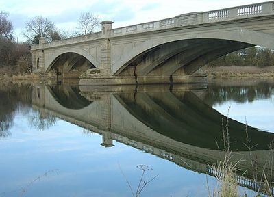
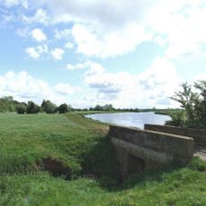
Gunthorpe Bridge is a three-span concrete arch bridge that crosses the River Trent in Nottinghamshire. The structure carries the A6097 road and connects communities on both sides of the river as an important local crossing point.
Viking-era settlements existed at this location, with a ferry service recorded in the Domesday Book of 1086. The present bridge was built in 1927 to replace earlier crossing methods and handle growing traffic demands.
The bridge has become a familiar landmark for local residents who cross it regularly on foot or by car as part of their daily routines. Over time, it has grown into an important connection point between neighboring villages that share cultural and economic ties.
The bridge deck is wide enough to accommodate both vehicles and pedestrians, offering clear views across the river. Daytime visits provide better visibility and easier passage through regular traffic flow.
The 1927 opening ceremony drew high-profile attendance that reflected the crossing's regional importance at the time. The construction represented a significant engineering achievement using advanced concrete techniques for its era.
Location: Nottinghamshire
Official opening: 1925
GPS coordinates: 52.98620,-0.98740
Latest update: December 14, 2025 12:21
Shelford Priory
877 m
St Michael's Church, Hoveringham
3.4 km
St Mary's Church, Lowdham
3.6 km
St Helen's Church, Burton Joyce
3.3 km
St Peter's Church, East Bridgford
1.1 km
St. Peter and St. Paul's Church, Shelford
2.3 km
Holy Trinity Church, Bulcote
2.7 km
St Helen's Church, Kneeton
3.7 km
St Aidan's Church, Caythorpe
2 km
United Reformed Church, Burton Joyce
3.6 km
Gunthorpe Lock
697 m
St John's Parish Church
705 m
Burton Joyce War Memorial
3.5 km
Spire Top One And A Half Metres West Of South Aisle At Church Of St Helen
3.3 km
Shelford War Memorial
2.4 km
Stable Block At Walnut House
2.4 km
Lowdham War Memorial
2.7 km
East Bridgford War Memorial Cross
1.2 km
Burton Joyce Library
3.2 km
Coach House At Kingswood
2.8 km
The Hall
719 m
Footbridge Over Stream Approximately 100 Metres South East Of 28 St Helens Road
3.3 km
Bulcote Corporation Model Farm
2.2 km
Ivy House
2.5 km
Burton Joyce Methodist Church And Adjoining School Room And Boundary Wall
3.2 km
Kingwood And Adjacent Pump
2.8 km
Farm Buildings At Mulberry Close
1.8 km
King's Barn
2.4 kmVisited this place? Tap the stars to rate it and share your experience / photos with the community! Try now! You can cancel it anytime.
Discover hidden gems everywhere you go!
From secret cafés to breathtaking viewpoints, skip the crowded tourist spots and find places that match your style. Our app makes it easy with voice search, smart filtering, route optimization, and insider tips from travelers worldwide. Download now for the complete mobile experience.
A unique approach to discovering new places❞
— Le Figaro
All the places worth exploring❞
— France Info
A tailor-made excursion in just a few clicks❞
— 20 Minutes