Gaunless Viaduct

Log in to your account

AroundUs is a community-driven map of interesting places, built by curious explorers like you. It grows with every review, story, and photo you share.
Connect to save your favorite spots, contribute locations, and create personalized routes.
By continuing, you accept our Terms and Conditions and our Privacy Policy

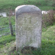
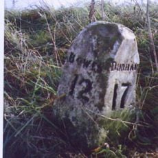
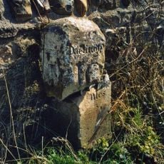
Gaunless Viaduct, Railway viaduct in County Durham, United Kingdom.

The Gaunless Viaduct spans the River Gaunless with four lattice truss spans supported by paired circular brick piers reaching a height of 161 feet.

The railway structure, designed by Thomas Bouch, opened in 1863 as part of the South Durham and Lancashire Union Railway connecting Bishop Auckland to Barnard Castle.

The viaduct represents the industrial development of County Durham, where railways played a central role in connecting communities and supporting coal mining operations.

Visitors can reach the viaduct location through local transportation networks and explore the surrounding trails that offer views of the remaining brick structures.

The construction cost of £15,422 in 1863 delivered a structure that accommodated a double track width, although initially only a single line was installed.

GPS coordinates: 54.62210,-1.80240

Latest update: March 10, 2025 14:45

Around this place
Show the full map
Raby Castle
United Kingdom

Raby Castle

3.5 km
The Greek Slave

The Greek Slave

3.5 km
Swin Bridge
United Kingdom

Swin Bridge

1.2 km
Church of St Mary, Staindrop
United Kingdom

Church of St Mary, Staindrop

4.6 km
Church of St John Evangelist
United Kingdom

Church of St John Evangelist

3.9 km
County Bridge Marker Approximately 100 Metres South Of Spinkford Bridge
United Kingdom

County Bridge Marker Approximately 100 Metres South Of Spinkford Bridge

4.5 km
Milestone Approximately C.800 Metres North Of Church Bridge, Staindrop
United Kingdom

Milestone Approximately C.800 Metres North Of Church Bridge, Staindrop

3.8 km
Church of St. Mary
United Kingdom

Church of St. Mary

992 m
Vane Mausoleum Approximately 100 Metres North Of Church Of St. Mary
United Kingdom

Vane Mausoleum Approximately 100 Metres North Of Church Of St. Mary

4.6 km
Church Bridge Over Langley Beck
United Kingdom

Church Bridge Over Langley Beck

4.6 km
Evenwood War Memorial
United Kingdom

Evenwood War Memorial

2.5 km
Butterknowle War Memorial
United Kingdom

Butterknowle War Memorial

2.4 km
North Gatehouse And Walls Attached Enclosing Castle; Gate House Formerly Listed As 'porter's Lodge'
United Kingdom

North Gatehouse And Walls Attached Enclosing Castle; Gate House Formerly Listed As 'porter's Lodge'

3.4 km
South Entrance Gateway To Raby Castle
United Kingdom

South Entrance Gateway To Raby Castle

4.5 km
Keverstone Grange Farmhouse With Outbuildings Attached
United Kingdom

Keverstone Grange Farmhouse With Outbuildings Attached

2.8 km
County Council Marker Stone In Front Of No. 13
United Kingdom

County Council Marker Stone In Front Of No. 13

4.6 km
Railway Indicator Stone C.3 1/2 Metres East Of Skew Bridge
United Kingdom

Railway Indicator Stone C.3 1/2 Metres East Of Skew Bridge

1.1 km
Byre House
United Kingdom

Byre House

3.2 km
Milestone C.40 Metres South Of Sun Inn
United Kingdom

Milestone C.40 Metres South Of Sun Inn

3.3 km
Stable Block North-East Of Stables And Coach-House
United Kingdom

Stable Block North-East Of Stables And Coach-House

3.2 km
Milestone C.200 Metres South-East Of Keverstone Grange Farmhouse
United Kingdom

Milestone C.200 Metres South-East Of Keverstone Grange Farmhouse

2.9 km
Milestone Approximately 4 Metres South-East Of Spinkford Bridge
United Kingdom

Milestone Approximately 4 Metres South-East Of Spinkford Bridge

4.4 km
Parish Boundary Stone C.100 Metres East Of Lead Mill House, On South Side Of Road
United Kingdom

Parish Boundary Stone C.100 Metres East Of Lead Mill House, On South Side Of Road

4.2 km
Milestone C.100 Metres North-East Of New Moor Lodge
United Kingdom

Milestone C.100 Metres North-East Of New Moor Lodge

3.6 km
Stables And Coachhouse, With Wall And Mounting-block Attached
United Kingdom

Stables And Coachhouse, With Wall And Mounting-block Attached

3.2 km
Gate Piers, Gates And Overthrow C.200 Metres North-East Of Church Of St.Mary
United Kingdom

Gate Piers, Gates And Overthrow C.200 Metres North-East Of Church Of St.Mary

4.6 km
High Etherley
United Kingdom

High Etherley

4.6 km
Toft Hill
United Kingdom

Toft Hill

3.9 km
Show the full map

Reviews

Visited this place? Tap the stars to rate it and share your experience / photos with the community! Try now! You can cancel it anytime.

« Gaunless Viaduct - Railway viaduct in County Durham, United Kingdom. » is provided by Around Us (aroundus.com). Images and texts are derived from Wikimedia project under a Creative Commons license. You are allowed to copy, distribute, and modify copies of this page, under the conditions set by the license, as long as this note is clearly visible.

Discover hidden gems everywhere you go!

From secret cafés to breathtaking viewpoints, skip the crowded tourist spots and find places that match your style. Our app makes it easy with voice search, smart filtering, route optimization, and insider tips from travelers worldwide. Download now for the complete mobile experience.

Around Us App Screenshot

A unique approach to discovering new places

Le Figaro

All the places worth exploring

France Info

A tailor-made excursion in just a few clicks

20 Minutes