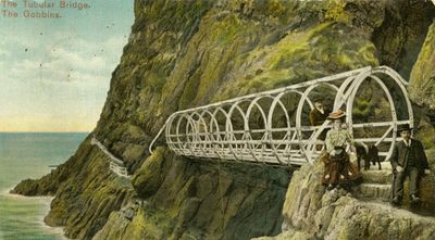
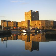
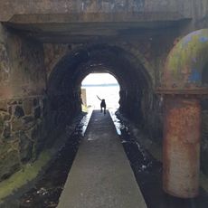
Gobbins path, Cliff-edge hiking trail in County Antrim, Northern Ireland.
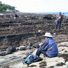
Gobbins Path is a coastal hiking route in County Antrim that follows a series of metal walkways and bridges attached to dramatic cliff faces above the ocean. The trail winds through dramatic terrain where you remain constantly aware of the sheer drops and open water below as you make your way along the route.
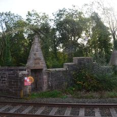
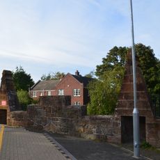
The path was created in 1902 by engineer Berkeley Deane Wise as a tourism initiative for the Northern Ireland coast. This project reflected the Victorian era's confidence in building infrastructure through challenging natural terrain to open remote areas to visitors.
The trail represents early twentieth-century engineering innovation, demonstrating how Victorian-era designers integrated infrastructure with natural coastal formations for public access.
The trail is accessed through guided tours that should be booked in advance, typically lasting around two hours. Sturdy footwear is essential for navigating the metal sections, and weather can change quickly along the coast so appropriate clothing is important.
The metal walkways pass so close to the cliff face that you can observe seabirds directly in their nests along the rock walls. This proximity to nesting colonies makes the path one of the few places where you can watch coastal birds up close during breeding season.
Location: County Antrim
Website: http://thegobbinscliffpath.com
GPS coordinates: 54.80100,-5.69000
Latest update: December 6, 2025 16:03
Ireland offers photographers a combination of historical structures, landscape formations and coastal sections. The island contains medieval fortresses such as Blarney Castle and Rock of Cashel, basalt formations at Giant's Causeway, and early medieval monastery sites at Glendalough. Trinity College...
Northern Ireland tells its story through stones, cliffs, and memories. From the Giant's Causeway to Derry's walls, each place seems filled with stories where Celtic myths, medieval heritage, and traces of the modern world intertwine. Belfast, once an industrial hub turned cultural center, showcases...
Taylors Avenue
11.5 km
The Maidens lighthouses
14.5 km
Carnfunnock Country Park
14.2 km
Blackhead Lighthouse
3.8 km
Chaine Memorial
9.1 km
Olderfleet Castle
9.1 km
Waterloo Bay
10.6 km
Pickie Fun Park
15.2 km
Ballylumford Dolmen
7 km
Grey Point Fort
14.4 km
Carrickfergus Borough Council Town Hall Joymount Carrickfergus Co. Antrim Bt38 7dl
12 km
Town Hall Upper Cross Street Larne Co Antrim Bt40 1sz
10.1 km
Carrickfergus Castle
12.3 km
Whitehead Railway Museum
5.1 km
Kilwaughter Castle
13.6 km
Ferris Point Lighthouse
8.5 km
Raloo Church Of Ireland Parish Church Glenoe Larne Co Antrim
9.2 km
Andrew Jackson Cottage & US Rangers Museum
10.6 km
Larne Museum & Art Centre
10.2 km
St Cedmaís C Of I Church Inver Road Larne Co Antrim
10.3 km
St Johnís C. Of I. Church Low Road Ballyharry Islandmagee Larne Co Antrim
2.4 km
Former Lighthouse Keepers Houses At Blackhead Lighthouse Mccrea's Brae Whitehead Co Antrim Bt38 9nz
3.8 km
Station Platforms Helen's Bay Station Helen's Bay Bangor Co.down
15.3 km
Railway Bridge Helen's Bay Railway Station Helen's Bay Bangor Co Down
15.3 km
Road Bridge Bridge Road Helen's Bay Bangor Co Down
15.3 km
3 Station Square Helen's Bay Bangor Co. Down
15.3 km
Railway Bridge Helen's Bay Station Helen's Bay Bangor Co.down
15.3 km
St Nicholas' Church, Carrickfergus
12.2 kmVisited this place? Tap the stars to rate it and share your experience / photos with the community! Try now! You can cancel it anytime.
Discover hidden gems everywhere you go!
From secret cafés to breathtaking viewpoints, skip the crowded tourist spots and find places that match your style. Our app makes it easy with voice search, smart filtering, route optimization, and insider tips from travelers worldwide. Download now for the complete mobile experience.
A unique approach to discovering new places❞
— Le Figaro
All the places worth exploring❞
— France Info
A tailor-made excursion in just a few clicks❞
— 20 Minutes