Heswall Dales, Protected natural area in Heswall, England
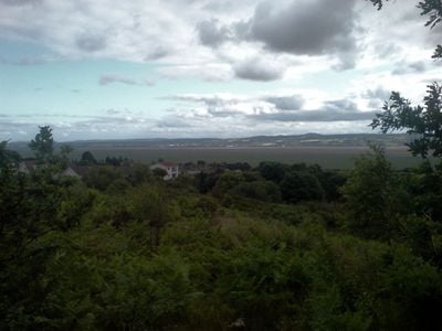
Heswall Dales is a protected natural area near the Dee Estuary covering about 72 acres of lowland heathland. The reserve supports heather, gorse, and mosses growing on acidic soils that characterize this coastal landscape.
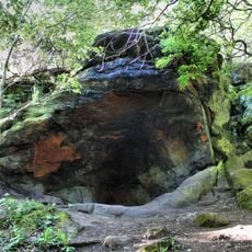
The land formed from Triassic sandstone exposed during the last Ice Age and once served as common grazing ground. It later gained protection status to preserve its natural character for the future.
Local volunteer groups work alongside Wirral Borough Council to maintain the heathland through regular management activities. Visitors often encounter these conservation teams caring for the landscape and can observe how the community participates in protecting this natural space.
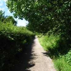
The reserve offers seven entry points, with recommended access from Oldfield Road or Bushway, though parking within the area is limited. Visitors should wear sturdy footwear as the ground can become wet seasonally, especially after rainfall.
This reserve serves as a watching point for Arctic waders and Pink Footed Geese that migrate along the Dee Estuary during winter months. These seasonal bird movements make it a special spot for nature observers during colder weather.
GPS coordinates: 53.33000,-3.11600
Latest update: December 14, 2025 17:42
Wirral Country Park
2.3 km
St Peter's Church, Heswall
1.2 km
Thurstaston Hall
2.3 km
The Dungeon SSSI
942 m
St. Bartholomew's Church, Thurstaston
2.3 km
Irby Hall
2.3 km
Christ Church, Barnston
2.6 km
Cleaver Heath Nature Reserve
224 m
Sundial to west of St Peter's Church
1.1 km
Thurstaston War Memorial
2.3 km
Barn To Dawpool Farm, To West Of Other Buildings Granary To Dawpool Farm, To West Of Other Buildings
2.5 km
The Old Farm, Gayton
2.2 km
Gatepiers To North Of Thurstaston Hall
2.4 km
Heswall War Memorial
1.2 km
Dawpool Farmhouse
2.5 km
South Lodge with Attached Gates and Gate Piers
2.5 km
Cattle Sheds Incorporating Smithy And Implement Shed At Dawpool Farm
2.4 km
Beech Farmhouse
2.6 km
Pensby Hall
1.3 km
Former Thurstaston School
2.4 km
Irby Farmhouse
2.4 km
Lloyds Bank, Heswall
1.1 km
Oldfield Farmhouse
836 m
Sundial approximately 40 metres to south of St Bartholomew's Church
2.3 km
The Clock Tower
2.5 km
Tower of former church of St Bartholomew
2.3 km
Milepost, NE of Gayton roundabout
2.4 km
Milepost, Barnston
2.5 kmVisited this place? Tap the stars to rate it and share your experience / photos with the community! Try now! You can cancel it anytime.
Discover hidden gems everywhere you go!
From secret cafés to breathtaking viewpoints, skip the crowded tourist spots and find places that match your style. Our app makes it easy with voice search, smart filtering, route optimization, and insider tips from travelers worldwide. Download now for the complete mobile experience.
A unique approach to discovering new places❞
— Le Figaro
All the places worth exploring❞
— France Info
A tailor-made excursion in just a few clicks❞
— 20 Minutes