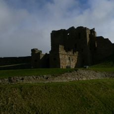
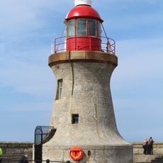
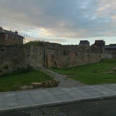
Jingling Geordie's Hole, Cave near Tynemouth Castle, England
Jingling Geordie's Hole is a cave along the cliffs near Tynemouth with a rectangular entrance opening toward King Edward's Bay. The narrow passage leads through the rock and past the castle wall into multiple inner chambers that suggest the cave system was modified by human hands over time.
The cave served as a lookout during the 17th century for a smuggler who tracked incoming ships near the Black Middens from this spot. Over later centuries the site shifted until major landslides in the 1880s partially sealed the entrance and transformed its physical character.
The cave takes its name from a 17th century smuggler whose story remains part of local memory in the area. Visitors can sense how this place connects to Tynemouth's maritime past through the tales people still share about those who used it.
Reach the entrance by climbing down a steep zigzag path from the top, which requires solid footing and caution. Expect limited space near the opening due to old landslip debris, and be ready for slippery or loose rocks underfoot in the narrow passages.
The interior shows evidence of shaped stonework suggesting that people modified the cave to suit their needs rather than finding a natural cavern. These traces indicate a constructed refuge rather than a purely natural formation.
GPS coordinates: 55.01800,-1.41700
Latest update: December 12, 2025 16:40
Collingwood Monument
407 m
Tynemouth Castle and Priory
133 m
Tyne Turrets
727 m
Clifford's Fort
1.4 km
Herd Groyne Light
1.3 km
Tynemouth North Pier light
978 m
Fish Quay Old Low Light
1.4 km
Tyne South Pier light
1.3 km
Old Lowlight Heritage Centre
1.4 km
Fish Quay Low Light
1.5 km
Church of Holy Saviour
920 m
Statue of Duke of Northumberland, South of Master Mariners' Homes
979 m
Statue of Queen Victoria
568 m
Church of St Augustin
1.4 km
Grand Hotel
617 m
Littlehaven Beach
1.5 km
Tynemouth Watch House
395 m
South African War Memorial Opposite Number 2
632 m
Master Mariners' Homes
980 m
North Pier With Crane Attached And Lighthouse
483 m
First World War Memorial Opposite Number 6
602 m
Land Of Green Ginger Shopping Mall And Former Church Hall Adjoining On East
535 m
Main Passenger Building Of Tynemouth Old Railway Station
661 m
Clifford's Fort Trinity House Almshouses And Boundary Stone Attached
1.4 km
Ballard's Smoke House Clifford's Fort And Boundary Stones Attached
1.3 km
1-3, Tynemouth Terrace
560 m
Tynemouth Toy Museum
1.1 km
Clifford's Fort South And East Wall Facing River
1.3 kmVisited this place? Tap the stars to rate it and share your experience / photos with the community! Try now! You can cancel it anytime.
Discover hidden gems everywhere you go!
From secret cafés to breathtaking viewpoints, skip the crowded tourist spots and find places that match your style. Our app makes it easy with voice search, smart filtering, route optimization, and insider tips from travelers worldwide. Download now for the complete mobile experience.
A unique approach to discovering new places❞
— Le Figaro
All the places worth exploring❞
— France Info
A tailor-made excursion in just a few clicks❞
— 20 Minutes