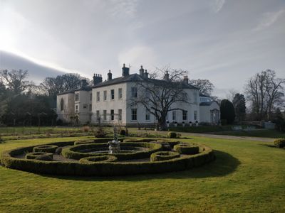
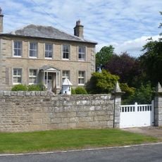
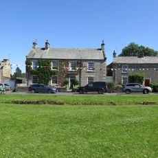
Lartington Hall, English country house in Lartington, England
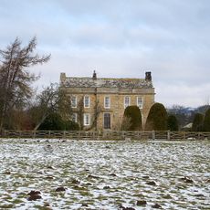
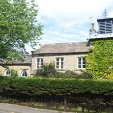
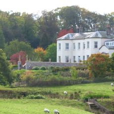
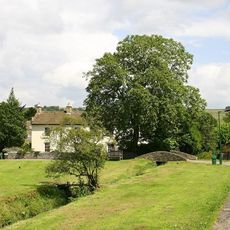
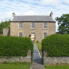
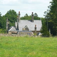
Lartington Hall is an English country house built in the late 1600s with a three-storey central block and Georgian additions, set within seven acres of formal gardens and woodland. The property overlooks approximately 100 acres of historic parkland in Lower Teesdale.
The estate was built in the late 1600s for Francis Appleby and received a Georgian extension around 1750. Throughout its history, the property has had only five different owners and served the Red Cross for a period after World War II.
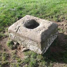
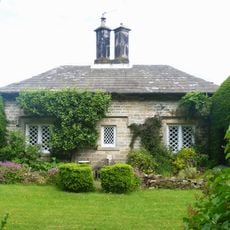
The hall houses a museum established in 1811 to display a fossil and art collection gathered by its owner at that time. Visitors today can still see parts of this historic collection, which reflects the interests of those who lived here in the past.
The property operates primarily as a venue for events and celebrations, available by arrangement. Access to the grounds and gardens is best planned in advance through the venue operators to ensure availability.
The property remained under the ownership of just five families throughout its entire existence, which is unusual for a large English estate and allowed the character and collections to remain relatively unchanged. This rare continuity of ownership helped maintain its original feel across the centuries.
Location: Lartington
Website: https://lartingtonhall.co.uk
GPS coordinates: 54.55500,-1.96839
Latest update: December 8, 2025 21:03
Barnard Castle
3 km
Tees railway viaduct
1.8 km
Cotherstone Castle
2.3 km
Mausoleum/Mortuary Chapel 90 Metres North Of Yew Trees
142 m
Barnard Castle Bridge
3 km
The White Swan Public House And Swan Cottage
3 km
Nabb Bridge, 160 Metres West Of Nabb House
3 km
Deepdale Aqueduct
2.6 km
Doe Park
2.9 km
The Christening Stone, 160m east of Doe Park
2.9 km
Balder Bridge
2.6 km
Post Office Post Office And Brampton House
3 km
Tower House
239 m
Garden Wall, With Statues And 2 Sets Of Gate Piers, Adjoining To East Of Lartington Hall
71 m
Outbuilding, 20 Metres West Of The Grove
687 m
The Grove
658 m
Cotherstone Bridge
2.6 km
Milepost Opposite East End Of Bowes Gate Cottages
2.9 km
The Green And Front Garden Wall
1.9 km
The Nook
212 m
Brook Lea House (Shown On Os Map As Brook House)
1.9 km
Pecknell Farmhouse
756 m
Hallgarth Hill House
2.3 km
The Beeches
628 m
The Woodlands
415 m
Milestone, ExYN 2 miles NE of Bowes
2.9 km
Gate Piers, End Piers, Gate And Linking Walls At Entrance To Lartington Squash Club
77 m
Footbridge over the River Balder
2.5 kmVisited this place? Tap the stars to rate it and share your experience / photos with the community! Try now! You can cancel it anytime.
Discover hidden gems everywhere you go!
From secret cafés to breathtaking viewpoints, skip the crowded tourist spots and find places that match your style. Our app makes it easy with voice search, smart filtering, route optimization, and insider tips from travelers worldwide. Download now for the complete mobile experience.
A unique approach to discovering new places❞
— Le Figaro
All the places worth exploring❞
— France Info
A tailor-made excursion in just a few clicks❞
— 20 Minutes