Chest opened
+${chestReward.xp} XP
Explorer
NOUVEAU ×${chestReward.collectible.quantity}
tapez pour fermer
Chest locked

Open chests in the app

Around Us is built for your phone — chests unlock when you walk, explore and capture nearby places.

Enable Location

We need your location to show you interesting places around you

Discover nearby places

Find interesting locations and hidden gems around you

Precise directions

Get accurate directions and distances to places

Your location is never shared with other users. It's only used when you tap the location button.

Log in to your account

Start exploring — it's free

Trusted by 72,898 travelers worldwide

Continue with Google
Continue with Apple
or

We will send you a code to connect

By continuing, you accept our Terms and Conditions and our Privacy Policy

Check your inbox

We've sent a pincode in your inbox. Please enter the code below.

Longley Park
Discussion Reviews Photo
2.6k Popularity

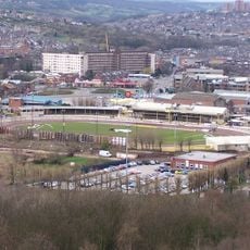
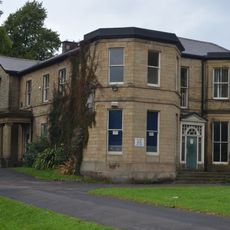
Longley Park, Urban park in northern Sheffield, England

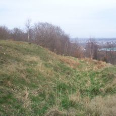
Longley Park is an urban park in Sheffield featuring rolling hills and valleys with scattered wooded areas containing mature trees. Multiple pathways wind through the grounds, connecting different sections of the park.

The park opened in 1929 on former farmland to serve the newly built Longley housing estate. It replaced a 14th-century manor house that previously occupied the site.

The park was shaped during the 1930s by local workers who built sports facilities like tennis courts and football pitches. These amenities continue to define how people in the area spend their free time.

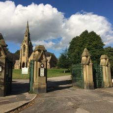
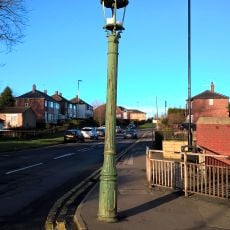
The main entrance on Crowder Road provides access to various recreational facilities throughout the grounds. The terrain is uneven in places, so wear sturdy shoes and allow time to explore the different pathways.

The Bagley Dike stream originates within the park before disappearing into an underground culvert system built during the 1930s development. This hidden water feature is a detail many visitors overlook.

The community of curious travelers

AroundUs brings together thousands of curated places, local tips, and hidden gems, enriched daily by 60,000 contributors worldwide.

Start exploring
Location
GPS coordinates
53.41840,-1.46210
Latest update
December 12, 2025 17:45
Around this place
Owlerton Stadium
United Kingdom

Owlerton Stadium

2.4 km
Wincobank
United Kingdom

Wincobank

2 km
St Paul's Church, Wordsworth Avenue
United Kingdom

St Paul's Church, Wordsworth Avenue

1.7 km
United Kingdom

Firth Park

1.1 km
Abbeyfield Park
United Kingdom

Abbeyfield Park

2.1 km
Christ Church
United Kingdom

Christ Church

2.4 km
St Thomas, Brightside
United Kingdom

St Thomas, Brightside

2.4 km
Church of St John The Baptist And Attached Boundary Wall And Gates
United Kingdom

Church of St John The Baptist And Attached Boundary Wall And Gates

2.7 km
Church of St James and St Christopher
United Kingdom

Church of St James and St Christopher

1.7 km
Church of St Cuthbert
United Kingdom

Church of St Cuthbert

1.4 km
Trinity Fir Vale Methodist Church
United Kingdom

Trinity Fir Vale Methodist Church

1.4 km
War Memorial 400 Metres North East of Chapel at Burngreave Cemetery
United Kingdom

War Memorial 400 Metres North East of Chapel at Burngreave Cemetery

2.1 km
Burngreave Cemetery
United Kingdom

Burngreave Cemetery

2.4 km
Cemetery Chapels At Burngreave Cemetery
United Kingdom

Cemetery Chapels At Burngreave Cemetery

2.3 km
Toll House And Attached Railing And Wall
United Kingdom

Toll House And Attached Railing And Wall

2 km
Firth Park Methodist Church, Adjoining Meeting Room And Boundary Wall
United Kingdom

Firth Park Methodist Church, Adjoining Meeting Room And Boundary Wall

915 m
Sheffield City Council Sport And Development Section District Office
United Kingdom

Sheffield City Council Sport And Development Section District Office

1.3 km
18, 20 And 22, Page Hall Road
United Kingdom

18, 20 And 22, Page Hall Road

1.4 km
Grimesthorpe Pump
United Kingdom

Grimesthorpe Pump

2 km
Wardsend Viaduct
United Kingdom

Wardsend Viaduct

2.2 km
Lodges, Railings And Gate Piers At Burngreave Cemetery
United Kingdom

Lodges, Railings And Gate Piers At Burngreave Cemetery

2.4 km
Hannah Rawson School
United Kingdom

Hannah Rawson School

2.1 km
Abbeyfield House
United Kingdom

Abbeyfield House

2 km
1-7, Hatfield House Croft
United Kingdom

1-7, Hatfield House Croft

1 km
Sewer Gas Lamp at Junction with Camborne Road
United Kingdom

Sewer Gas Lamp at Junction with Camborne Road

2.7 km
Sewer Gas Lamp at Junction with Tipton Lane
United Kingdom

Sewer Gas Lamp at Junction with Tipton Lane

2.6 km
Sewer Gas Lamp at Junction with Monckton Road
United Kingdom

Sewer Gas Lamp at Junction with Monckton Road

1.8 km
St Cecilia
United Kingdom

St Cecilia

2.2 km
Show the full map
Reviews
Share your experience

No review yet

Discussions
Start a discussion...

No discussion yet

« Longley Park - Urban park in northern Sheffield, England » is provided by Around Us (aroundus.com). Images and texts are derived from Wikimedia project under a Creative Commons license. You are allowed to copy, distribute, and modify copies of this page, under the conditions set by the license, as long as this note is clearly visible.

Discover hidden gems everywhere you go!

From secret cafés to breathtaking viewpoints, skip the crowded tourist spots and find places that match your style. Our app makes it easy with voice search, smart filtering, route optimization, and insider tips from travelers worldwide. Download now for the complete mobile experience.

Around Us App Screenshot

A unique approach to discovering new places

Le Figaro

All the places worth exploring

France Info

A tailor-made excursion in just a few clicks

20 Minutes

Around Us
Travel Guide & Maps
Download

Send to your phone

QR Code
1

Open the camera app on your mobile.

2

Point at the QR code with your camera. A notification will appear.

3

Tap the notification to open the link.