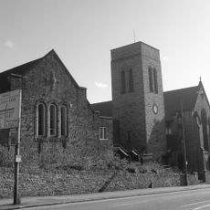
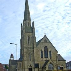
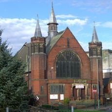
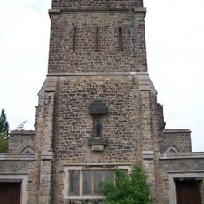
St Paul's Church, Wordsworth Avenue, Grade II* listed church building in Wordsworth Avenue, Sheffield, England
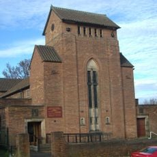
St Paul's Church is a listed church building on Wordsworth Avenue in Sheffield featuring an Italianate tower. The structure displays architectural details characteristic of early 18th-century construction with stone walls and period design elements.
Construction of the church began in 1720 funded by public subscription to serve the growing community. The site was closed in 1937 and subsequently demolished, though parts of the structure found new uses elsewhere.
The church is named after the Apostle Paul and received two oak chancel screens from the Sheffield Master Silversmiths Association as a tribute to local craftsmanship. This connection reflects how deeply the building was linked to the city's silverware traditions.
Visitors can appreciate the architectural details and Italianate tower design while exploring the area. Current information about access and any community activities can be found through local resources and online sources.
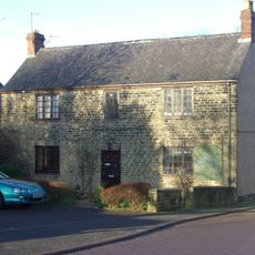
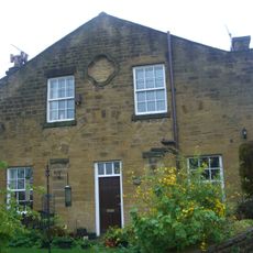
After its closure in 1937, stones from the original structure were repurposed for residential buildings in Bents Green. This recycling of materials demonstrates how demolished structures contributed to new construction projects in the surrounding area.
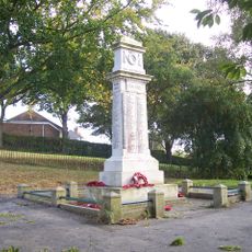
Location: Sheffield
GPS coordinates: 53.43320,-1.46930
Latest update: December 14, 2025 09:40
Whitley Hall
2 km
Ecclesfield Priory
1.2 km
Church of St. Mary, Ecclesfield
1.2 km
Birley Old Hall
2.4 km
Barnes Hall
3 kmFirth Park
2.5 km
St Mark's Church, Grenoside
2.3 km
Church of St James and St Christopher
1.9 km
Church of St Cuthbert
3.1 km
Trinity Fir Vale Methodist Church
3.1 km
Ecclesfield War Memorial
1.1 km
Sheffield City Council Sport And Development Section District Office
2.8 km
Chapeltown War Memorial
3.1 km
18, 20 And 22, Page Hall Road
3.1 km
Firth Park Methodist Church, Adjoining Meeting Room And Boundary Wall
2.1 km
Wardsend Viaduct
2.8 km
Grenoside War Memorial
2.1 km
1-7, Hatfield House Croft
1.6 km
The Falconry At Birley Old Hall
2.3 km
Hannah Rawson School
2.1 km
Sewer Gas Lamp at Junction with Camborne Road
2.3 km
Mile Post Approximately 45 Metres North Of Junction With Wheel Lane, Halifax Road And Salt Box Lane
1.8 km
Milepost Opposite Number 182
2.8 km
Sewer Gas Lamp at Junction with Monckton Road
2.8 km
Birley Hall Farmhouse
2.4 km
St Cecilia
1.5 km
Milestone, Highgreave, Cross Hill
843 m
Enchanted Chairs
2.9 kmVisited this place? Tap the stars to rate it and share your experience / photos with the community! Try now! You can cancel it anytime.
Discover hidden gems everywhere you go!
From secret cafés to breathtaking viewpoints, skip the crowded tourist spots and find places that match your style. Our app makes it easy with voice search, smart filtering, route optimization, and insider tips from travelers worldwide. Download now for the complete mobile experience.
A unique approach to discovering new places❞
— Le Figaro
All the places worth exploring❞
— France Info
A tailor-made excursion in just a few clicks❞
— 20 Minutes