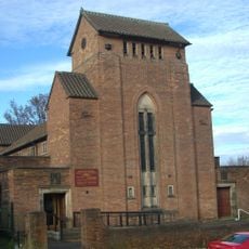
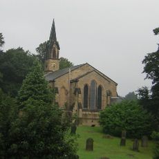
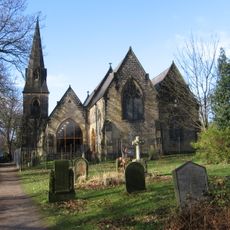
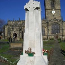
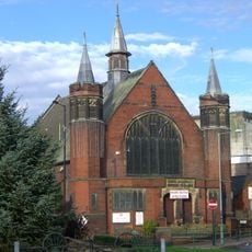
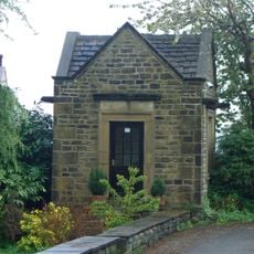
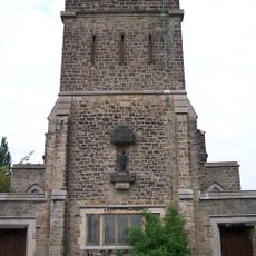
Ecclesfield Priory, Medieval monastery in Ecclesfield, England
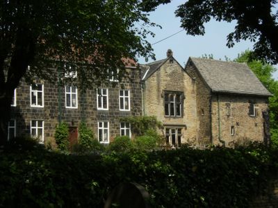
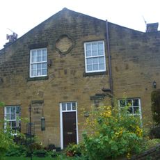
Ecclesfield Priory is a monastery building in England constructed from sandstone and millstone grit, oriented from north to south. A chapel sits at the southeast corner featuring liturgical fixtures such as a piscina and aumbry for religious use.
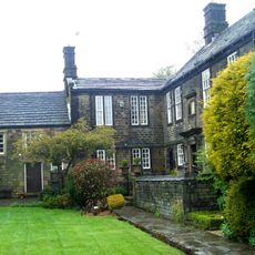
The priory was founded in 1201 under the authority of an abbey in Normandy. In 1386 it came under different monastic governance, marking a shift in its administrative structure and oversight.
The name reflects its religious roots and connection to the local community. Visitors can observe the medieval architectural details including pointed windows and the vaulted ceiling in the chapel section.
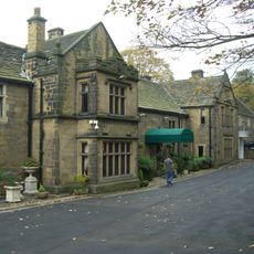
The building holds Grade II* listed status under English heritage protection, ensuring its preservation and limiting alterations to its structure. Visitors should check ahead as such protected buildings often have restricted access and specific visiting conditions.
Armed messengers were sent during the 14th century to retrieve a prior accused of financial mismanagement. This unusual action reveals how seriously such allegations were treated and what enforcement methods existed within monastic communities.
Location: Ecclesfield
Inception: 13 century
GPS coordinates: 53.44397,-1.47069
Latest update: December 12, 2025 17:44
Whitley Hall
972 m
Church of St. Mary, Ecclesfield
63 m
Birley Old Hall
2.7 km
St Paul's Church, Wordsworth Avenue
1.2 km
Barnes Hall
2 kmFirth Park
3.6 km
St Mark's Church, Grenoside
2.1 km
Church of St James and St Christopher
2.5 km
Church of the Holy Trinity
3.1 km
Church of St John the Baptist
2.3 km
Ecclesfield War Memorial
105 m
Chapeltown War Memorial
1.9 km
Firth Park Methodist Church, Adjoining Meeting Room And Boundary Wall
3.2 km
Grenoside War Memorial
1.7 km
Hannah Rawson School
3 km
Picture Palace
2.1 km
The Falconry At Birley Old Hall
2.7 km
Milepost Opposite Number 182
1.7 km
1-7, Hatfield House Croft
2.6 km
Mile Post Approximately 45 Metres North Of Junction With Wheel Lane, Halifax Road And Salt Box Lane
1.7 km
Sewer Gas Lamp at Junction with Camborne Road
2.9 km
Mile Post Approximately 7 Metres South Of Junction With Commerce Street
2.3 km
Milepost Approximately 40 Metres South East Of Junction With Penistone Road
3.1 km
Milepost Opposite Junction With Bevan
2.1 km
St Cecilia
2.1 km
Birley Hall Farmhouse
2.7 km
Milestone, Highgreave, Cross Hill
1.1 km
Milestone, just N of A629, Hallwood Road jct
3.2 kmVisited this place? Tap the stars to rate it and share your experience / photos with the community! Try now! You can cancel it anytime.
Discover hidden gems everywhere you go!
From secret cafés to breathtaking viewpoints, skip the crowded tourist spots and find places that match your style. Our app makes it easy with voice search, smart filtering, route optimization, and insider tips from travelers worldwide. Download now for the complete mobile experience.
A unique approach to discovering new places❞
— Le Figaro
All the places worth exploring❞
— France Info
A tailor-made excursion in just a few clicks❞
— 20 Minutes