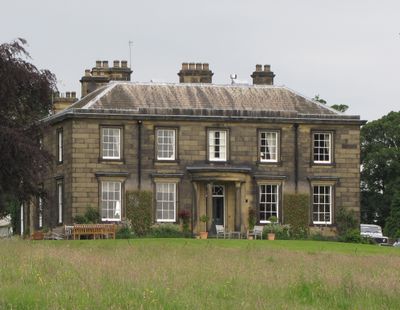
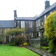
Barnes Hall, Grade II listed house in Ecclesfield, England.
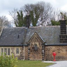
Barnes Hall is a Grade II listed house on Bracken Hill built from sandstone blocks with a Welsh slate roof and classical proportions. The structure displays neoclassical design details typical of its construction period.
The original structure dates back to the 14th century during Edward III's reign, while the current building was erected in 1824 by William Smith. This rebuilding marked a transformation of the estate.
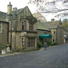
The property contains historical farm buildings like a dovecote from 1740 and a cartshed from 1820, offering insights into how people managed rural estates. These structures show the rhythm of agricultural work that defined life here.
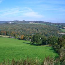
The building sits in an established area of Ecclesfield and is accessible through local pathways. Visitors should check local conditions and access arrangements before planning a visit.
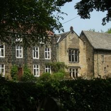
Thomas Rotherham, Archbishop of York, owned the hall until 1500. His connection to the property links it to a notable figure in English church history.
Location: Ecclesfield
GPS coordinates: 53.45670,-1.49276
Latest update: December 14, 2025 11:25
Whitley Hall
1.1 km
Beeley Wood
3.7 km
Ecclesfield Priory
2 km
Church of St. Mary, Ecclesfield
2.1 km
Birley Old Hall
3 km
St Paul's Church, Wordsworth Avenue
3 km
St Mark's Church, Grenoside
1.8 km
Church of St John the Baptist
1.7 km
Ecclesfield War Memorial
2.1 km
Chapeltown War Memorial
2 km
Grenoside War Memorial
1.5 km
Sewer Gas Lamp at Junction with Camborne Road
3.6 km
The Falconry At Birley Old Hall
3 km
Milepost Opposite Number 182
2.2 km
Mile Post Approximately 45 Metres North Of Junction With Wheel Lane, Halifax Road And Salt Box Lane
2.1 km
Picture Palace
1.9 km
Milepost Approximately 45 Metres To South West Of Junction With Kirby Lane
3.4 km
Birley Hall Farmhouse
3 km
Mile Post Approximately 7 Metres South Of Junction With Commerce Street
2 km
Oughtibridge Station
3.4 km
Milestone On North East Side Of Junction With Bank Lane
3.3 km
Guide Pillar At Junction With Long Lane, On South East Side Of Junction
4 km
Wayside cross at Howbrook crossroads
2.7 km
Milepost Approximately 40 Metres South East Of Junction With Penistone Road
1 km
Milepost Opposite Junction With Bevan
1 km
St Cecilia
3.1 km
Milepost Approximately 150 Metres Nort West Of Entrance To Town End Farm
2.7 km
Milestone, Highgreave, Cross Hill
3.2 kmVisited this place? Tap the stars to rate it and share your experience / photos with the community! Try now! You can cancel it anytime.
Discover hidden gems everywhere you go!
From secret cafés to breathtaking viewpoints, skip the crowded tourist spots and find places that match your style. Our app makes it easy with voice search, smart filtering, route optimization, and insider tips from travelers worldwide. Download now for the complete mobile experience.
A unique approach to discovering new places❞
— Le Figaro
All the places worth exploring❞
— France Info
A tailor-made excursion in just a few clicks❞
— 20 Minutes