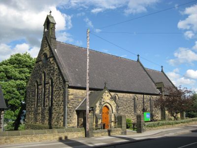
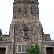
St Mark's Church, Grenoside, Anglican church in Grenoside, England
St Mark's Church is an Anglican worship space in Grenoside with a traditional interior layout centered on a main nave. The building also contains a separate community hall that hosts gatherings beyond regular services.
The church was founded in 1884 as the local population of Grenoside expanded and needed its own worship space. This development reflected how growing communities created new religious institutions during that era.
The church serves as a gathering place where different generations meet regularly for worship and community events. You can experience this connection firsthand through the shared activities and meals that happen throughout the year.
Main services happen on Sunday mornings and welcome people of all ages, including children. The community hall can be booked on weekdays if you need to use the space outside service times.
The congregation is led by two volunteer Readers who are specially trained to conduct parts of the worship service. This shows how churches often rely on committed community members to help run their operations day to day.
Website: http://stmarksgrenoside.net
GPS coordinates: 53.44120,-1.50170
Latest update: December 14, 2025 15:02
Whitley Hall
1.6 km
Beeley Wood
2 km
Ecclesfield Priory
2.1 km
Church of St. Mary, Ecclesfield
2.1 km
Birley Old Hall
1.2 km
St Paul's Church, Wordsworth Avenue
2.3 km
Barnes Hall
1.8 km
Church of St John the Baptist
3.3 km
Church At Middlewood Hospital
2.9 km
Ecclesfield War Memorial
2.1 km
Wardsend Viaduct
3.2 km
Hillsborough Park Cinema
3.3 km
Grenoside War Memorial
468 m
Milepost Approximately 50 Metres North Of Junction With Stockarth Lane
2.4 km
Mile Post Approximately 45 Metres North Of Junction With Wheel Lane, Halifax Road And Salt Box Lane
607 m
64, Towngate Road
3.2 km
Sewer Gas Lamp at Junction with Camborne Road
1.8 km
Hannah Rawson School
2.3 km
The Falconry At Birley Old Hall
1.2 km
Guide Pillar At Junction With Long Lane, On South East Side Of Junction
2.9 km
Oughtibridge Station
2.1 km
Birley Hall Farmhouse
1.2 km
Milepost At Conjunction With Langsett Road North
3.1 km
Milepost Approximately 40 Metres South East Of Junction With Penistone Road
2.5 km
Milepost Opposite Junction With Bevan
2.7 km
St Cecilia
1.6 km
Milestone, Highgreave, Cross Hill
2.9 km
Milestone, jct Middlewood Road and Catchbar Lane
3.2 kmVisited this place? Tap the stars to rate it and share your experience / photos with the community! Try now! You can cancel it anytime.
Discover hidden gems everywhere you go!
From secret cafés to breathtaking viewpoints, skip the crowded tourist spots and find places that match your style. Our app makes it easy with voice search, smart filtering, route optimization, and insider tips from travelers worldwide. Download now for the complete mobile experience.
A unique approach to discovering new places❞
— Le Figaro
All the places worth exploring❞
— France Info
A tailor-made excursion in just a few clicks❞
— 20 Minutes