Enable Location

We need your location to show you interesting places around you

Discover nearby places

Find interesting locations and hidden gems around you

Precise directions

Get accurate directions and distances to places

Your location is never shared with other users. It's only used when you tap the location button.

Beeley Wood

Log in to your account

Start exploring — it's free

Trusted by 62,583 travelers worldwide

Continue with Google
Continue with Apple
or

We will send you a code to connect

By continuing, you accept our Terms and Conditions and our Privacy Policy

Check your inbox

We've sent a pincode in your inbox. Please enter the code below.

Beeley Wood

Beeley Wood, Ancient woodland in northern Sheffield, England.

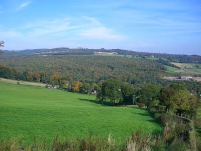
Beeley Wood is a woodland north of Sheffield with steep slopes rising from the River Don. The forest covers a large area and is crossed by various paths that give visitors ways to move through its interior.

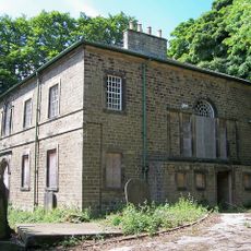
The woodland's name comes from a medieval document that links it to an Anglo-Saxon farm. The forest has existed as a wooded place for a very long time and is part of the area's natural history.

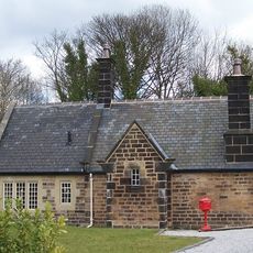
The woodland is home to native trees and plants that support local wildlife, which visitors can observe during walks through the forest. The way the forest sits beside the city shows Sheffield's commitment to keeping green spaces around populated areas.

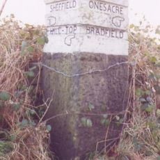
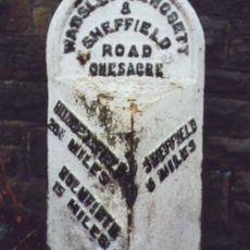
The woodland can be reached from multiple entry points, and visitors can choose different routes to start their walks. The paths follow the natural shape of the land and allow different ways to move through the forest.

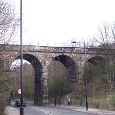
An old railway line passes through the woodland and shows signs of its industrial past. This railway connects the forest to Sheffield's manufacturing history and creates an interesting contrast between nature and industry.

The community of curious travelers

AroundUs brings together thousands of curated places, local tips, and hidden gems, enriched daily by 60,000 contributors worldwide.

Start exploring
Location
GPS coordinates
53.42970,-1.52556
Latest update
December 12, 2025 17:47
Around this place
Loxley House
United Kingdom

Loxley House

2.3 km
Onesacre Hall
United Kingdom

Onesacre Hall

2 km
Birley Old Hall
United Kingdom

Birley Old Hall

1.4 km
Dial House
United Kingdom

Dial House

2.6 km
Wadsley Parish Church
United Kingdom

Wadsley Parish Church

2 km
Loxley United Reformed Church
United Kingdom

Loxley United Reformed Church

2.8 km
St Mark's Church, Grenoside
United Kingdom

St Mark's Church, Grenoside

2 km
Hillsborough Trinity Methodist Church
United Kingdom

Hillsborough Trinity Methodist Church

2.7 km
Church At Middlewood Hospital
United Kingdom

Church At Middlewood Hospital

1.6 km
Cupola Contemporary Arts
United Kingdom

Cupola Contemporary Arts

2.5 km
Wardsend Viaduct
United Kingdom

Wardsend Viaduct

2.9 km
Wadsley Hall And Adjoining Barns And Stables
United Kingdom

Wadsley Hall And Adjoining Barns And Stables

2.5 km
Hillsborough Park Cinema
United Kingdom

Hillsborough Park Cinema

2.5 km
Grenoside War Memorial
United Kingdom

Grenoside War Memorial

2.5 km
Milepost Approximately 50 Metres North Of Junction With Stockarth Lane
United Kingdom

Milepost Approximately 50 Metres North Of Junction With Stockarth Lane

811 m
Guide Pillar At Junction With Burnt Hill Lane, East Side Of Junction
United Kingdom

Guide Pillar At Junction With Burnt Hill Lane, East Side Of Junction

2.8 km
Hannah Rawson School
United Kingdom

Hannah Rawson School

2.3 km
Hillsborough House And Attached Boundary Walls, Railings And Outbuildings
United Kingdom

Hillsborough House And Attached Boundary Walls, Railings And Outbuildings

2.6 km
The Falconry At Birley Old Hall
United Kingdom

The Falconry At Birley Old Hall

1.4 km
Mile Post Approximately 45 Metres North Of Junction With Wheel Lane, Halifax Road And Salt Box Lane
United Kingdom

Mile Post Approximately 45 Metres North Of Junction With Wheel Lane, Halifax Road And Salt Box Lane

2.2 km
Sewer Gas Lamp at Junction with Camborne Road
United Kingdom

Sewer Gas Lamp at Junction with Camborne Road

1.7 km
64, Towngate Road
United Kingdom

64, Towngate Road

1.1 km
Sewer Gas Lamp 15 Metres South Of Number 237 (Number 237 Not Included)
United Kingdom

Sewer Gas Lamp 15 Metres South Of Number 237 (Number 237 Not Included)

1.9 km
Birley Hall Farmhouse
United Kingdom

Birley Hall Farmhouse

1.4 km
Oughtibridge Station
United Kingdom

Oughtibridge Station

967 m
Guide Pillar At Junction With Long Lane, On South East Side Of Junction
United Kingdom

Guide Pillar At Junction With Long Lane, On South East Side Of Junction

1.7 km
St Cecilia
United Kingdom

St Cecilia

2.3 km
Milepost At Conjunction With Langsett Road North
United Kingdom

Milepost At Conjunction With Langsett Road North

2.1 km
Show the full map
« Beeley Wood - Ancient woodland in northern Sheffield, England » is provided by Around Us (aroundus.com). Images and texts are derived from Wikimedia project under a Creative Commons license. You are allowed to copy, distribute, and modify copies of this page, under the conditions set by the license, as long as this note is clearly visible.

Discover hidden gems everywhere you go!

From secret cafés to breathtaking viewpoints, skip the crowded tourist spots and find places that match your style. Our app makes it easy with voice search, smart filtering, route optimization, and insider tips from travelers worldwide. Download now for the complete mobile experience.

Around Us App Screenshot

A unique approach to discovering new places

Le Figaro

All the places worth exploring

France Info

A tailor-made excursion in just a few clicks

20 Minutes

Around Us
Travel Guide & Maps
Download

Send to your phone

QR Code
1

Open the camera app on your mobile.

2

Point at the QR code with your camera. A notification will appear.

3

Tap the notification to open the link.