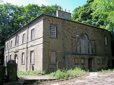
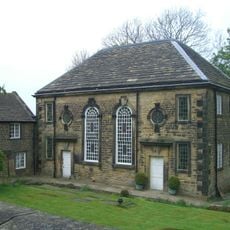
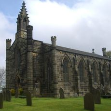
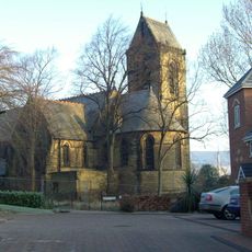
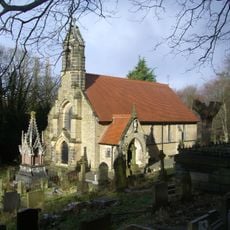
Loxley United Reformed Church, Grade II* listed religious building in Bradfield, England
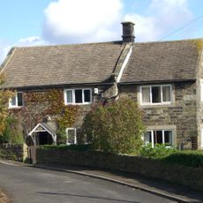
Loxley United Reformed Church stands on Loxley Road, built from squared gritstone with Venetian windows in a traditional English chapel style. The structure displays 18th-century architectural features that shape the character of the surrounding area.
Built in 1787 for curate Benjamin Greaves at a cost of 1,000 pounds, the building initially served Anglican worship. By 1798 it had become an Independent church, reflecting the religious shifts of that era.
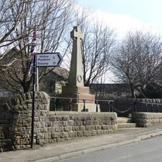
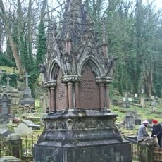
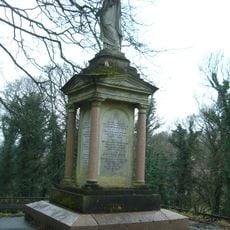
The churchyard holds graves of people who died in the Great Sheffield Flood of 1864, including members of the Armitage and Bower families. These burial sites mark a local tragedy that shaped the community's memory and remains visible to visitors today.
The building has been in critical condition since a severe fire in August 2016 destroyed the roof and upper floor. Visitors should be aware the structure is not currently safe to enter and should be viewed from outside.
Henry Tingle Wilde, who later became Chief Officer of the RMS Titanic, was christened at this church in 1872. This connection to one of the world's most famous ships gives the place an unexpected historical link.
Location: Bradfield
GPS coordinates: 53.40740,-1.54571
Latest update: December 14, 2025 14:42
Loxley House
1.3 km
Monastery of The Holy Spirit, Sheffield
2.7 km
Revell Grange
2.6 km
Dial House
2.2 km
Little Matlock Rolling Mill
977 m
Wadsley Parish Church
1.9 km
Underbank Chapel
1.6 km
Christ Church
1.7 km
Stannington War Memorial
1.6 km
Rivelin Valley Chair
2.4 km
Church At Middlewood Hospital
2.2 km
St Michaels Cemetery Chapel
2.6 km
Monument And Railings To Gh Foster 7 Metres West Of St Michaels Cemetery Chapel
2.6 km
Hollins Bridge
2.5 km
Walsh Monument And Railing At Rivelin Glen Cemetery
2.6 km
Wadsley Hall And Adjoining Barns And Stables
2.5 km
Milepost Approximately 50 Metres North Of Junction With Stockarth Lane
2.3 km
Stannington Cross At Junction With Stannington Road On West Side Of Junction
1.9 km
Guide Pillar At Junction With Burnt Hill Lane, East Side Of Junction
2.4 km
Packhorse Bridge Over River Loxley At Croft House
726 m
Spout House
1.4 km
White House Farmhouse
2.1 km
Well House
1.9 km
64, Towngate Road
2 km
Sewer Gas Lamp at Junction with Portsea Road
2.5 km
Sewer Gas Lamp 15 Metres South Of Number 237 (Number 237 Not Included)
1.8 km
Milestone, jct Middlewood Road and Catchbar Lane
2.7 km
Damflask Reservoir
2.6 kmVisited this place? Tap the stars to rate it and share your experience / photos with the community! Try now! You can cancel it anytime.
Discover hidden gems everywhere you go!
From secret cafés to breathtaking viewpoints, skip the crowded tourist spots and find places that match your style. Our app makes it easy with voice search, smart filtering, route optimization, and insider tips from travelers worldwide. Download now for the complete mobile experience.
A unique approach to discovering new places❞
— Le Figaro
All the places worth exploring❞
— France Info
A tailor-made excursion in just a few clicks❞
— 20 Minutes