Little Matlock Rolling Mill, Industrial mill in Bradfield, England
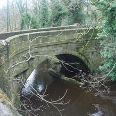
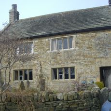
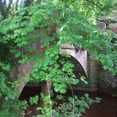
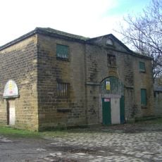
Little Matlock Rolling Mill is a rolling mill on the River Loxley with squared stone walls and a slate roof, retaining its original industrial structure from the 19th century. The facility operates today as a hand-rolling workshop, continuing metalworking practices in its original form.
The mill began operations in 1732 under a lease from the Duke of Norfolk and survived the major Sheffield flood of 1864. From its origins as a water-powered site, it evolved into a significant rolling mill for metalworking.
The mill represents Sheffield's metalworking heritage, showing how skilled techniques passed down through generations remain visible in its working spaces. Visitors can observe how traditional crafts continue to shape the region's industrial identity.
The mill sits directly on the River Loxley with reasonable access to Sheffield city center and surrounding footpaths. Visitors should note that the site remains an active working facility, so access may be limited depending on current operations.
The mill houses an imposing stationary water wheel approximately 5.6 meters in diameter, still attached to the building and a rare remaining example of water-powered industrial machinery in Sheffield. This wheel represents one of the last of its kind and demonstrates how flowing water once powered local manufacturing.
Location: Bradfield
Part of: Little Matlock rolling mill immediately south and east of Olive Terrace
GPS coordinates: 53.40080,-1.53600
Latest update: December 14, 2025 13:08
Hillsborough House
2.3 km
Loxley House
1.1 km
Dial House
1.7 km
Wadsley Parish Church
1.7 km
Loxley United Reformed Church
977 m
Underbank Chapel
1.5 km
Christ Church
1.2 km
Hillsborough Trinity Methodist Church
2.3 km
Walkley Library
2.3 km
Stannington War Memorial
1.2 km
Rivelin Valley Chair
1.4 km
Yorkshire Natural History Museum
2.1 km
Church At Middlewood Hospital
2.2 km
St Michaels Cemetery Chapel
1.6 km
Monument And Railings To Gh Foster 7 Metres West Of St Michaels Cemetery Chapel
1.6 km
Cemetery Chapel At Crookes Cemetery
2.3 km
Hollins Bridge
1.6 km
Walsh Monument And Railing At Rivelin Glen Cemetery
1.7 km
Wadsley Hall And Adjoining Barns And Stables
2 km
White House Farmhouse
1.6 km
Packhorse Bridge Over River Loxley At Croft House
963 m
Coach House And Stable 20 Metres North West Of Hillsborough Hall
2.3 km
Well House
1.4 km
Spout House
1.2 km
Stannington Cross At Junction With Stannington Road On West Side Of Junction
971 m
Sewer Gas Lamp At Junction Wuith Stannington View Road
2.3 km
Sewer Gas Lamp at Junction with Portsea Road
1.8 km
Sewer Gas Lamp 15 Metres South Of Number 237 (Number 237 Not Included)
1.7 kmVisited this place? Tap the stars to rate it and share your experience / photos with the community! Try now! You can cancel it anytime.
Discover hidden gems everywhere you go!
From secret cafés to breathtaking viewpoints, skip the crowded tourist spots and find places that match your style. Our app makes it easy with voice search, smart filtering, route optimization, and insider tips from travelers worldwide. Download now for the complete mobile experience.
A unique approach to discovering new places❞
— Le Figaro
All the places worth exploring❞
— France Info
A tailor-made excursion in just a few clicks❞
— 20 Minutes