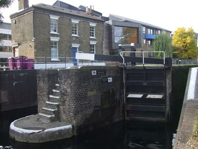
Mile End Lock, Canal lock in Mile End, United Kingdom.
Mile End Lock is a canal lock on the Regent's Canal positioned between Queen Mary University of London and Mile End Park. It controls water levels between different sections of the canal, allowing boats to navigate the waterway.
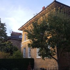
The lock was constructed during the Industrial Revolution as part of the 19th-century Regent's Canal system. A lock keeper's cottage from that era remains standing, showing how the canal infrastructure developed to support transportation.
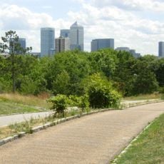
The towpath here is where locals walk and cycle, creating a meeting point between the university area and the park on either side. It serves as a social spine for the neighborhood, drawing people who want to experience the waterfront.
The lock sits close to Mile End Underground station, making it straightforward to find and visit. The towpath provides comfortable walking and cycling routes where you can watch the lock in operation and see boats passing through.
The lock is the ninth structure in the Regent's Canal sequence, nestled between two other named locks in the system. This middle position gives it an important role in managing boat traffic throughout the waterway.
Location: London Borough of Tower Hamlets
GPS coordinates: 51.52510,-0.03803
Latest update: December 14, 2025 16:43
Mile End Park
118 m
Mile End Hospital
349 m
Novo Cemetery
110 m
Statue of Clement Attlee
308 m
People's Palace
306 m
Queens' Building
249 m
Sylvia Pankhurst
365 m
The Guardian Angels Roman Catholic Church
128 m
Tower Hamlets Local History Library and Archives
333 m
1733 Foundation Plaque In South Wall Of Novo Cemetery
111 m
St Benet's Chapel
224 m
First Flying bomb on London fell here (blue plaque), Tower Hamlets
308 m
19-21, Rhondda Grove E3
368 m
5-11, Aberavon Road E3
245 m
24 And 25, Rhondda Grove E3
361 m
23, Rhondda Grove E3
361 m
1, Aberavon Road E3
247 m
Drinking fountain and clock tower at Queen Mary College
274 m
43 And 45, Aberavon Road E3
255 m
Guardian Angels Roman Catholic Primary School
107 m
6-11, Rhondda Grove E3
322 m
2-34 Aberavon Road and area railings
274 m
33-41, Aberavon Road E3
250 m
28-31, Rhondda Grove E3
357 m
Guardian Angels Presbytery
139 m
3, Aberavon Road E3
248 m
13-31, Aberavon Road E3
244 m
South East And South West Boundary Walls To Jewish Burial Ground
202 mVisited this place? Tap the stars to rate it and share your experience / photos with the community! Try now! You can cancel it anytime.
Discover hidden gems everywhere you go!
From secret cafés to breathtaking viewpoints, skip the crowded tourist spots and find places that match your style. Our app makes it easy with voice search, smart filtering, route optimization, and insider tips from travelers worldwide. Download now for the complete mobile experience.
A unique approach to discovering new places❞
— Le Figaro
All the places worth exploring❞
— France Info
A tailor-made excursion in just a few clicks❞
— 20 Minutes