Enable Location

We need your location to show you interesting places around you

Discover nearby places

Find interesting locations and hidden gems around you

Precise directions

Get accurate directions and distances to places

Your location is never shared with other users. It's only used when you tap the location button.

Log in to your account

Start exploring — it's free

Trusted by 68,201 travelers worldwide

Continue with Google
Continue with Apple
or

We will send you a code to connect

By continuing, you accept our Terms and Conditions and our Privacy Policy

Check your inbox

We've sent a pincode in your inbox. Please enter the code below.

Municipal Borough of Kidderminster
Discussion Reviews Photo
600+ Popularity

Municipal Borough of Kidderminster, Municipal borough in Worcestershire, England

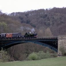
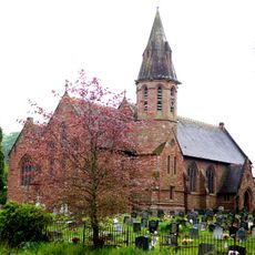
The Municipal Borough of Kidderminster is an urban area in Worcestershire within the West Midlands region of England. The territory spreads across land shaped by the River Stour and major railway connections that linked it to neighboring communities.

The borough was established in 1835 through the Municipal Reform Act and maintained its independent status for nearly 140 years. In 1974, it was absorbed into the Wyre Forest District as part of a nationwide reorganization of local government.

The borough adopted a Latin motto that reflected its industrial heritage and population growth from 24,333 residents in 1911 to 41,671 in 1961.

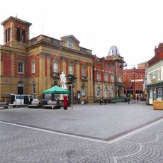
The town's main civic building is Kidderminster Town Hall, completed in 1877 and still serving administrative functions today. This structure stands as the focal point for municipal matters in the historic town center.

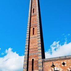
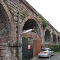
The area became known for carpet weaving, an industry strengthened by the opening of the Staffordshire and Worcestershire Canal in 1771. This waterway allowed manufacturers to transport materials and goods, transforming the region into a center of textile production.

The community of curious travelers

AroundUs brings together thousands of curated places, local tips, and hidden gems, enriched daily by 60,000 contributors worldwide.

Start exploring
GPS coordinates
52.38800,-2.24900
Latest update
March 6, 2026 16:53
Around this place
West Midland Safari Park
United Kingdom

West Midland Safari Park

3 km
Severn Valley Railway
United Kingdom

Severn Valley Railway

758 m
Aggborough
United Kingdom

Aggborough

942 m
St Mary and All Saints' Church, Kidderminster
United Kingdom

St Mary and All Saints' Church, Kidderminster

283 m
Kidderminster Register Office
United Kingdom

Kidderminster Register Office

627 m
Caldwall Castle
United Kingdom

Caldwall Castle

498 m
St. John's Church, Kidderminster
United Kingdom

St. John's Church, Kidderminster

818 m
Kidderminster Town Hall
United Kingdom

Kidderminster Town Hall

132 m
The Shrubbery
United Kingdom

The Shrubbery

938 m
St George's Church, Kidderminster
United Kingdom

St George's Church, Kidderminster

510 m
Church of St John the Baptist, Wolverley
United Kingdom

Church of St John the Baptist, Wolverley

2.6 km
Church of St Mary
United Kingdom

Church of St Mary

3.5 km
Church of All Saints
United Kingdom

Church of All Saints

4 km
Statue of Sir Rowland Hill
United Kingdom

Statue of Sir Rowland Hill

133 m
Church of St Peter
United Kingdom

Church of St Peter

3.6 km
Wribbenhall War Memorial, North West of Church of All Saints
United Kingdom

Wribbenhall War Memorial, North West of Church of All Saints

4 km
Rose Theatre, Kidderminster
United Kingdom

Rose Theatre, Kidderminster

1.4 km
Slingfield Mills, Chimney And Boiler House
United Kingdom

Slingfield Mills, Chimney And Boiler House

244 m
Piano Building Warehouse And Canal Tow Path Bridge To South West Brintons Carpet Works
United Kingdom

Piano Building Warehouse And Canal Tow Path Bridge To South West Brintons Carpet Works

274 m
Oak House, The Court House and The Old School House
United Kingdom

Oak House, The Court House and The Old School House

2.8 km
K4 Telephone Kiosk South Of Main Station Buildings
United Kingdom

K4 Telephone Kiosk South Of Main Station Buildings

4.2 km
Railway Viaduct And Adjoining Revetments Immediately North West Of Bewdley Railway Station
United Kingdom

Railway Viaduct And Adjoining Revetments Immediately North West Of Bewdley Railway Station

4.2 km
Hoobrook War Memorial
United Kingdom

Hoobrook War Memorial

2 km
The Baxter Monument
United Kingdom

The Baxter Monument

240 m
Churchyard Walls And Lychgate At Church Of All Saints
United Kingdom

Churchyard Walls And Lychgate At Church Of All Saints

4 km
Caldwall Hall
United Kingdom

Caldwall Hall

472 m
Mortons Works (Former Carpet Manufacturing Company)
United Kingdom

Mortons Works (Former Carpet Manufacturing Company)

562 m
North Lodges And Gateway Of Lea Castle
United Kingdom

North Lodges And Gateway Of Lea Castle

3.2 km
Show the full map
Reviews
Share your experience

No review yet

Discussions
Start a discussion...

No discussion yet

« Municipal Borough of Kidderminster - Municipal borough in Worcestershire, England » is provided by Around Us (aroundus.com). Images and texts are derived from Wikimedia project under a Creative Commons license. You are allowed to copy, distribute, and modify copies of this page, under the conditions set by the license, as long as this note is clearly visible.

Discover hidden gems everywhere you go!

From secret cafés to breathtaking viewpoints, skip the crowded tourist spots and find places that match your style. Our app makes it easy with voice search, smart filtering, route optimization, and insider tips from travelers worldwide. Download now for the complete mobile experience.

Around Us App Screenshot

A unique approach to discovering new places

Le Figaro

All the places worth exploring

France Info

A tailor-made excursion in just a few clicks

20 Minutes

Around Us
Travel Guide & Maps
Download

Send to your phone

QR Code
1

Open the camera app on your mobile.

2

Point at the QR code with your camera. A notification will appear.

3

Tap the notification to open the link.