Ram's Island, Lake island in Lough Neagh, Northern Ireland
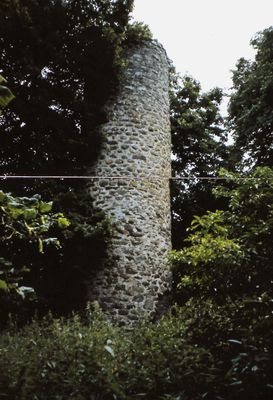
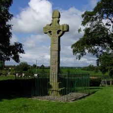
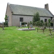
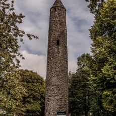
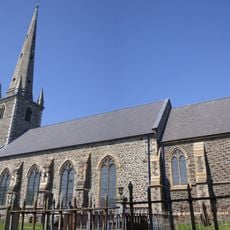
Ram's Island is the largest island in Lough Neagh and stretches roughly a mile in length. It holds the remains of an early medieval monastery complete with a round tower that reflects religious life from that era.
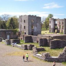
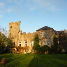
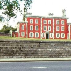
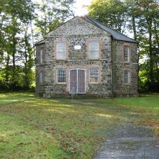
The monastery was founded during the early medieval period when Christian communities sought refuge on remote islands. In the 19th century, the O'Neill family built a summer residence here before the property changed hands to other owners.
The island served as a center for early Christian monks who built a monastery with a distinctive round tower. These structures show how religious communities chose isolated locations for prayer and contemplation during the medieval period.
The island is only accessible by boat, with regular services departing from several landing points around Lough Neagh. Visiting is possible year-round, though weather and water conditions can vary depending on the season.
During World War II, the Royal Air Force used this island as a strategic base to protect western coasts from attack. This reveals how a peaceful place once held military importance for the country.
GPS coordinates: 54.58620,-6.30340
Latest update: December 12, 2025 09:06
Shane's Castle ruins
16.4 km
Divis
18.6 km
Antrim Castle
15.8 km
Castle Upton
19 km
Ardboe High Cross
13.5 km
Brownlow House Windsor Avenue Lurgan Co.armagh
13.5 km
Oxford Island
11.7 km
Christ Church Cathedral, Lisburn
18.9 km
Lisburn Courthouse
18.6 km
Lurgan Town Hall
14 km
Kilwarlin Moravian Church
17.4 km
Old Town Hall, Lisburn
18.8 km
Picture House
13.7 km
Waringstown Presbyterian Church Mill Hill Waringstown Craigavon Co.down
16.9 km
Ballinderry Middle Church Lower Ballinderry Road Brakenhill Glenavy Crumlin County Antrim Bt28 2jh
7.3 km
St Comgall's Rc Church Castle Street Antrim
15.8 km
Deerpark Bridge Antrim Castle Gardens Randalstown Road Antrim Co Antrim
15.3 km
Clotworthy House Randalstown Road Antrim Bt41 4lh
15.4 km
Waringstown House Magherana Waringstown Craigavon Co.down
17.4 km
Lurgan Library
14 km
The Steeple Steeple Road Antrim Co Antrim Bt41 1bj
16.7 km
Railway Bridge Straidballymorris Dunadry Co Antrim
16.1 km
Railway Viaduct Randalstown Antrim Co Antrim
18.1 km
Long Canals And Round Pond Antrim Castle Gardens Randalstown Road Antrim Co Antrim
15.6 km
Christ church, Derriaghy
18.2 km
Christ Church Cathedral Market Square Lisburn Co. Antrim
18.8 km
Non-subscribing Presbyterian Church Main Street Crumlin Co Antrim
6.8 km
Saint John's Parish Church Of Ireland Main Street Moira County Down
12.9 kmVisited this place? Tap the stars to rate it and share your experience / photos with the community! Try now! You can cancel it anytime.
Discover hidden gems everywhere you go!
From secret cafés to breathtaking viewpoints, skip the crowded tourist spots and find places that match your style. Our app makes it easy with voice search, smart filtering, route optimization, and insider tips from travelers worldwide. Download now for the complete mobile experience.
A unique approach to discovering new places❞
— Le Figaro
All the places worth exploring❞
— France Info
A tailor-made excursion in just a few clicks❞
— 20 Minutes