Enable Location

We need your location to show you interesting places around you

Discover nearby places

Find interesting locations and hidden gems around you

Precise directions

Get accurate directions and distances to places

Your location is never shared with other users. It's only used when you tap the location button.

North Moor

Log in to your account

Start exploring — it's free

Trusted by 61,481 travelers worldwide

Continue with Google
Continue with Apple
or

We will send you a code to connect

By continuing, you accept our Terms and Conditions and our Privacy Policy

Check your inbox

We've sent a pincode in your inbox. Please enter the code below.

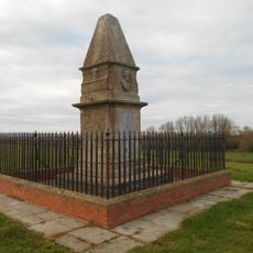
North Moor, Protected wetland site in Somerset, England.

Description

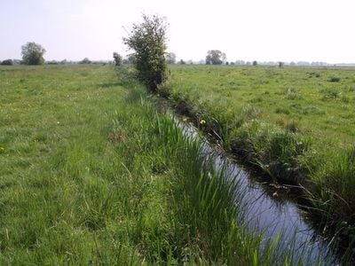
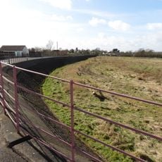
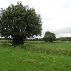
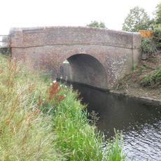
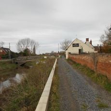
North Moor is a protected wetland site in the Somerset Levels covering extensive grazing marshes divided by networks of ditches and waterways. The landscape consists of open grasslands punctuated by these water channels that shape the entire terrain.

History

The site gained protection as a Site of Special Scientific Interest in 1986, establishing official recognition of its ecological value. This formal designation reflected the wetland's importance for conservation.

Culture

The area serves as a research location where scientists regularly conduct studies on local biodiversity and ecosystem management techniques.

Practical

You can walk through the site using marked paths while following guidelines that protect the natural habitats. Staying on designated routes helps preserve the area and ensures visitor safety.

Did you know?

The wetland hosts several plant species that are nationally scarce and flourish within its specialized ditch network. These botanical rarities make the site particularly valuable to naturalists.

GPS coordinates
51.06980,-2.96476
Latest update
December 14, 2025 13:07

AroundUs brings together thousands of curated places, local tips, and hidden gems, enriched daily by 60,000 contributors worldwide. Discover all places nearby (United Kingdom).

Around this place
Church of St Gregory, Stoke St Gregory
United Kingdom

Church of St Gregory, Stoke St Gregory

4.1 km
Church of St Bartholomew, Lyng
United Kingdom

Church of St Bartholomew, Lyng

1.8 km
Burrow Mump
United Kingdom

Burrow Mump

3.4 km
Church of St Mary, North Petherton
United Kingdom

Church of St Mary, North Petherton

4.3 km
Maunsel House
United Kingdom

Maunsel House

2.1 km
Westonzoyland Pumping Station Museum
United Kingdom

Westonzoyland Pumping Station Museum

2.7 km
Willows and Wetlands Visitor Centre
United Kingdom

Willows and Wetlands Visitor Centre

3.6 km
Balt Moor Wall
United Kingdom

Balt Moor Wall

1.9 km
Curry and Hay Moors
United Kingdom

Curry and Hay Moors

3.2 km
Church of St Peter, North Newton
United Kingdom

Church of St Peter, North Newton

2.5 km
Langmead and Weston Level
United Kingdom

Langmead and Weston Level

3.8 km
Church of St Peter and St John
United Kingdom

Church of St Peter and St John

2 km
Church of St Michael
United Kingdom

Church of St Michael

3.3 km
Church of St Michael
United Kingdom

Church of St Michael

2.3 km
Church of St John
United Kingdom

Church of St John

4.1 km
King Alfred's Monument With Railings
United Kingdom

King Alfred's Monument With Railings

2.4 km
King Alfred Public House
United Kingdom

King Alfred Public House

3.3 km
Higher Maunsell Bridge At St 308294  Higher Maunsell Lock No 4 At St 308294
United Kingdom

Higher Maunsell Bridge At St 308294 Higher Maunsell Lock No 4 At St 308294

2 km
Rose And Crown Hotel
United Kingdom

Rose And Crown Hotel

1.8 km
Lower Maunsell Bridge At St 308298  Lower Maunsell Lock No 3 At St 308298  Maunsell Lock
United Kingdom

Lower Maunsell Bridge At St 308298 Lower Maunsell Lock No 3 At St 308298 Maunsell Lock

1.9 km
Railway Bridge Over Main Line Railway Taunton To Bristol
United Kingdom

Railway Bridge Over Main Line Railway Taunton To Bristol

2.9 km
Burrow Bridge At Ngr St 3075 3043
United Kingdom

Burrow Bridge At Ngr St 3075 3043

3.2 km
North Petherton Library
United Kingdom

North Petherton Library

4.4 km
Coxhill Bridge At St 304306
United Kingdom

Coxhill Bridge At St 304306

2.1 km
Remains of Church on Burrow Mump
United Kingdom

Remains of Church on Burrow Mump

3.4 km
Manor Farmhouse
United Kingdom

Manor Farmhouse

2.6 km
Milestone, Compass, between North Petherton & Bridgwater
United Kingdom

Milestone, Compass, between North Petherton & Bridgwater

4.3 km
Milestone, Fore Street, opp. Crosswell Close
United Kingdom

Milestone, Fore Street, opp. Crosswell Close

4.3 km
Show the full map
« North Moor - Protected wetland site in Somerset, England » is provided by Around Us (aroundus.com). Images and texts are derived from Wikimedia project under a Creative Commons license. You are allowed to copy, distribute, and modify copies of this page, under the conditions set by the license, as long as this note is clearly visible.

Discover hidden gems everywhere you go!

From secret cafés to breathtaking viewpoints, skip the crowded tourist spots and find places that match your style. Our app makes it easy with voice search, smart filtering, route optimization, and insider tips from travelers worldwide. Download now for the complete mobile experience.

Around Us App Screenshot

A unique approach to discovering new places

Le Figaro

All the places worth exploring

France Info

A tailor-made excursion in just a few clicks

20 Minutes

Around Us
Travel Guide & Maps
Download

Send to your phone

QR Code
1

Open the camera app on your mobile.

2

Point at the QR code with your camera. A notification will appear.

3

Tap the notification to open the link.