North Pennine Ring

Log in to your account

AroundUs is a community-driven map of interesting places, built by curious explorers like you. It grows with every review, story, and photo you share.
Connect to save your favorite spots, contribute locations, and create personalized routes.
Continue with Google
Continue with Apple
Continue with X
Continue with Facebook
Continue with email
By continuing, you accept our Terms and Conditions and our Privacy Policy
Create an account

North Pennine Ring

Add to collection
Map
Suggest a change
Share

North Pennine Ring, Canal ring system through the Pennines, United Kingdom.

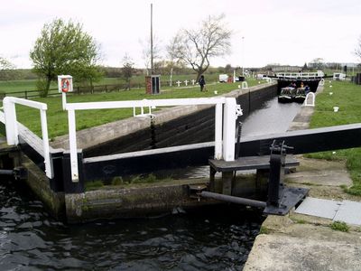
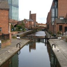
The North Pennine Ring is a canal network comprising five separate waterways across northern England that link major towns through a continuous route. The system spans approximately 184 miles (296 kilometers) with around 215 locks and passes through varying landscapes from urban centers to rural countryside.

The network developed gradually, beginning with the Bridgewater Canal around 1761 as its oldest section, though the complete ring only became navigable after the Rochdale Canal's restoration in 2002. Before this recent revival, parts of the route were damaged or inaccessible, making the through-journey impossible for many decades.

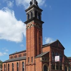
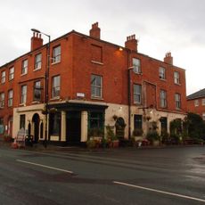
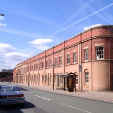
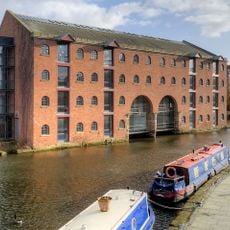
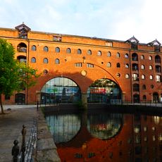
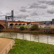
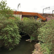
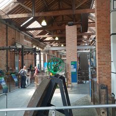
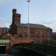
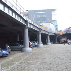
The waterways linked manufacturing towns and remain visible markers of the region's industrial past, with old warehouses and mills still standing along the routes. Visitors notice how communities developed around these water corridors, which were central to daily work and trade for generations.

Travelers can navigate sections individually or attempt the complete ring over several weeks depending on experience and available time. Check conditions on specific stretches before departure, as water levels can change with seasons and recent weather, particularly after dry periods or winter.

The ring connects five historically distinct canals originally built to serve different industries, together forming a through-route only recently made complete. The Rochdale Canal section remained partially impassable for over a century until volunteer restoration groups brought it back to navigation.

GPS coordinates: 53.47440,-2.25667

Latest update: December 14, 2025 14:21

Photos
Around this place
Manchester Liverpool Road railway station
United Kingdom

Manchester Liverpool Road railway station

330 m
Science and Industry Museum
United Kingdom

Science and Industry Museum

288 m
Castlefield Viaduct
United Kingdom

Castlefield Viaduct

164 m
Church of St George, Chester Road, Hulme
United Kingdom

Church of St George, Chester Road, Hulme

310 m
1830 warehouse, Liverpool Road railway station
United Kingdom

1830 warehouse, Liverpool Road railway station

342 m
Castlefield Congregational Chapel
United Kingdom

Castlefield Congregational Chapel

269 m
Rochdale Canal Lock Number 92 And Castle Street Bridge
United Kingdom

Rochdale Canal Lock Number 92 And Castle Street Bridge

58 m
Commercial Hotel
United Kingdom

Commercial Hotel

289 m
Castlefield Gallery
United Kingdom

Castlefield Gallery

357 m
Former Liverpool Road Railway Station Station Masters House
United Kingdom

Former Liverpool Road Railway Station Station Masters House

341 m
Merchants Warehouse
United Kingdom

Merchants Warehouse

44 m
Latticework Viaducts, Castlefield
United Kingdom

Latticework Viaducts, Castlefield

188 m
Middle Warehouse, At Former Castle Field Goods Yard
United Kingdom

Middle Warehouse, At Former Castle Field Goods Yard

144 m
Museum Of Science And Industry, Air And Space Museum
United Kingdom

Museum Of Science And Industry, Air And Space Museum

316 m
The Giants Basin
United Kingdom

The Giants Basin

153 m
Railway Viaduct Linking Bridge Over Irwell To Liverpool Road Station
United Kingdom

Railway Viaduct Linking Bridge Over Irwell To Liverpool Road Station

375 m
Boundary Stone On Knott Mill Bridge
United Kingdom

Boundary Stone On Knott Mill Bridge

331 m
Pair Of Culvert Arches Over River Medlock And Associated Overflow Channel
United Kingdom

Pair Of Culvert Arches Over River Medlock And Associated Overflow Channel

201 m
Bridgewater Canal Offices
United Kingdom

Bridgewater Canal Offices

233 m
Power Hall of Museum of Science and Industry
United Kingdom

Power Hall of Museum of Science and Industry

287 m
Former Canal Flour Mills
United Kingdom

Former Canal Flour Mills

213 m
Castlefield Canal Basin
United Kingdom

Castlefield Canal Basin

244 m
DOT Motorcycles Works, Ellesmere St
United Kingdom

DOT Motorcycles Works, Ellesmere St

361 m
Former Market Hall
United Kingdom

Former Market Hall

377 m
Colonnaded Railway Viaduct At Former Liverpool Road Goods Depot
United Kingdom

Colonnaded Railway Viaduct At Former Liverpool Road Goods Depot

361 m
29-41, Liverpool Road
United Kingdom

29-41, Liverpool Road

322 m
Former St Mathews Sunday School
United Kingdom

Former St Mathews Sunday School

256 m
123, Liverpool Road
United Kingdom

123, Liverpool Road

286 m
Show the full map
Reviews

Visited this place? Tap the stars to rate it and share your experience / photos with the community! Try now! You can cancel it anytime.

« North Pennine Ring - Canal ring system through the Pennines, United Kingdom » is provided by Around Us (aroundus.com). Images and texts are derived from Wikimedia project under a Creative Commons license. You are allowed to copy, distribute, and modify copies of this page, under the conditions set by the license, as long as this note is clearly visible.

Discover hidden gems everywhere you go!

From secret cafés to breathtaking viewpoints, skip the crowded tourist spots and find places that match your style. Our app makes it easy with voice search, smart filtering, route optimization, and insider tips from travelers worldwide. Download now for the complete mobile experience.

Around Us App Screenshot

A unique approach to discovering new places

Le Figaro

All the places worth exploring

France Info

A tailor-made excursion in just a few clicks

20 Minutes