Peak Forest Canal

Log in to your account

AroundUs is a community-driven map of interesting places, built by curious explorers like you. It grows with every review, story, and photo you share.
Connect to save your favorite spots, contribute locations, and create personalized routes.
Continue with Google
Continue with Apple
Continue with X
Continue with Facebook
Continue with email
By continuing, you accept our Terms and Conditions and our Privacy Policy
Create an account

Peak Forest Canal

Add to collection
Map
Suggest a change
Share

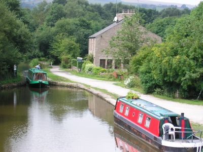
Peak Forest Canal, Navigation canal in Tameside and Stockport, England

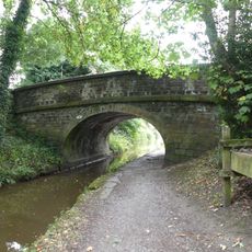
Peak Forest Canal is a transport waterway running through the region of Tameside, Stockport, and nearby areas for about 15 kilometers. The waterway is interrupted by 16 locks that allow boats to navigate across varying ground levels.

The waterway was designed in 1794 by engineer Benjamin Outram and opened in stages beginning in 1796. All sections including locks and aqueducts were fully operational by 1800.

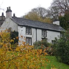
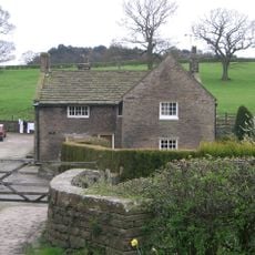
The name comes from the moorland landscape of the Peak District nearby. Today, anglers and boat owners use it regularly, keeping alive a piece of local industrial heritage that still shapes how people see this region.

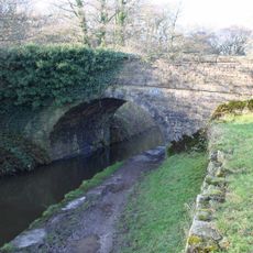
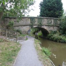
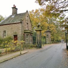
A continuous towpath follows the waterway from Tameside to Stockport with numerous access points along the route. Visitors can explore on foot or by bicycle, though shade is limited on sunny days.

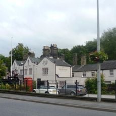
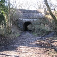
Bugsworth Basin served as a major transfer point for limestone and coal during industrial times and survives as a historic landmark today. This old basin still shows traces of the busy trade that once took place there.

Location: Tameside

Location: Stockport

Location: High Peak

Location: Cheshire East

GPS coordinates: 53.36600,-2.05400

Latest update: December 8, 2025 13:43

Photos
Around this place
Church of St Thomas and lychgate
United Kingdom

Church of St Thomas and lychgate

1.2 km
St Paul's Church
United Kingdom

St Paul's Church

1.2 km
Canal Bridge, Number 23 By Little Woodend
United Kingdom

Canal Bridge, Number 23 By Little Woodend

751 m
Number 10 (Marriott's Bridge) on Macclesfield Canal
United Kingdom

Number 10 (Marriott's Bridge) on Macclesfield Canal

1.3 km
Lych gate to Church of St Mary
United Kingdom

Lych gate to Church of St Mary

1.3 km
Lyme Gate Cottage
United Kingdom

Lyme Gate Cottage

1.1 km
High Lane War Memorial
United Kingdom

High Lane War Memorial

1.1 km
The Milestone At West Corner Of The Fountain
United Kingdom

The Milestone At West Corner Of The Fountain

1.3 km
Ram's Head Hotel And Mounting Block
United Kingdom

Ram's Head Hotel And Mounting Block

1.3 km
Stanley Hall
United Kingdom

Stanley Hall

571 m
Hagg Bank Farmhouse
United Kingdom

Hagg Bank Farmhouse

1.2 km
The Fountain
United Kingdom

The Fountain

1.3 km
Disley War Memorial
United Kingdom

Disley War Memorial

1.3 km
Brookside Farmhouse
United Kingdom

Brookside Farmhouse

1.2 km
Kiosk Against Western Edge Of The Square
United Kingdom

Kiosk Against Western Edge Of The Square

1.2 km
Schoolhouse Surgery
United Kingdom

Schoolhouse Surgery

1.3 km
Extension To Parish Hall
United Kingdom

Extension To Parish Hall

1.3 km
Lodge and Gatepiers and Gates on Lyme Park Drive
United Kingdom

Lodge and Gatepiers and Gates on Lyme Park Drive

1 km
The Old Court House
United Kingdom

The Old Court House

1 km
Aqueduct south west of Peers Cottages, Strines, on Peak Forest Canal
United Kingdom

Aqueduct south west of Peers Cottages, Strines, on Peak Forest Canal

768 m
Milestone adjacent to Bridge Number 10 an Macclesfield Canal
United Kingdom

Milestone adjacent to Bridge Number 10 an Macclesfield Canal

1.3 km
Number 9 (Windlehurst Bridge) on Macclesfield Canal
United Kingdom

Number 9 (Windlehurst Bridge) on Macclesfield Canal

1.3 km
Barn attached at right angles to Stanley Hall
United Kingdom

Barn attached at right angles to Stanley Hall

559 m
Tomb of Samuel Brady in the churchyard of St Mary
United Kingdom

Tomb of Samuel Brady in the churchyard of St Mary

1.3 km
Former Stables At Ram's Head Hotel
United Kingdom

Former Stables At Ram's Head Hotel

1.3 km
Moore's Buildings
United Kingdom

Moore's Buildings

1.3 km
The Vicarage
United Kingdom

The Vicarage

1.3 km
Forward gate piers to Lyme Park Drive
United Kingdom

Forward gate piers to Lyme Park Drive

988 m
Show the full map
Reviews

Visited this place? Tap the stars to rate it and share your experience / photos with the community! Try now! You can cancel it anytime.

« Peak Forest Canal - Navigation canal in Tameside and Stockport, England » is provided by Around Us (aroundus.com). Images and texts are derived from Wikimedia project under a Creative Commons license. You are allowed to copy, distribute, and modify copies of this page, under the conditions set by the license, as long as this note is clearly visible.

Discover hidden gems everywhere you go!

From secret cafés to breathtaking viewpoints, skip the crowded tourist spots and find places that match your style. Our app makes it easy with voice search, smart filtering, route optimization, and insider tips from travelers worldwide. Download now for the complete mobile experience.

Around Us App Screenshot

A unique approach to discovering new places

Le Figaro

All the places worth exploring

France Info

A tailor-made excursion in just a few clicks

20 Minutes