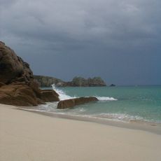
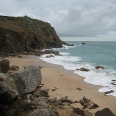
Pedn Vounder, Beach in Cornwall, United Kingdom.
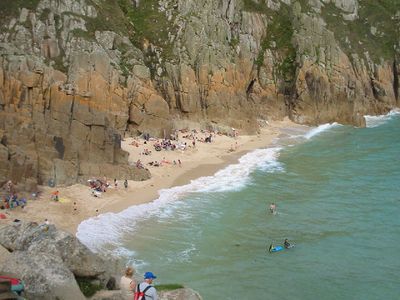
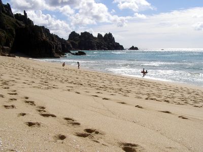
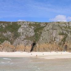
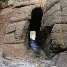
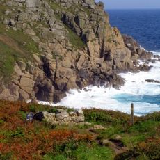
Pedn Vounder is a sandy beach on Cornwall's southeastern coast, featuring golden sand banks and turquoise waters enclosed by steep granite cliffs. The beach takes on different shapes depending on the tides, revealing or covering various sections of sand throughout the day.
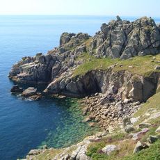
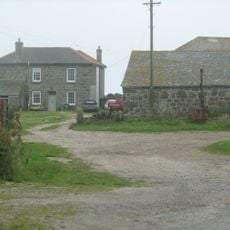
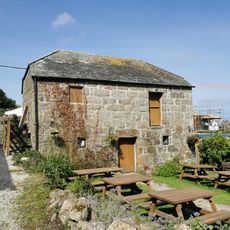
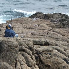
The beach served as a working harbor for fishing boats and coastal traders for centuries. Its rocky coves and natural shelter made it a reliable landing point long before modern ports existed.
The beach remains woven into the daily life of fishing families who work these waters. Visitors can observe how the sea shapes the rhythm of the local community throughout the year.
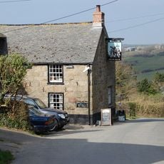
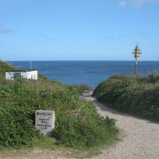
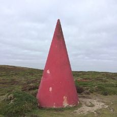
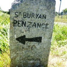
Access requires a steep walk down from St. Levan village, with only a handful of parking spaces at the cliff-top. Wear sturdy shoes and check the tide times before visiting to make the most of your time on the sand.
When the tide goes out, natural pools form between the sand banks and the open sea, creating temporary lagoons. These shallow basins appear only briefly and offer a surprising sight as the water retreats.
Location: St Levan
GPS coordinates: 50.04358,-5.64229
Latest update: December 8, 2025 19:51
Logan Rock
484 m
Museum of Global Communications
840 m
Treen Cliff
278 m
Treryn Dinas
501 m
St Levan's Church, St Levan
1.3 km
Cripp's Cove
595 m
The Logan Rock Inn
808 m
Porthcurno Beach
588 m
Porthgwarra Beach
2.3 km
Roskestal Farmhouse, Including Front Garden Walls And Gate-Piers
2.1 km
Porthchapel Beach
1.2 km
Porthgwarra Ullies
2.2 km
Barn Immediately North Of The Logan Rock Inn
821 m
Cable Hut At Porthcurno Telegraph Station
655 m
Cross 150m south west of Rospletha
1.1 km
Wayside cross in St Levan churchyard, 10m north east of the church
1.3 km
Guide Post At Sw400247
2.5 km
Black/White Runnel Stone daymark
2.6 km
Churchyard cross in St Levan churchyard, 10m south of the church
1.3 km
Cross At Sw378223
1.5 km
Barn And Adjoining Outbuilding At Aproximately 40 Metres North-North-East Of Roskestal Farmhouse
2.1 km
World War Ii Tunnels At Porthcurno Telegraph Station
986 m
Old Farmhouse And Adjoining Outbuilding At Approximately 15 Metres North Of Treen Farmhouse
789 m
Milestone At Sw377233
2.2 km
Red Runnel Stone daymark
2.6 km
Minack Point
671 m
Guide Post At Sw399241
1.9 km
Holy well 30m north west of St Levan's Chapel
1.3 kmVisited this place? Tap the stars to rate it and share your experience / photos with the community! Try now! You can cancel it anytime.
Discover hidden gems everywhere you go!
From secret cafés to breathtaking viewpoints, skip the crowded tourist spots and find places that match your style. Our app makes it easy with voice search, smart filtering, route optimization, and insider tips from travelers worldwide. Download now for the complete mobile experience.
A unique approach to discovering new places❞
— Le Figaro
All the places worth exploring❞
— France Info
A tailor-made excursion in just a few clicks❞
— 20 Minutes