Porthchapel Beach

Log in to your account

AroundUs is a community-driven map of interesting places, built by curious explorers like you. It grows with every review, story, and photo you share.
Connect to save your favorite spots, contribute locations, and create personalized routes.
By continuing, you accept our Terms and Conditions and our Privacy Policy

Porthchapel Beach

Add to collection
Map
Suggest a change
Share

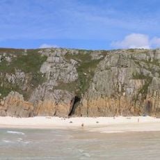
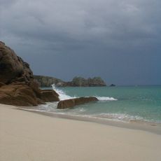
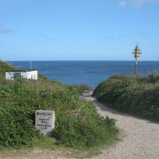
Porthchapel Beach, Sandy beach in Cornwall, England

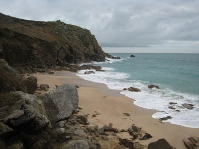
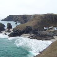
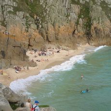
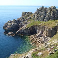
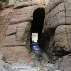
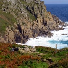
Porthchapel Beach is a sandy cove on the Cornwall coast featuring pale sand, clear waters, and steep cliffs that rise dramatically from the shoreline. The bay is shaped by rocky outcrops and natural formations that define its character along the coast.

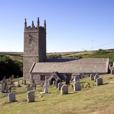
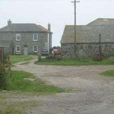
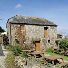
The cove served as a landing point for small fishing boats for many generations and supported local maritime activities. It became an important anchor for coastal communities that relied on the sea for their livelihood.

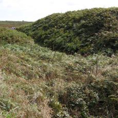
The beach connects to ancient pathways that once linked tin mining communities with fishing settlements across the coastline. These routes shaped how people moved through the region and remain visible in the landscape today.

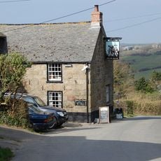
You can reach the beach via a 30-minute walk from Porthcurno car park or a 10-minute path from St Levan, both involving steep sections. Wear sturdy shoes and check the tide times, especially if you plan to explore the rock pools that form along the shore.

When the tide goes out, numerous rock pools appear along the shore, revealing small sea creatures and hidden geological layers. These natural basins show a glimpse of marine life that is normally underwater and the stone layers that form the cliffs.

GPS coordinates: 50.03928,-5.65770

Latest update: December 6, 2025 19:07

Photos
Hidden locations in Cornwall

Cornwall holds scattered coves, historic manors, and ancient stone circles that together create a collection of places reflecting the region's history, culture, and landscape. Visitors can discover medieval castles like Tintagel Castle, climb lighthouses, explore underground caves, and walk through...

Around this place
Logan Rock
United Kingdom

Logan Rock

1.5 km
Pedn Vounder
United Kingdom

Pedn Vounder

1.2 km
Museum of Global Communications
United Kingdom

Museum of Global Communications

491 m
Runnel Stone
United Kingdom

Runnel Stone

1.6 km
Treen Cliff
United Kingdom

Treen Cliff

1.5 km
Treryn Dinas
United Kingdom

Treryn Dinas

1.5 km
St Levan's Church, St Levan
United Kingdom

St Levan's Church, St Levan

394 m
Cripp's Cove
United Kingdom

Cripp's Cove

1.6 km
The Logan Rock Inn
United Kingdom

The Logan Rock Inn

1.7 km
Porthcurno Beach
United Kingdom

Porthcurno Beach

660 m

Roskestal Farmhouse, Including Front Garden Walls And Gate-Piers
United Kingdom

Roskestal Farmhouse, Including Front Garden Walls And Gate-Piers

1.2 km
Porthgwarra Beach
United Kingdom

Porthgwarra Beach

1.1 km
Barn Immediately North Of The Logan Rock Inn
United Kingdom

Barn Immediately North Of The Logan Rock Inn

1.7 km
Porthgwarra Ullies
United Kingdom

Porthgwarra Ullies

1 km
Cross 150m south west of Rospletha
United Kingdom

Cross 150m south west of Rospletha

459 m
Cable Hut At Porthcurno Telegraph Station
United Kingdom

Cable Hut At Porthcurno Telegraph Station

670 m
Wayside cross in St Levan churchyard, 10m north east of the church
United Kingdom

Wayside cross in St Levan churchyard, 10m north east of the church

387 m
World War Ii Tunnels At Porthcurno Telegraph Station
United Kingdom

World War Ii Tunnels At Porthcurno Telegraph Station

904 m
Cross At Sw378223
United Kingdom

Cross At Sw378223

623 m
Barn And Adjoining Outbuilding At Aproximately 40 Metres North-North-East Of Roskestal Farmhouse
United Kingdom

Barn And Adjoining Outbuilding At Aproximately 40 Metres North-North-East Of Roskestal Farmhouse

1.2 km
Black/White Runnel Stone daymark
United Kingdom

Black/White Runnel Stone daymark

1.4 km
Holy well 30m north west of St Levan's Chapel
United Kingdom

Holy well 30m north west of St Levan's Chapel

126 m
Churchyard cross in St Levan churchyard, 10m south of the church
United Kingdom

Churchyard cross in St Levan churchyard, 10m south of the church

359 m
Red Runnel Stone daymark
United Kingdom

Red Runnel Stone daymark

1.4 km
Minack Point
United Kingdom

Minack Point

535 m
Milestone At Sw377233
United Kingdom

Milestone At Sw377233

2 km
Old Farmhouse And Adjoining Outbuilding At Approximately 15 Metres North Of Treen Farmhouse
United Kingdom

Old Farmhouse And Adjoining Outbuilding At Approximately 15 Metres North Of Treen Farmhouse

1.7 km
Show the full map
Reviews

Visited this place? Tap the stars to rate it and share your experience / photos with the community! Try now! You can cancel it anytime.

« Porthchapel Beach - Sandy beach in Cornwall, England » is provided by Around Us (aroundus.com). Images and texts are derived from Wikimedia project under a Creative Commons license. You are allowed to copy, distribute, and modify copies of this page, under the conditions set by the license, as long as this note is clearly visible.

Discover hidden gems everywhere you go!

From secret cafés to breathtaking viewpoints, skip the crowded tourist spots and find places that match your style. Our app makes it easy with voice search, smart filtering, route optimization, and insider tips from travelers worldwide. Download now for the complete mobile experience.

Around Us App Screenshot

A unique approach to discovering new places

Le Figaro

All the places worth exploring

France Info

A tailor-made excursion in just a few clicks

20 Minutes