Treryn Dinas, Iron Age promontory fort in St Levan, England
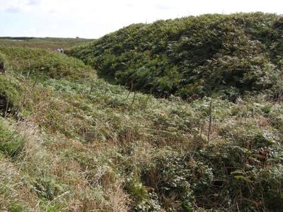
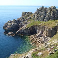
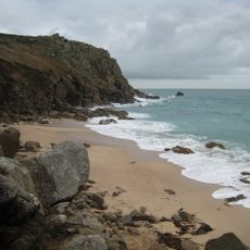
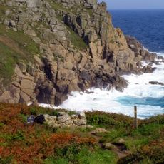
Treryn Dinas is an Iron Age fort built on a headland between two coves on the Cornish coast. The site is defined by four successive ramparts and ditches arranged in concentric rings around the highest point.
The fort was built during the Iron Age when communities constructed defensive works on coastal headlands. The structure was likely used and modified over several centuries as settlement patterns changed.
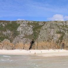
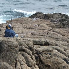
The site reveals how ancient inhabitants used coastal headlands to create defensible settlements with natural protection. Today the place draws walkers who follow the coastal path and stop to explore its layered earthworks.
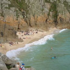
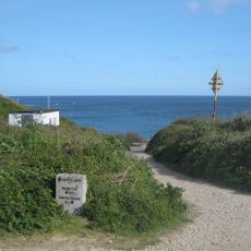
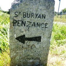
The site sits directly on the long-distance coastal walking route and can be reached via a causewayed entrance. Parking is available in the nearby village and the paths are walkable though they become slippery after rain.
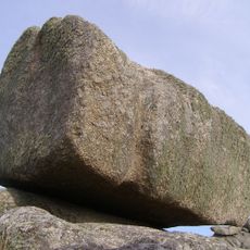
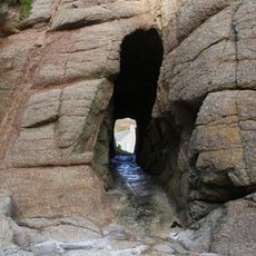
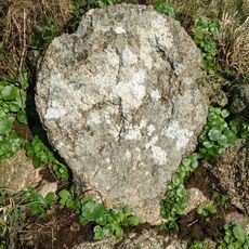
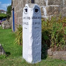
The site features the Logan Rock, a massive boulder balanced on the promontory that rocks slightly when pushed with pressure. This natural oddity draws visitors who want to experience the stone gently sway.
Location: Cornwall
Location: St Levan
GPS coordinates: 50.04073,-5.63685
Latest update: December 14, 2025 14:25
Logan Rock
75 m
Pedn Vounder
501 m
Museum of Global Communications
1.3 km
Treen Cliff
514 m
St Levan's Church, St Levan
1.7 km
Cripp's Cove
136 m
The Logan Rock Inn
1.2 km
Porthcurno Beach
1 km
Roskestal Farmhouse, Including Front Garden Walls And Gate-Piers
2.6 km
Porthchapel Beach
1.5 km
Porthgwarra Beach
2.6 km
Porthgwarra Ullies
2.5 km
Barn Immediately North Of The Logan Rock Inn
1.2 km
Cross 150m south west of Rospletha
1.5 km
Cable Hut At Porthcurno Telegraph Station
1.1 km
Wayside cross in St Levan churchyard, 10m north east of the church
1.7 km
Black/White Runnel Stone daymark
2.9 km
Guide Post At Sw400247
2.7 km
Cross At Sw378223
1.9 km
Barn And Adjoining Outbuilding At Aproximately 40 Metres North-North-East Of Roskestal Farmhouse
2.5 km
Churchyard cross in St Levan churchyard, 10m south of the church
1.7 km
World War Ii Tunnels At Porthcurno Telegraph Station
1.5 km
Old Farmhouse And Adjoining Outbuilding At Approximately 15 Metres North Of Treen Farmhouse
1.1 km
Milestone At Sw377233
2.7 km
Minack Point
982 m
Guide Post At Sw399241
2.2 km
Holy well 30m north west of St Levan's Chapel
1.6 kmVisited this place? Tap the stars to rate it and share your experience / photos with the community! Try now! You can cancel it anytime.
Discover hidden gems everywhere you go!
From secret cafés to breathtaking viewpoints, skip the crowded tourist spots and find places that match your style. Our app makes it easy with voice search, smart filtering, route optimization, and insider tips from travelers worldwide. Download now for the complete mobile experience.
A unique approach to discovering new places❞
— Le Figaro
All the places worth exploring❞
— France Info
A tailor-made excursion in just a few clicks❞
— 20 Minutes