Enable Location

We need your location to show you interesting places around you

Discover nearby places

Find interesting locations and hidden gems around you

Precise directions

Get accurate directions and distances to places

Your location is never shared with other users. It's only used when you tap the location button.

Portgate

Log in to your account

Start exploring — it's free

Trusted by 61,509 travelers worldwide

Continue with Google
Continue with Apple
or

We will send you a code to connect

By continuing, you accept our Terms and Conditions and our Privacy Policy

Check your inbox

We've sent a pincode in your inbox. Please enter the code below.

Portgate

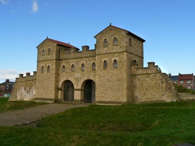
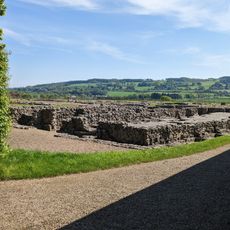
Portgate, Fortified gateway in Northumberland, England.

Description

Portgate is a fortified gateway where Hadrian's Wall intersected with the Roman road Dere Street, serving as a major control point for traffic moving north and south. The remains include a west tower structure that extended beyond the main defensive barrier.

History

This structure was built approximately 50 years before Hadrian's Wall was constructed, using large stone blocks in its design. The earlier establishment of this site shows that controlling traffic at this crossing was already a priority for Roman forces.

Culture

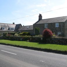
The name Portgate comes from Anglo-Saxon roots, showing how later peoples adapted Roman structures into their own naming traditions. Walking through the area, you can sense how this crossing point remained important to communities long after Rome withdrew.

Practical

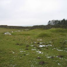
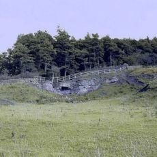
The remains are located beneath the former B6318 Military Road near Stagshaw Roundabout, making them difficult to access directly. Archaeological work has revealed the structures, but you may need local guidance to find and understand what you are looking at.

Did you know?

Historical records from 1732 describe a square fortress structure at this location that was divided into two equal sections. This documented description provides rare insight into the exact layout of the original Roman installation.

Location
GPS coordinates
55.01266,-2.02161
Latest update
December 14, 2025 11:24

AroundUs brings together thousands of curated places, local tips, and hidden gems, enriched daily by 60,000 contributors worldwide. Discover all places nearby (Northumberland).

« Portgate - Fortified gateway in Northumberland, England » is provided by Around Us (aroundus.com). Images and texts are derived from Wikimedia project under a Creative Commons license. You are allowed to copy, distribute, and modify copies of this page, under the conditions set by the license, as long as this note is clearly visible.

Discover hidden gems everywhere you go!

From secret cafés to breathtaking viewpoints, skip the crowded tourist spots and find places that match your style. Our app makes it easy with voice search, smart filtering, route optimization, and insider tips from travelers worldwide. Download now for the complete mobile experience.

Around Us App Screenshot

A unique approach to discovering new places

Le Figaro

All the places worth exploring

France Info

A tailor-made excursion in just a few clicks

20 Minutes

Around Us
Travel Guide & Maps
Download

Send to your phone

QR Code
1

Open the camera app on your mobile.

2

Point at the QR code with your camera. A notification will appear.

3

Tap the notification to open the link.